The Painted Hills and Columbia River Gorge

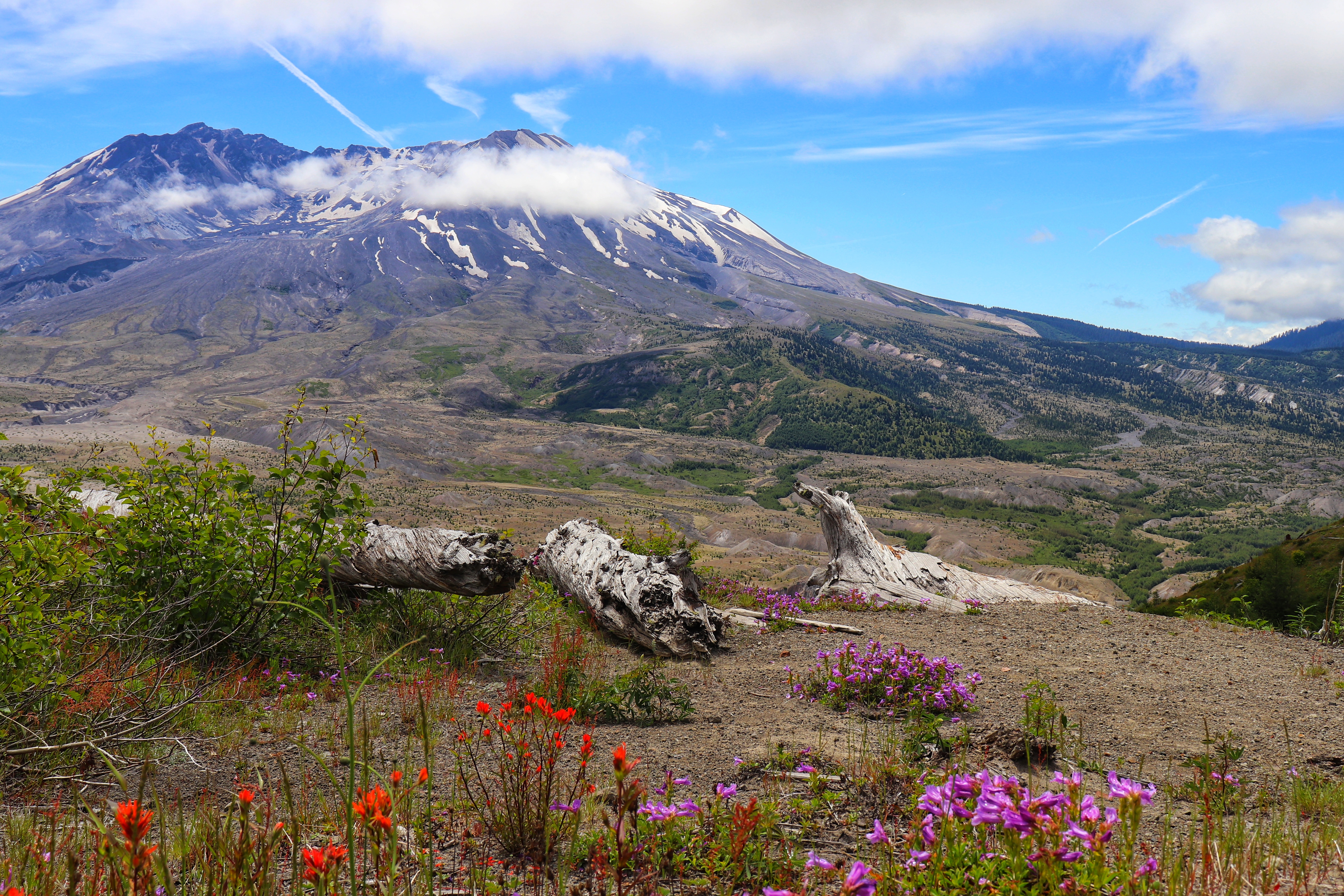
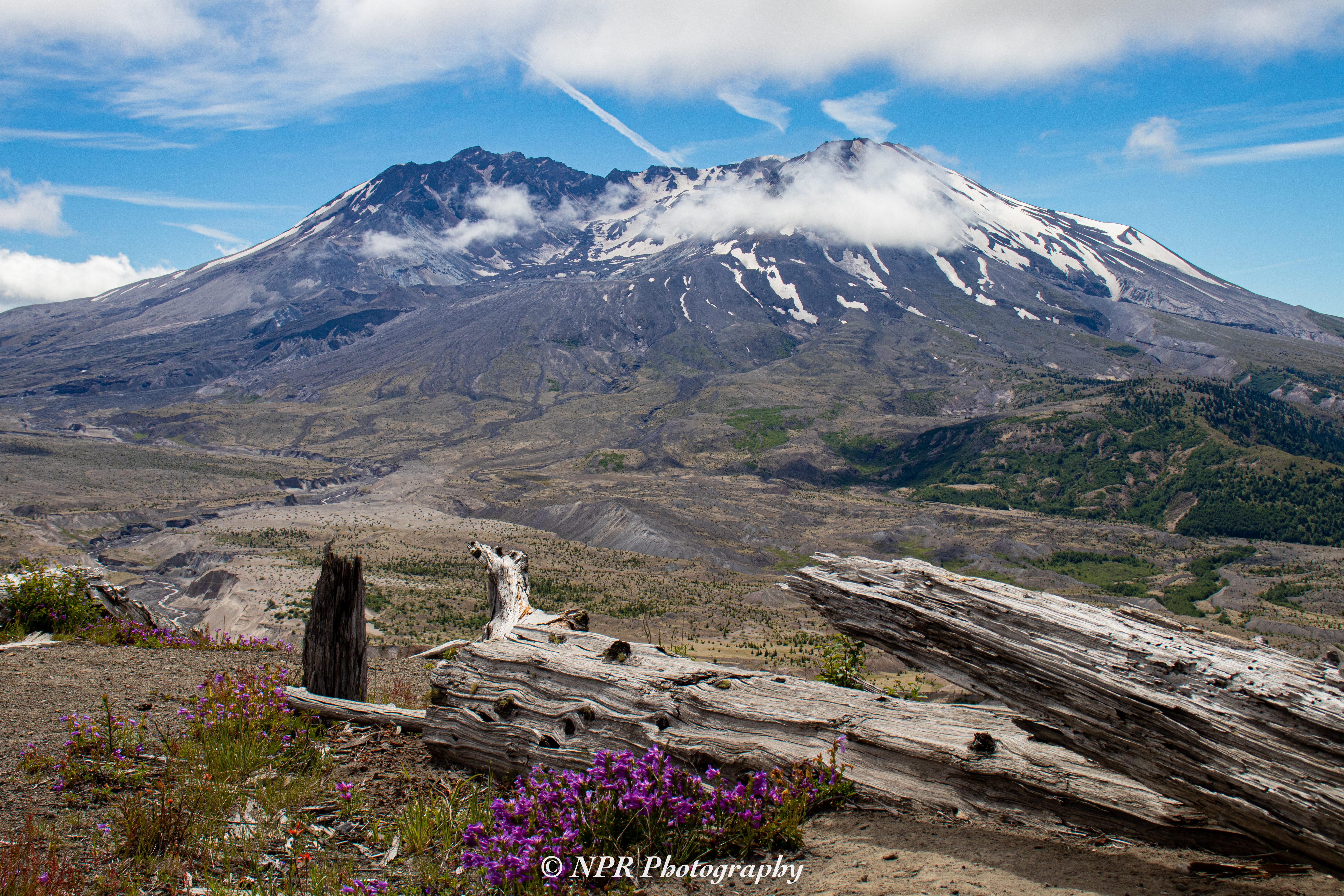
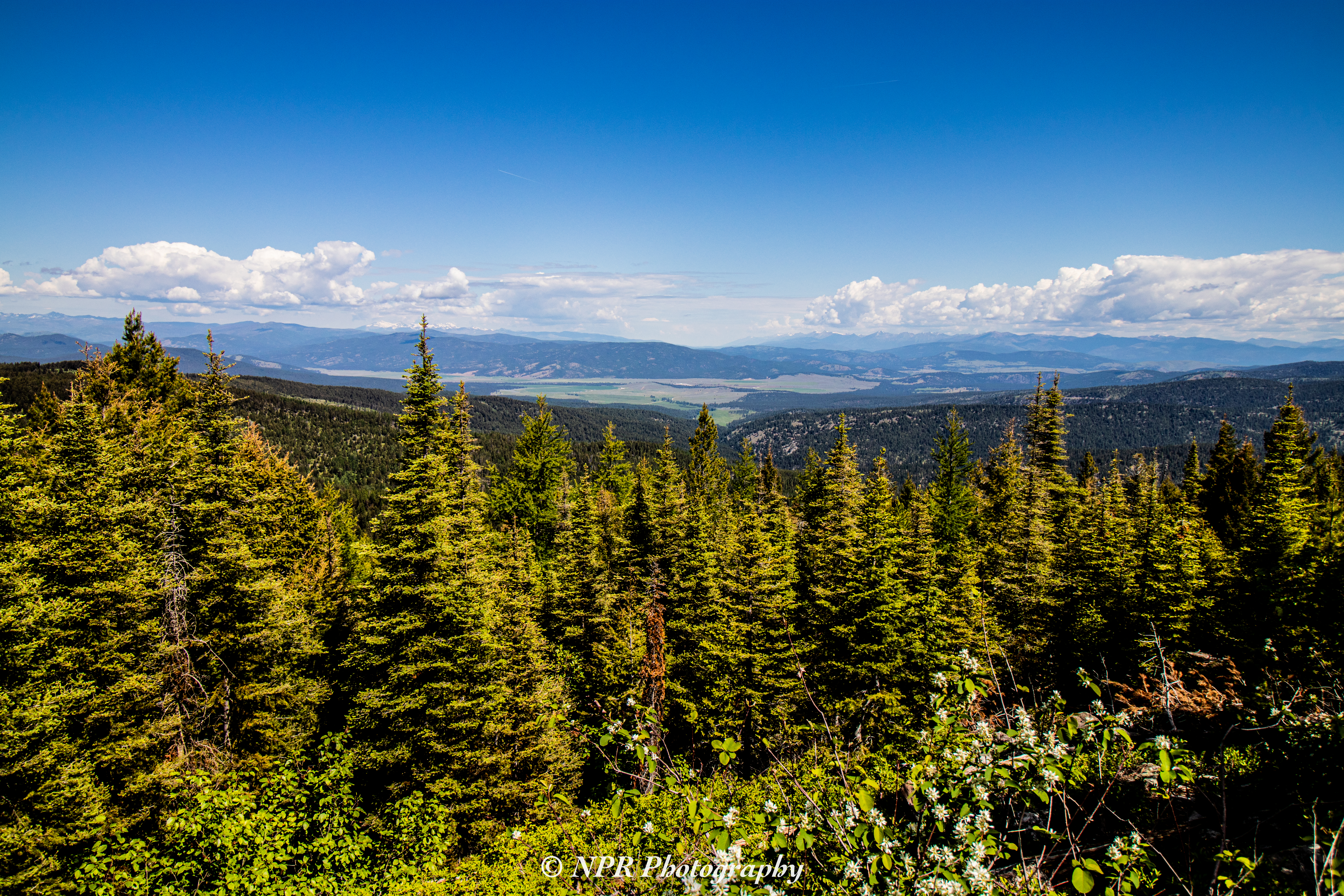
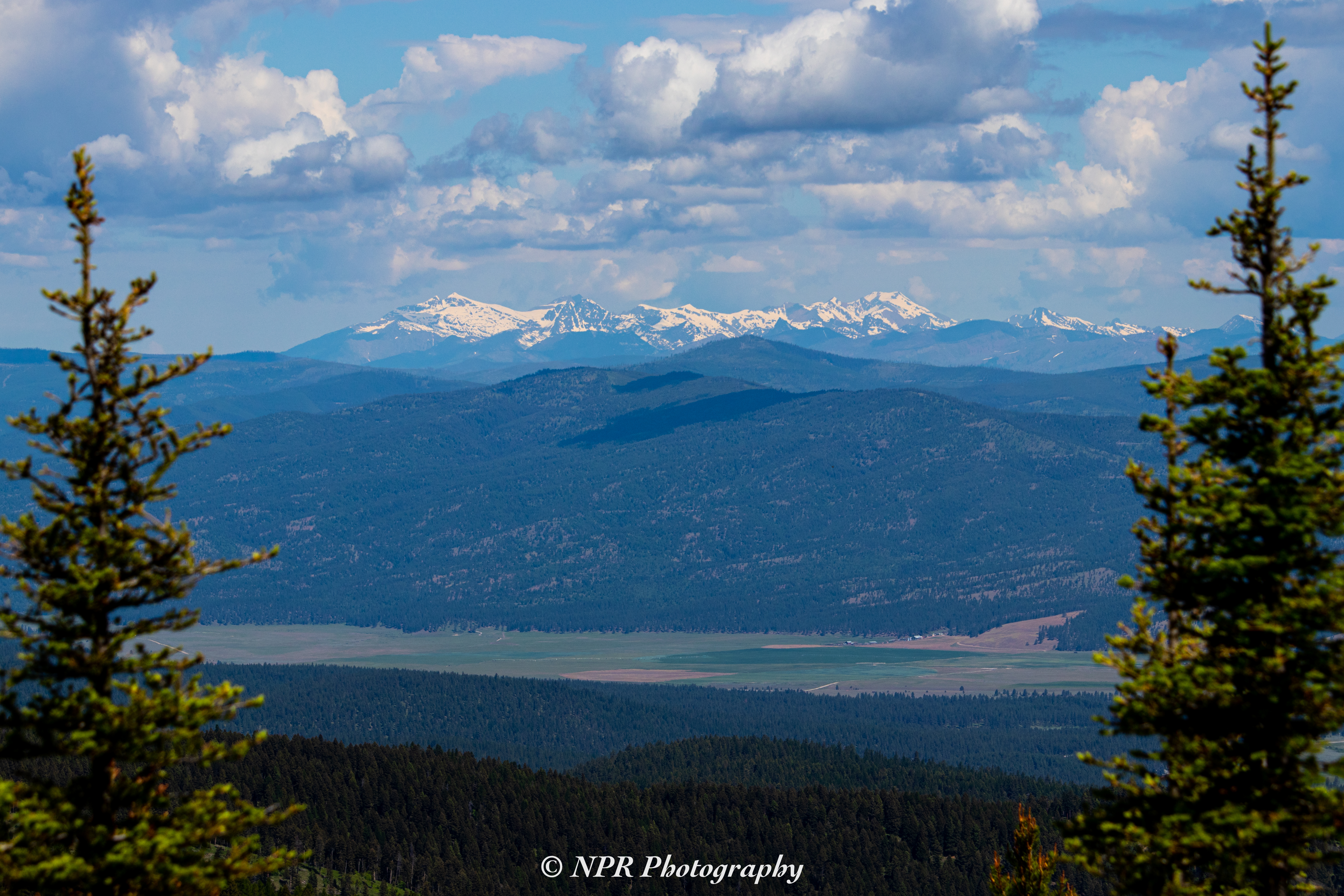
It was shortly after 7:30 AM on Wednesday, June 19th of 2019, when we began our journey Southeast from Portland, OR. The drive toward central Oregon is beautiful in a wholly different way from the beauty of the region West of the Cascades. You emerge from the Cascade mountain range and arrive at a wide, flat plain as you follow the path of Highway 26. Gazing toward the horizon, you can see the most prominent snowcapped peaks of the Cascade Mountains stretching along their North/South axis.

A relatively short while later, you pass through a smaller set of mountains and hills, quite reminiscent of the Black Hills here in South Dakota, as you’re cutting along the Western edge of the Ochoco National Forest. From there, our destination isn’t far.

Shortly before Mitchell, OR we take a left on Bridge Creek Road. We’d previously visited the Painted Hills in 2017, and we wanted to spend a more substantial interval there this time.

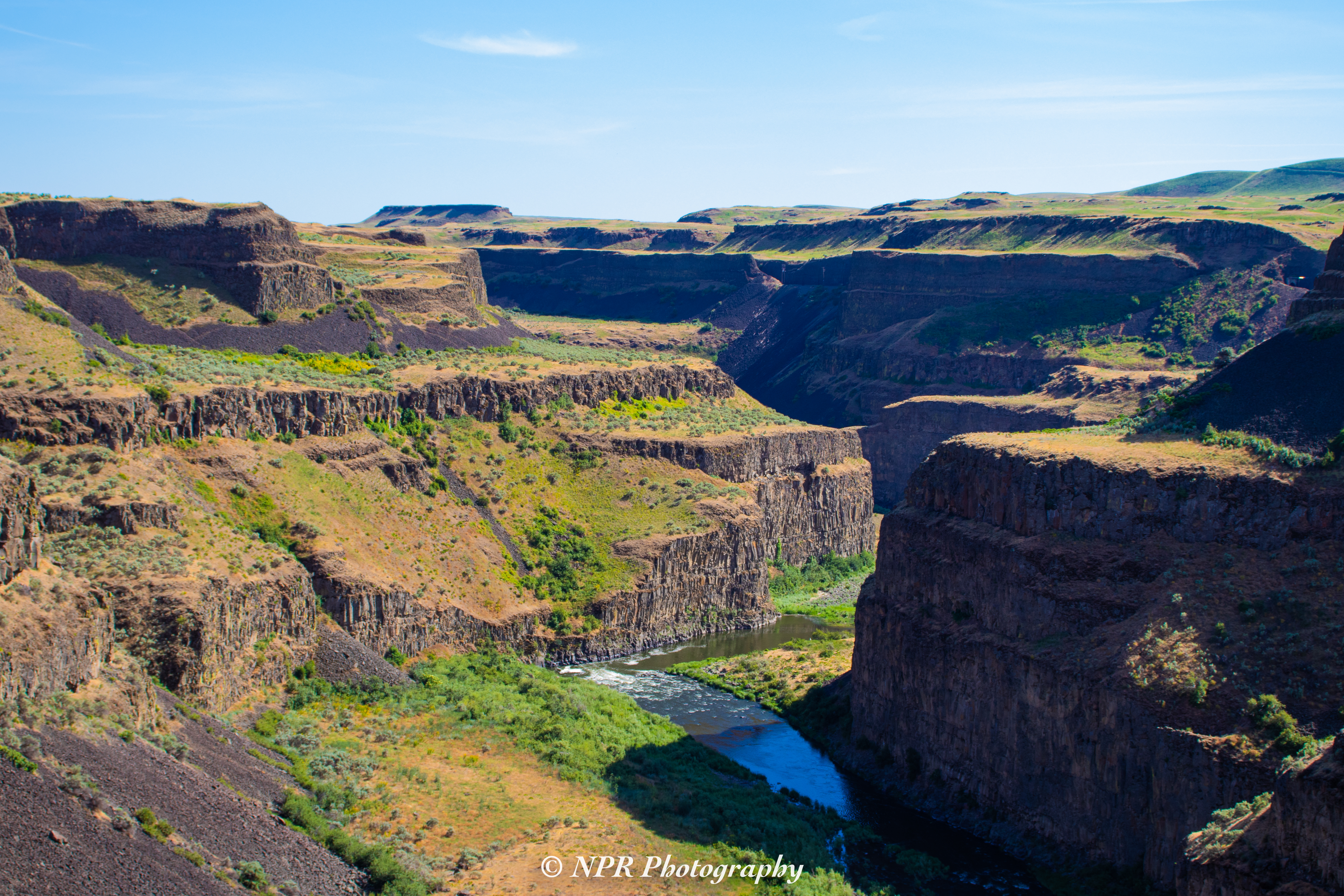
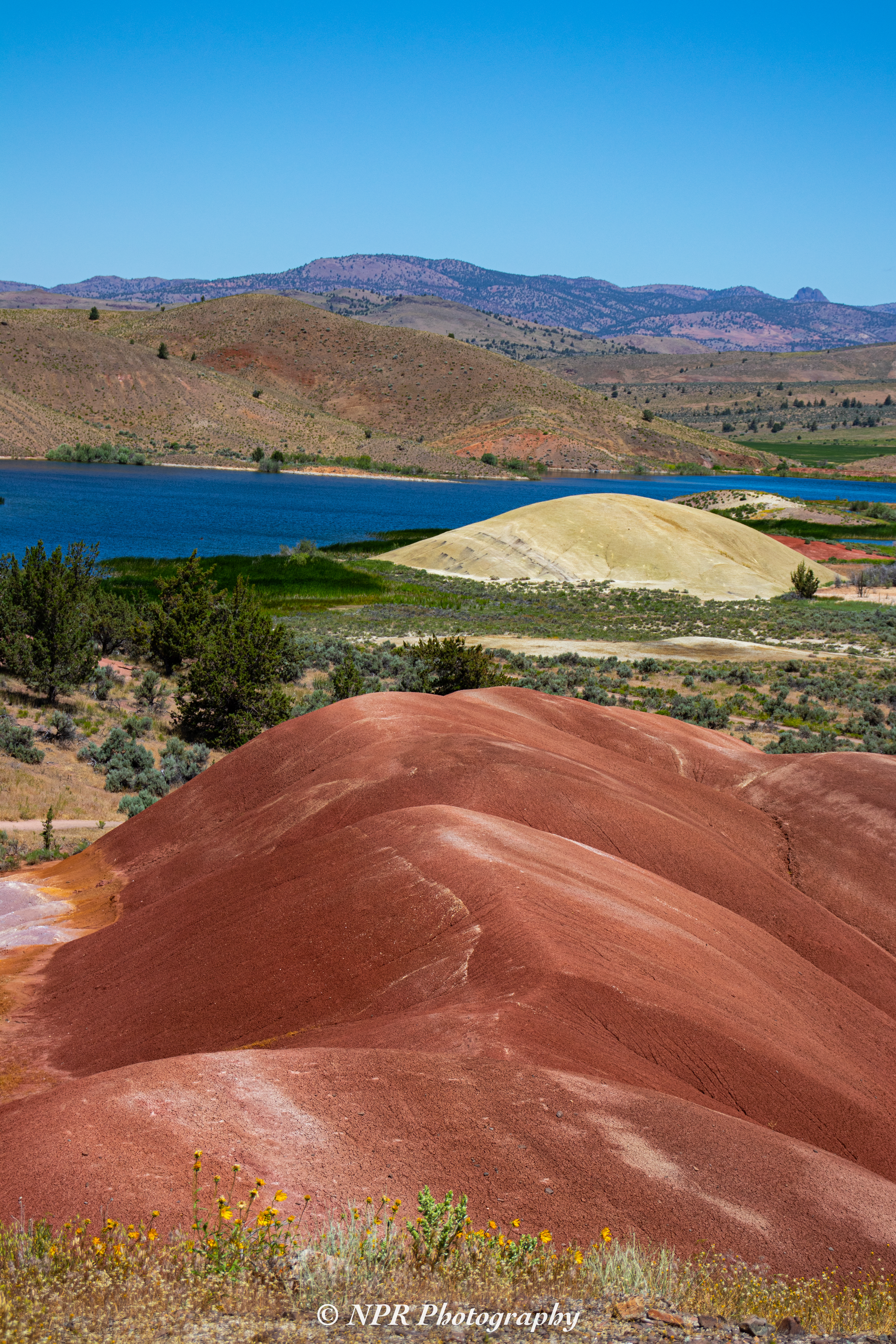
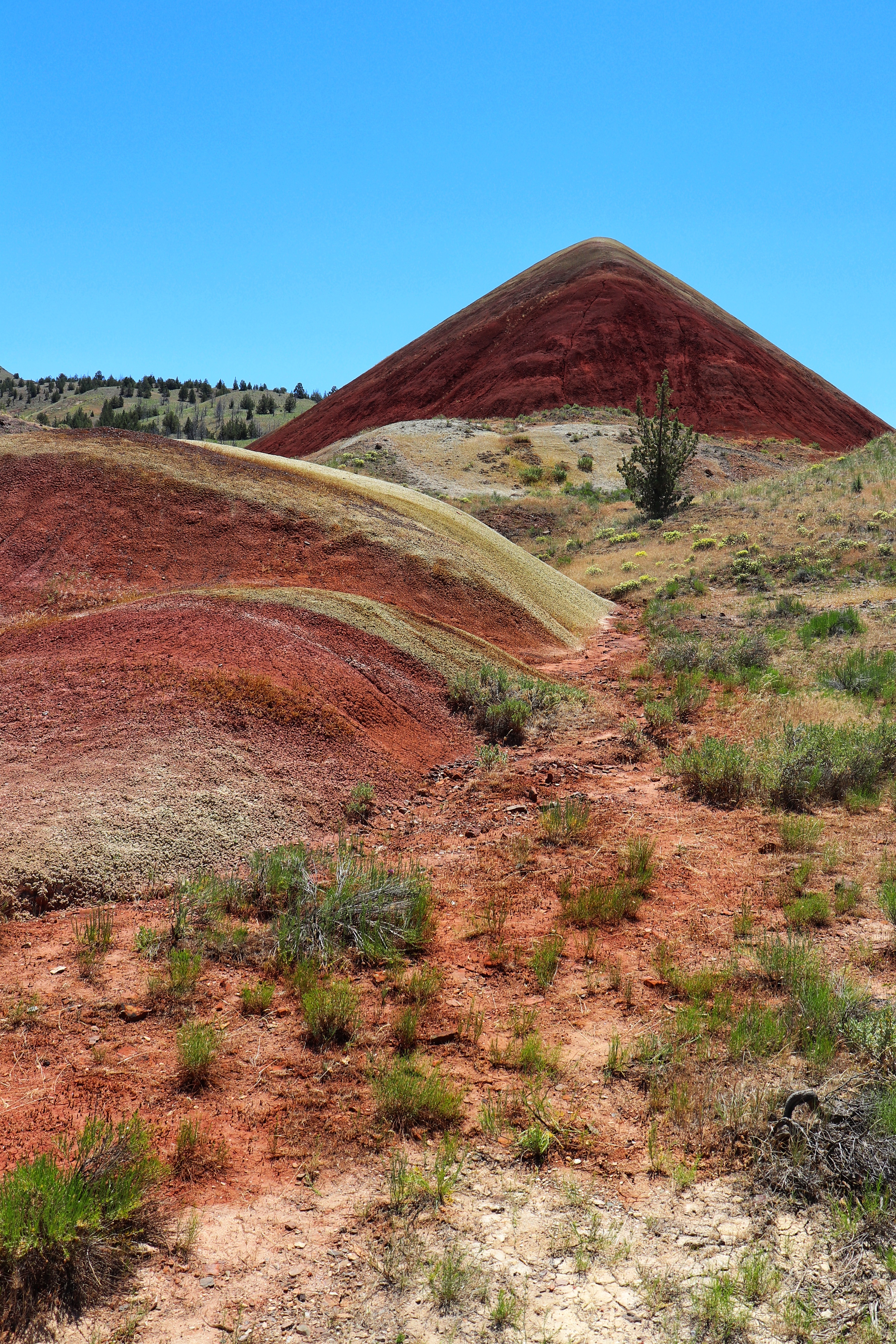
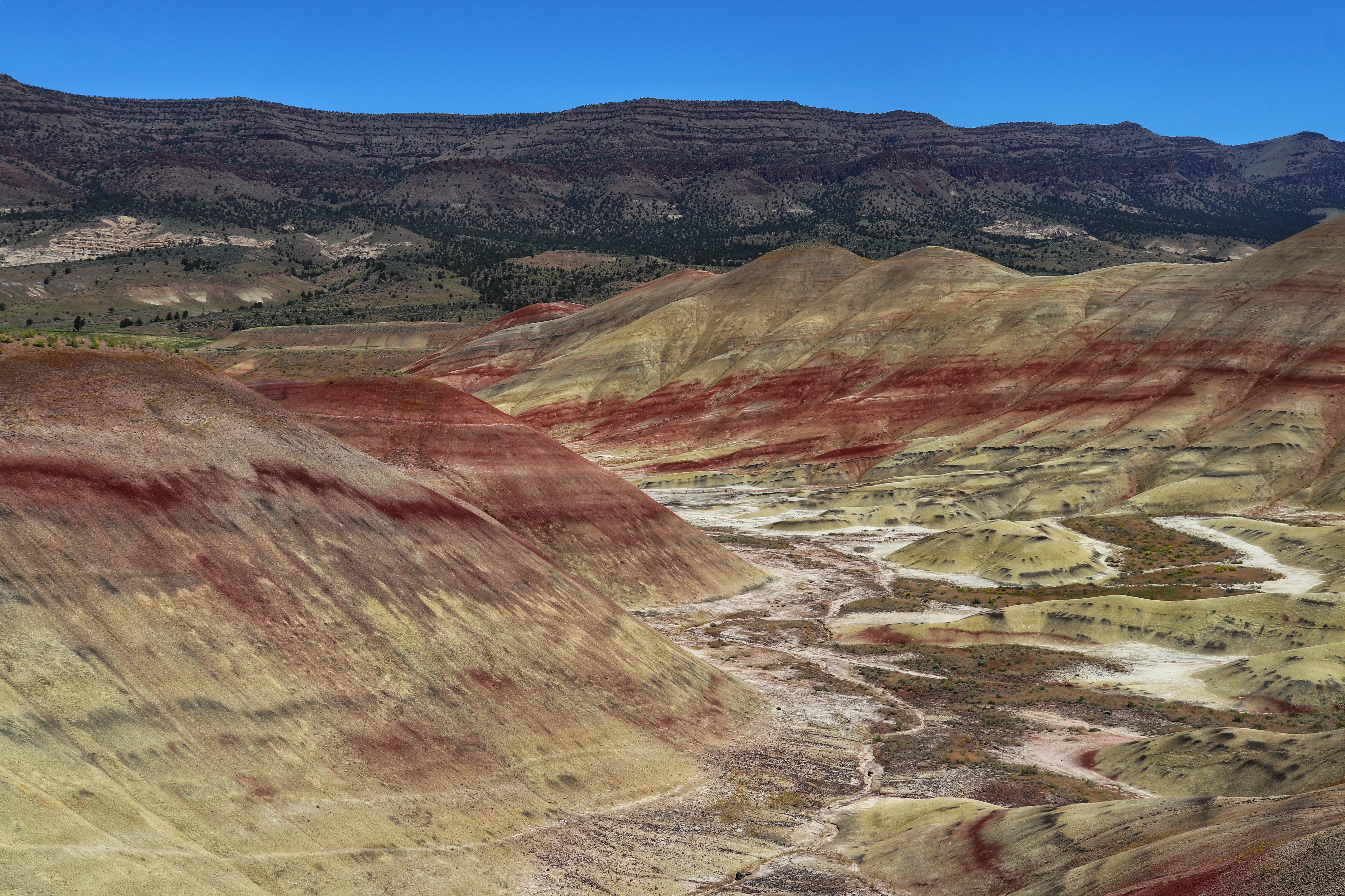
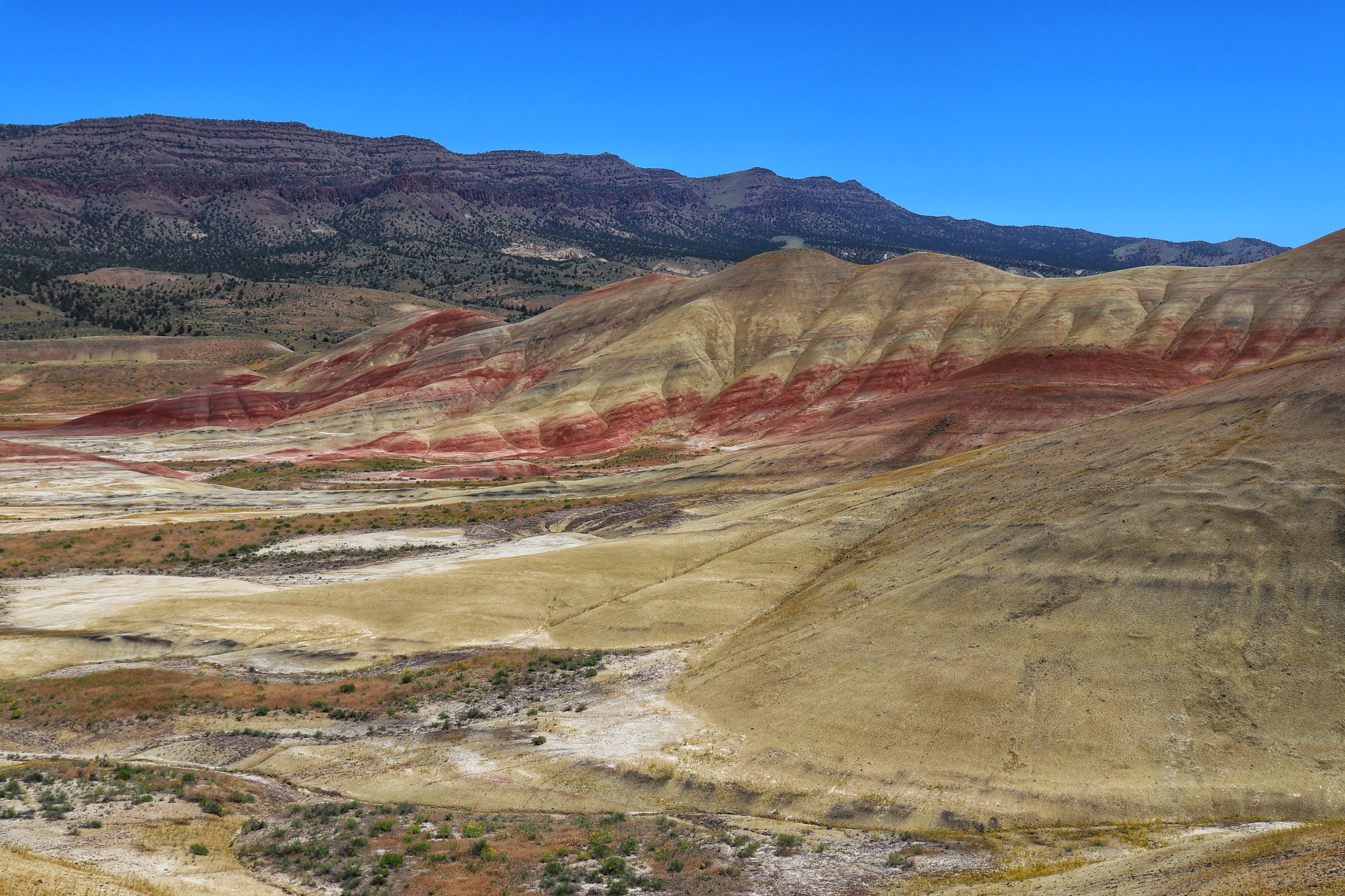
Located in the John Day Fossil Beds National Monument, the Painted Hills are relatively similar to certain features of Badlands National Park.

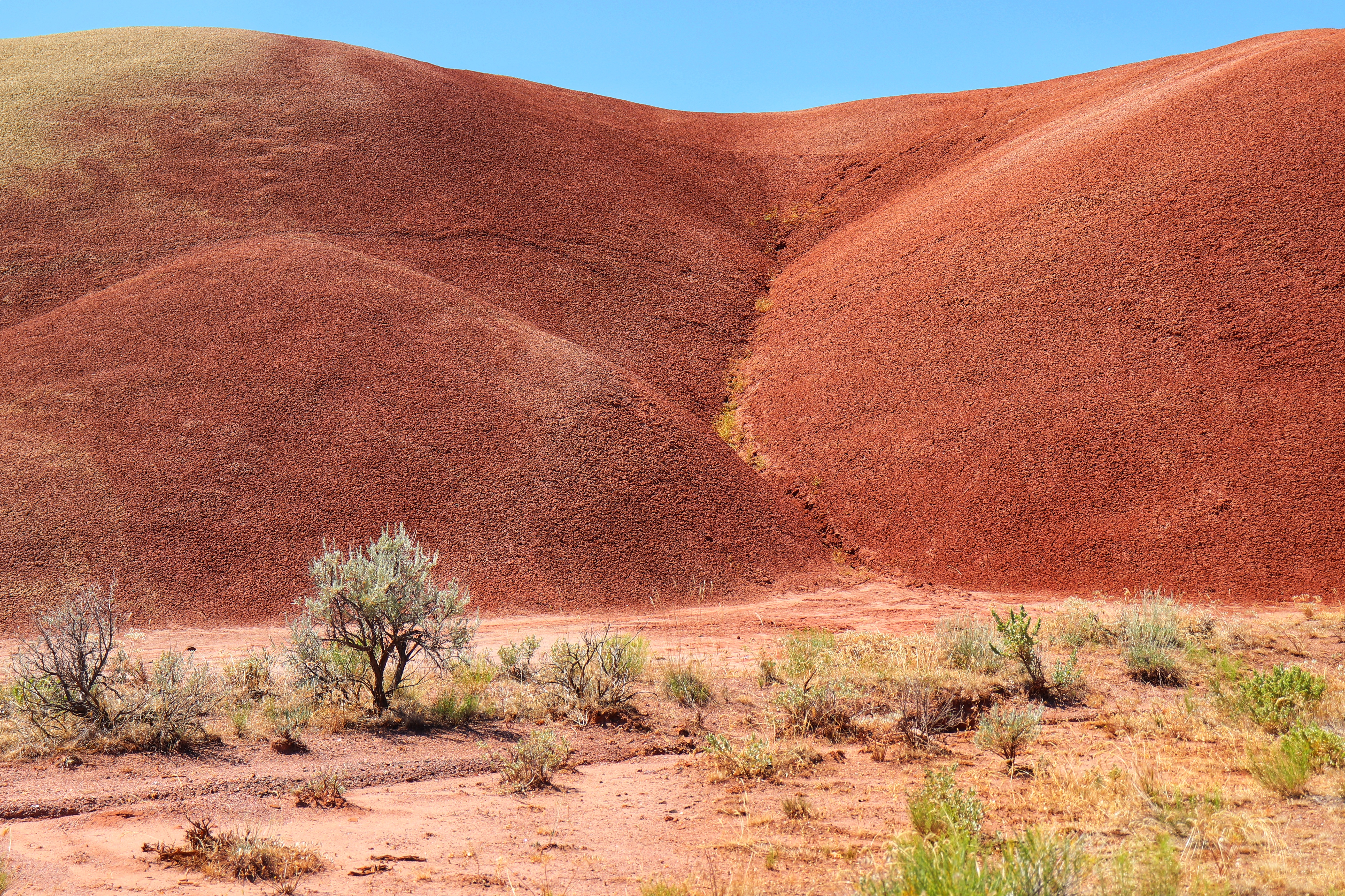
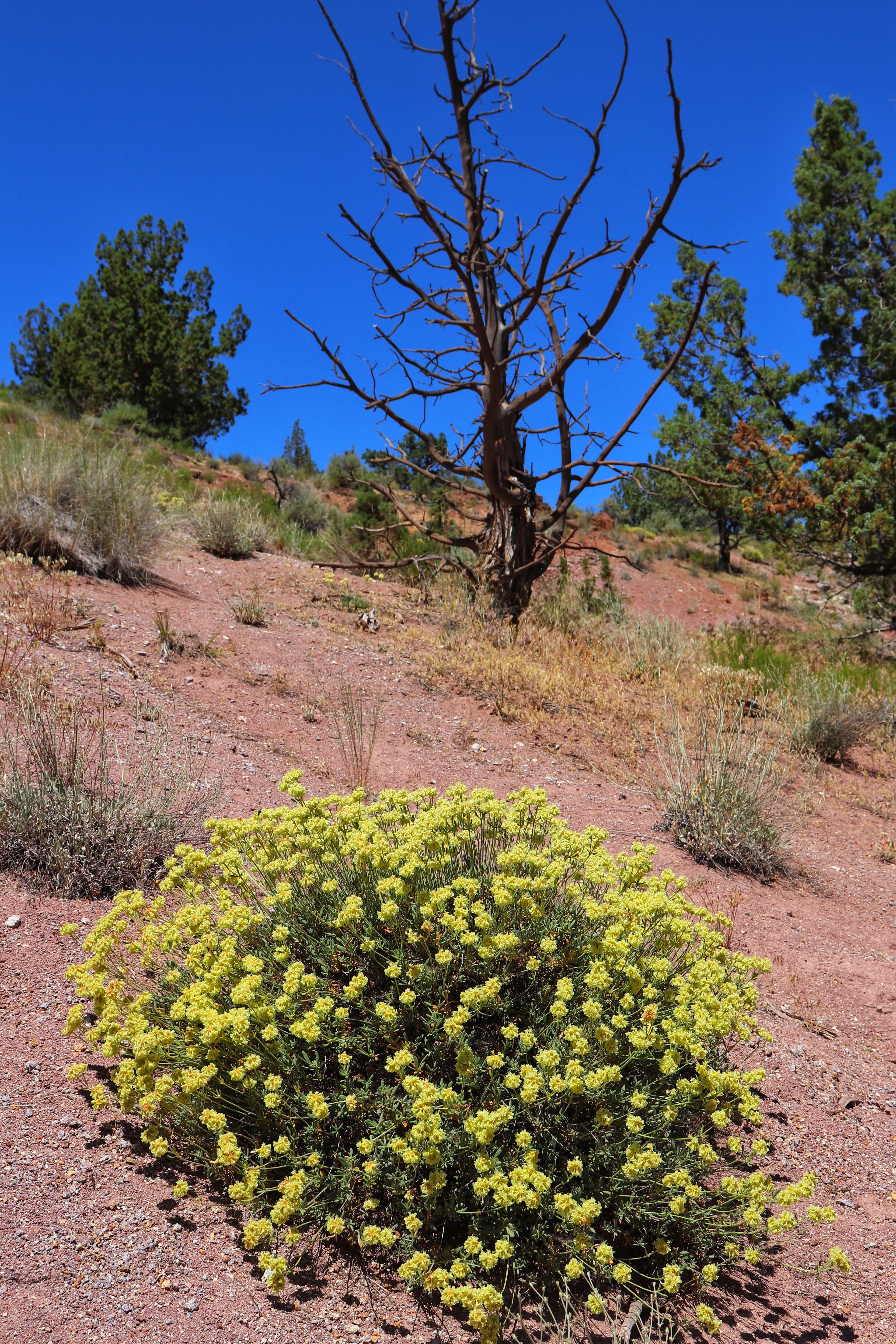
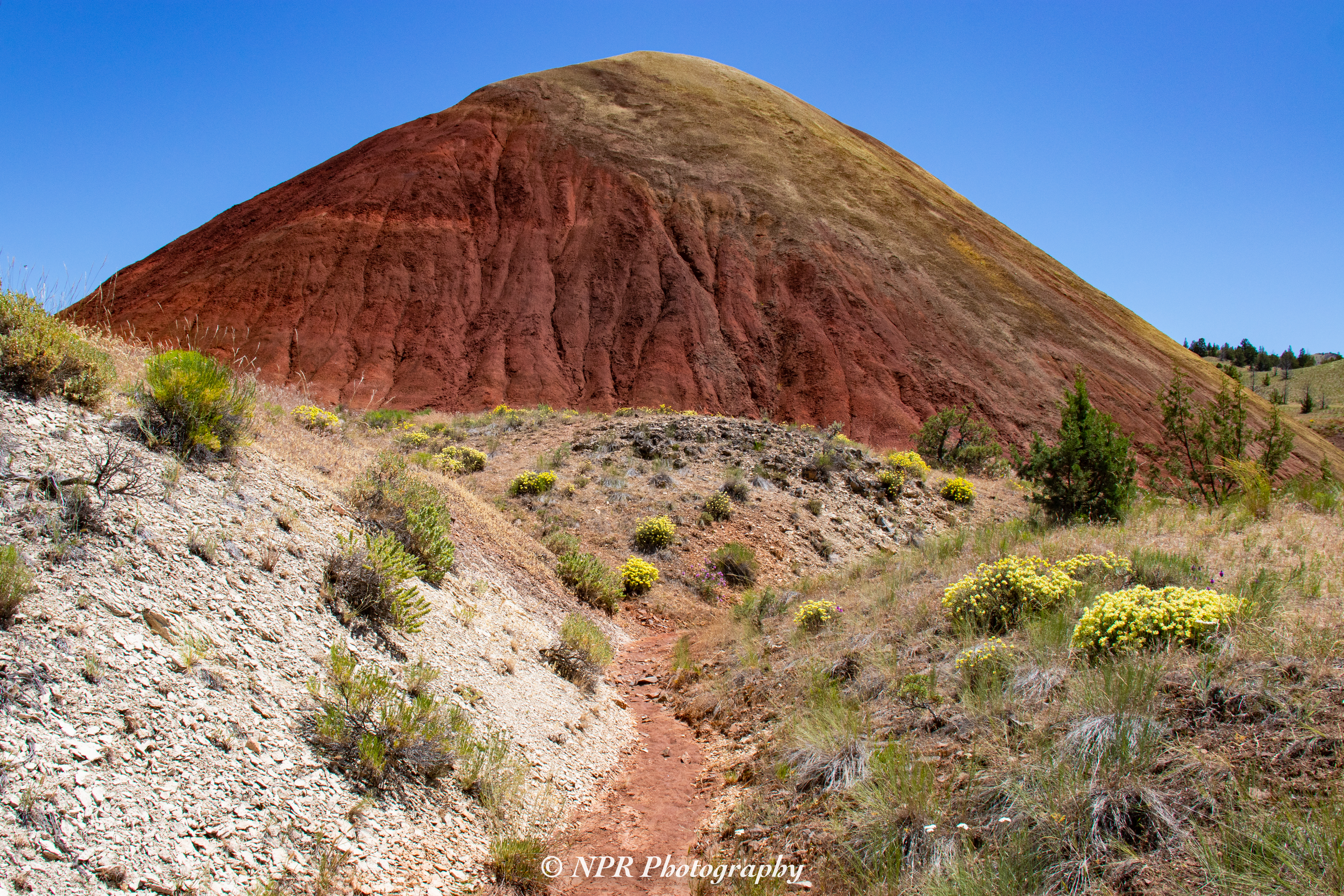
Our first stop is the Painted Cove Trail, a leisurely boardwalk trail circling through and around a series of beautiful, red tinted mounds. This only takes about fifteen to twenty minutes to enjoy, but slowing down to take in the scenery is a must.

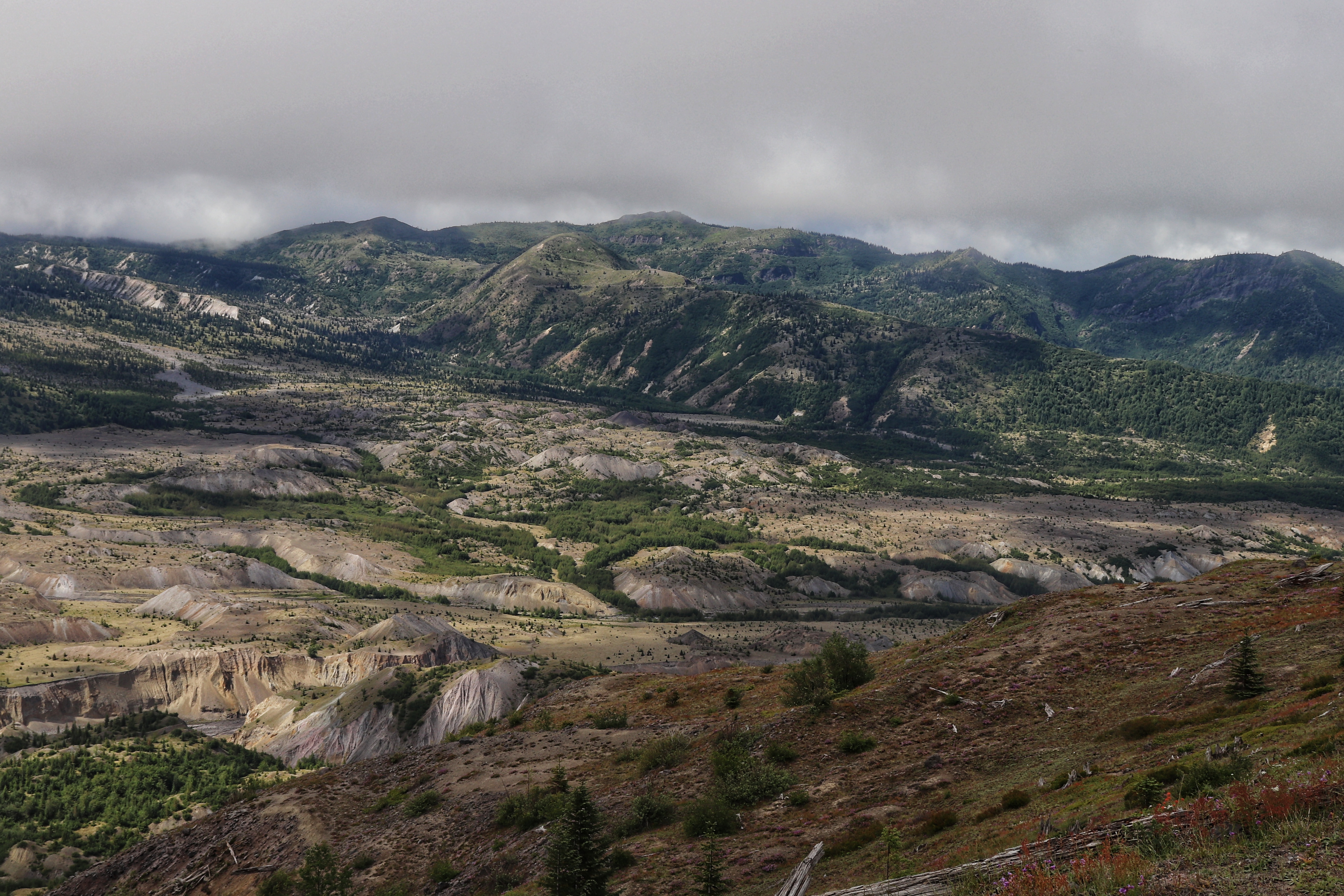
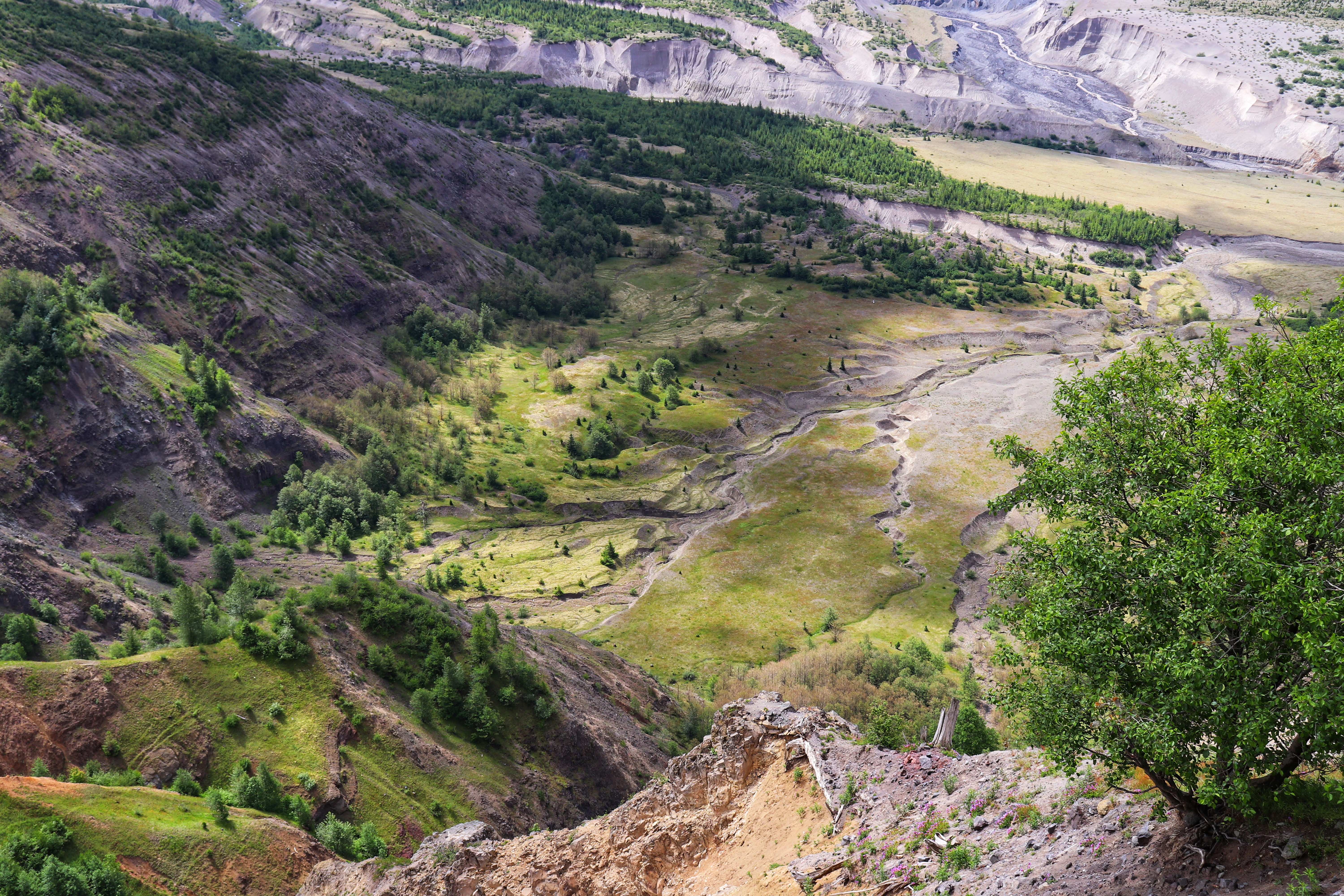
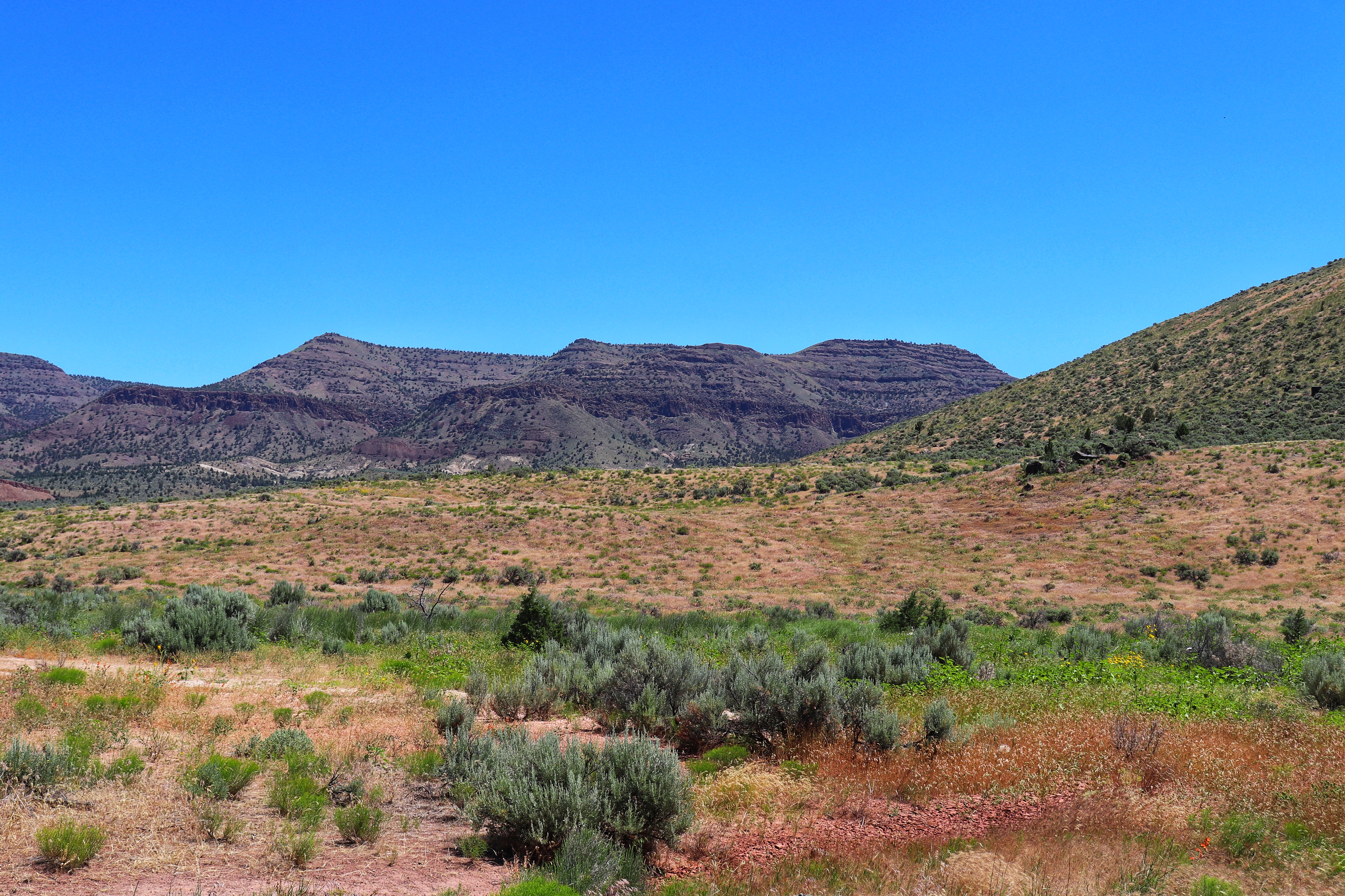
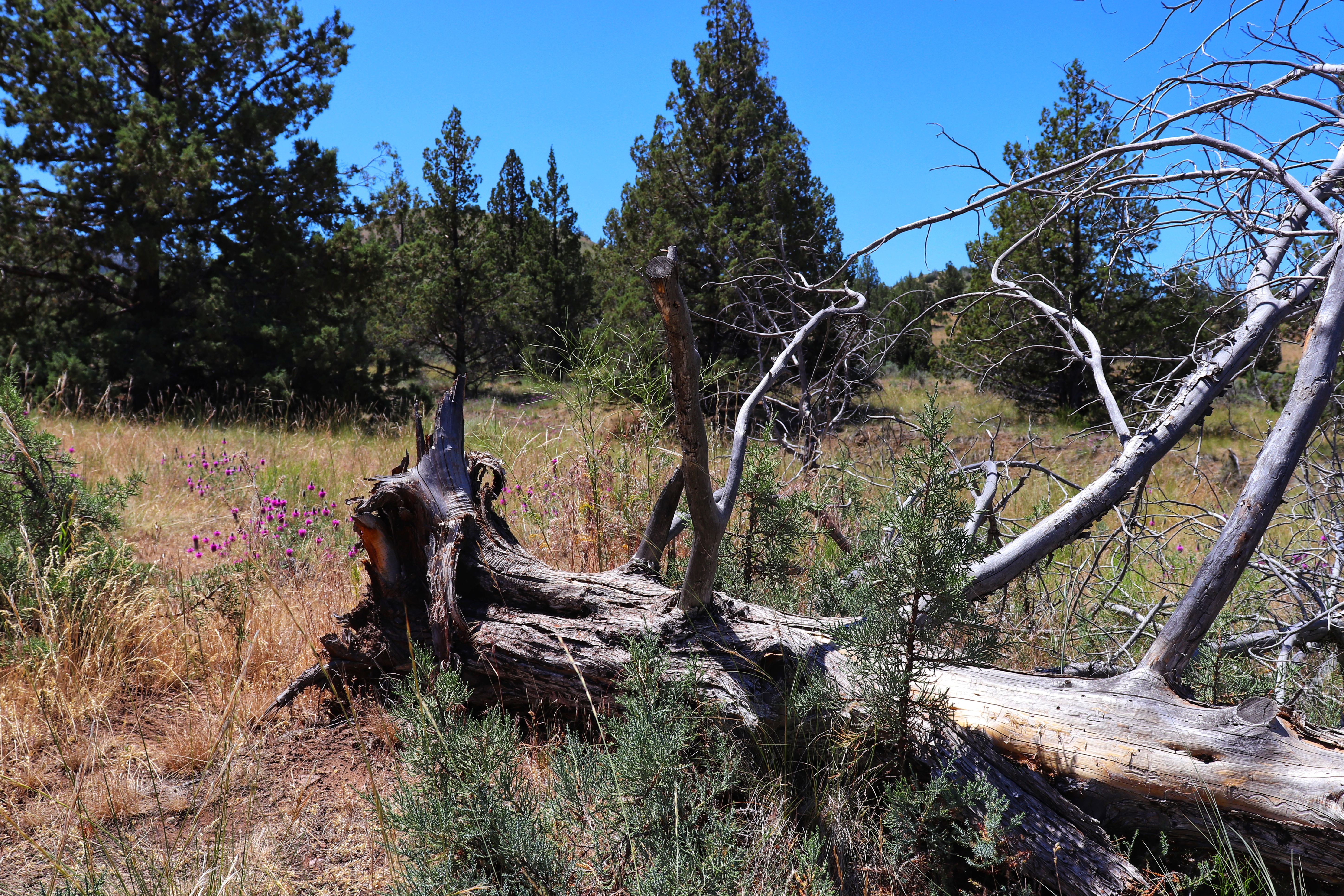
From there it’s only a short drive to reach the Red Hill Trail, nestled further into the park area. The hike to a viewpoint overlooking the region is a gravel and dirt path that doesn’t suffer from poor maintenance.

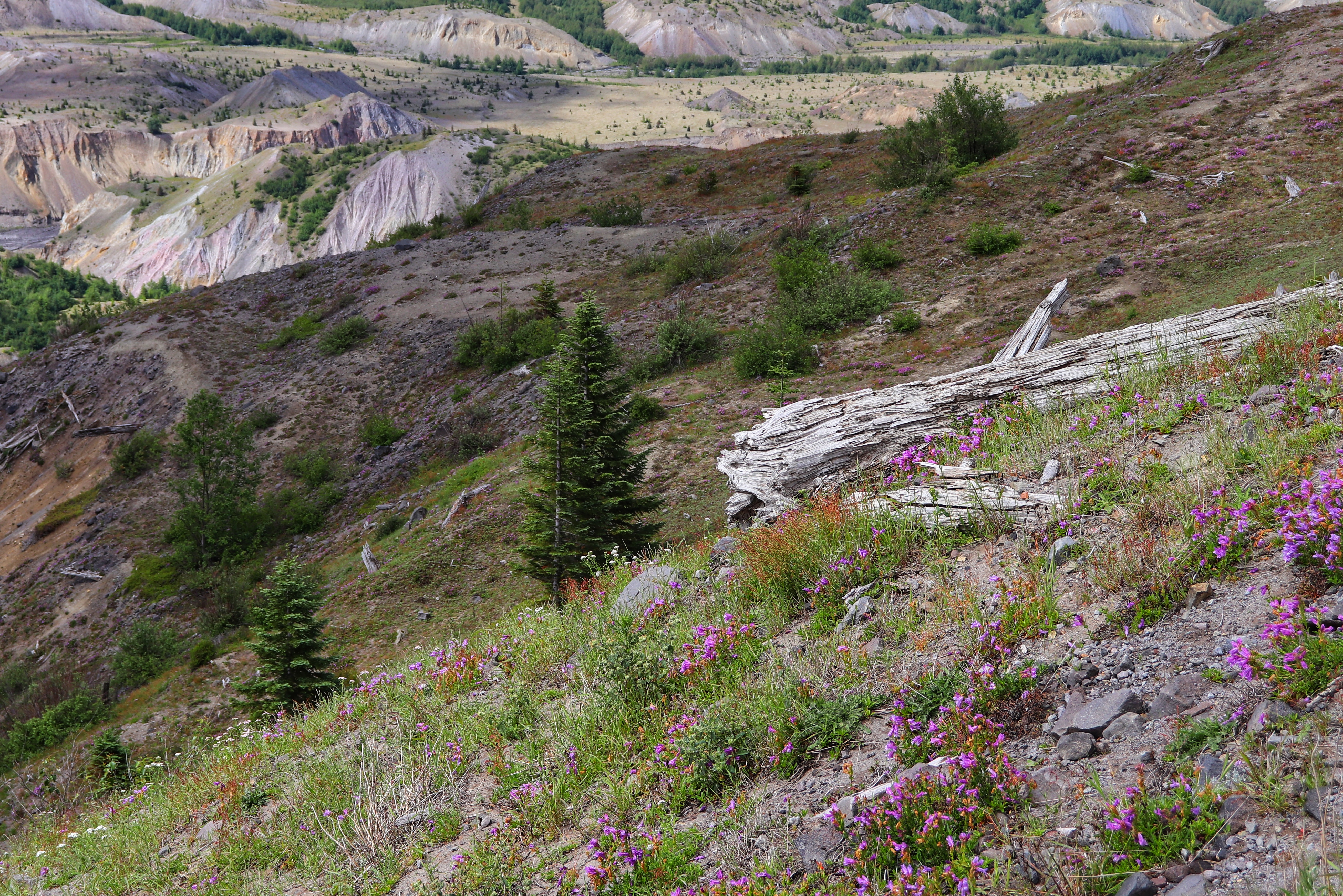
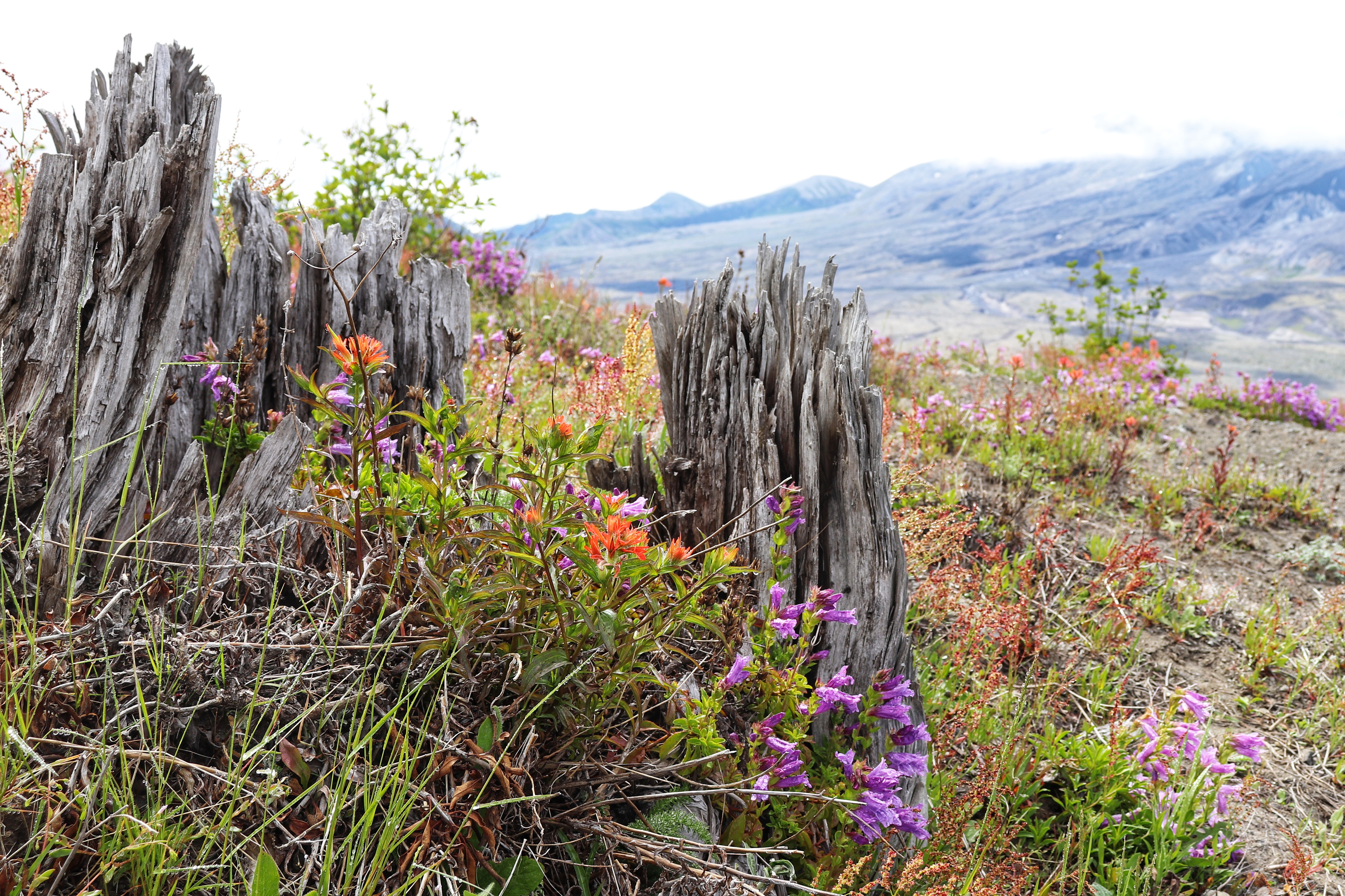
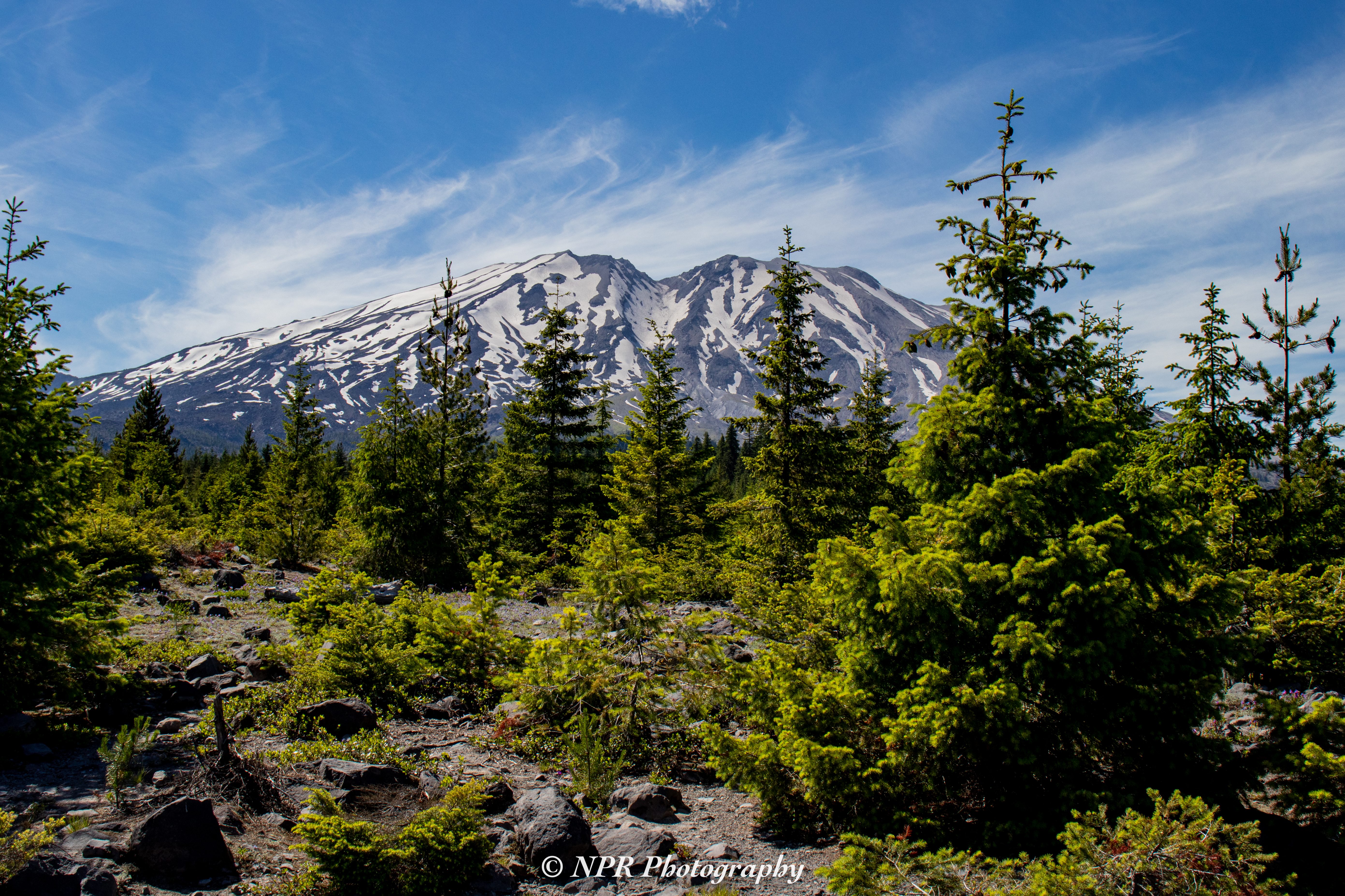
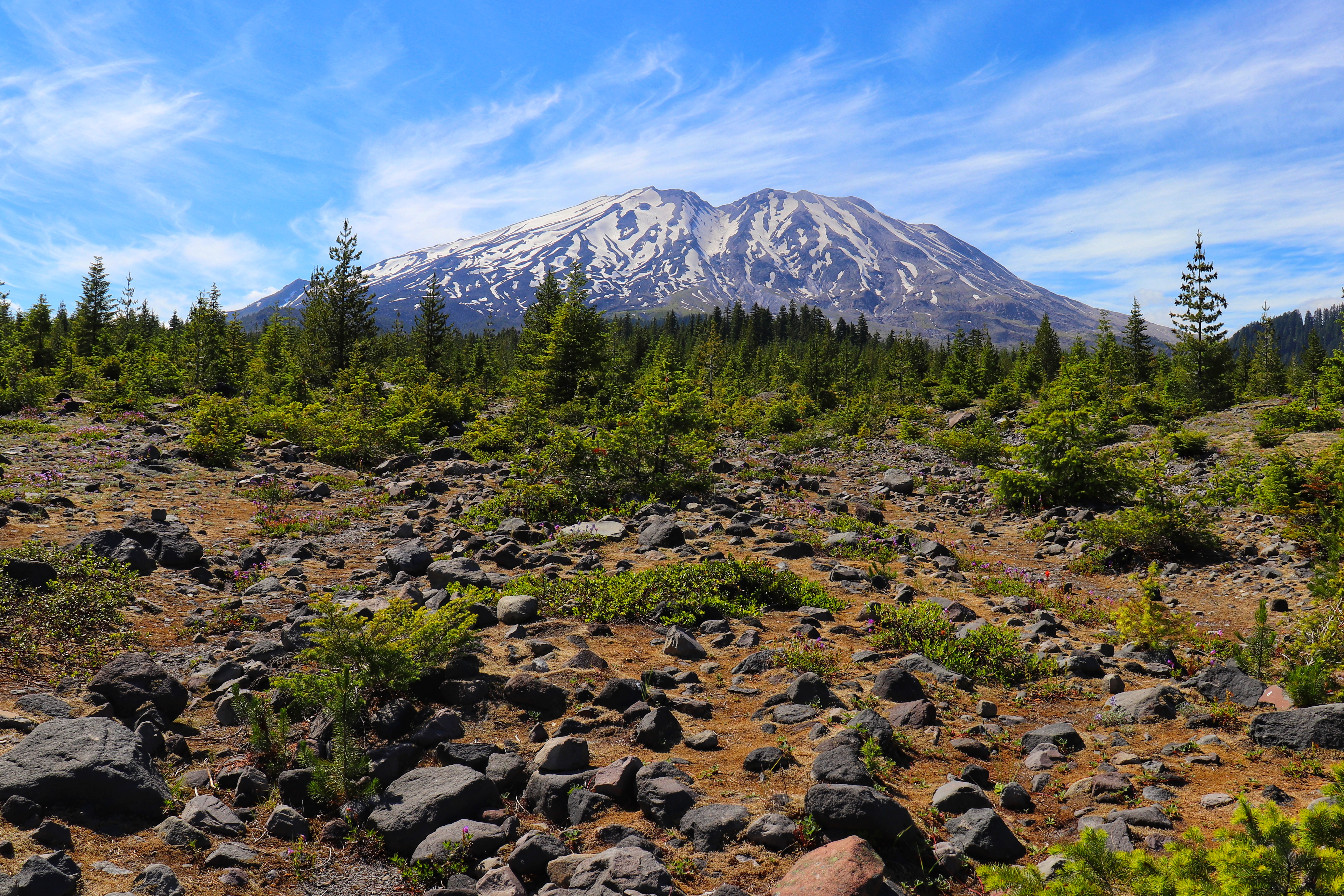
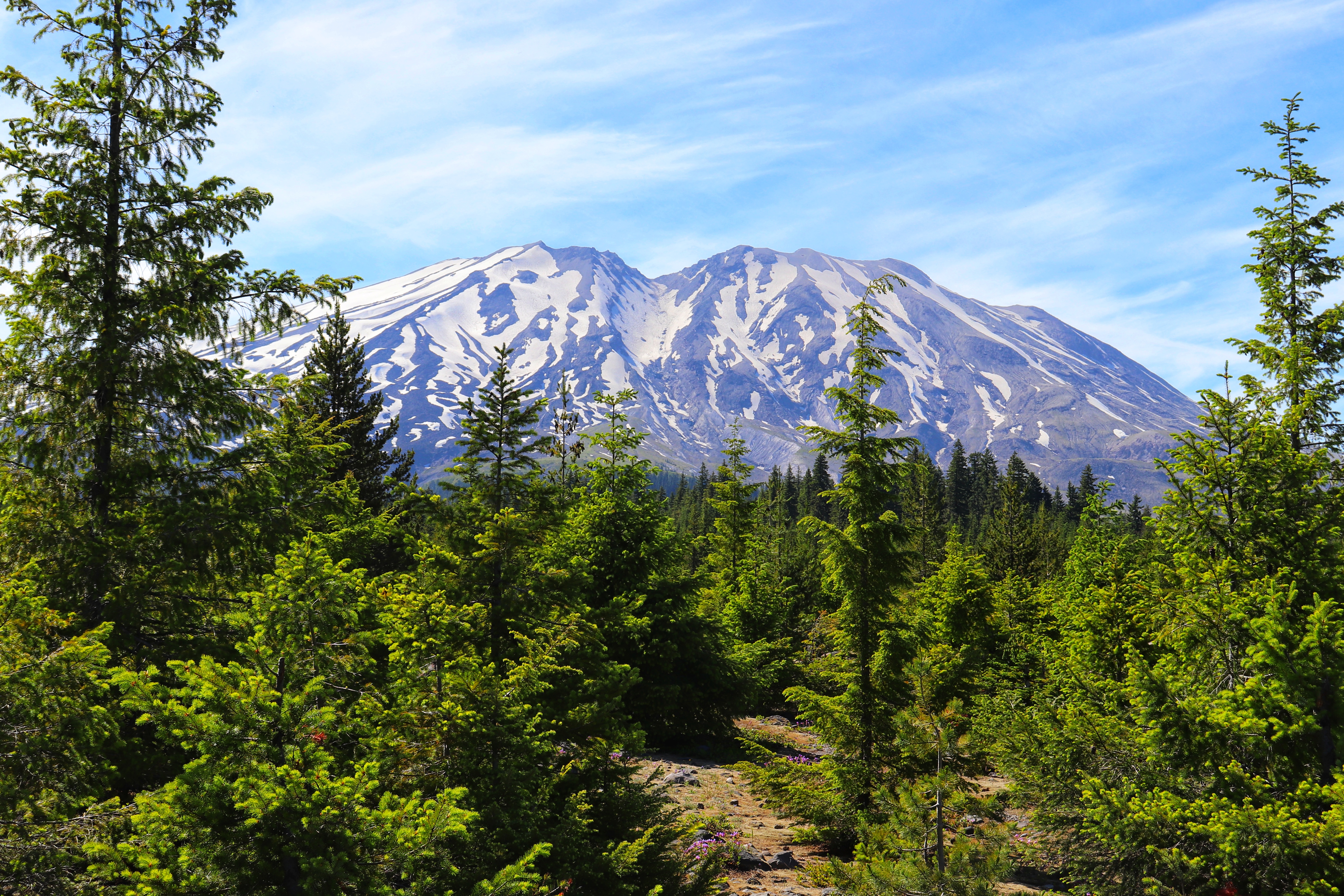
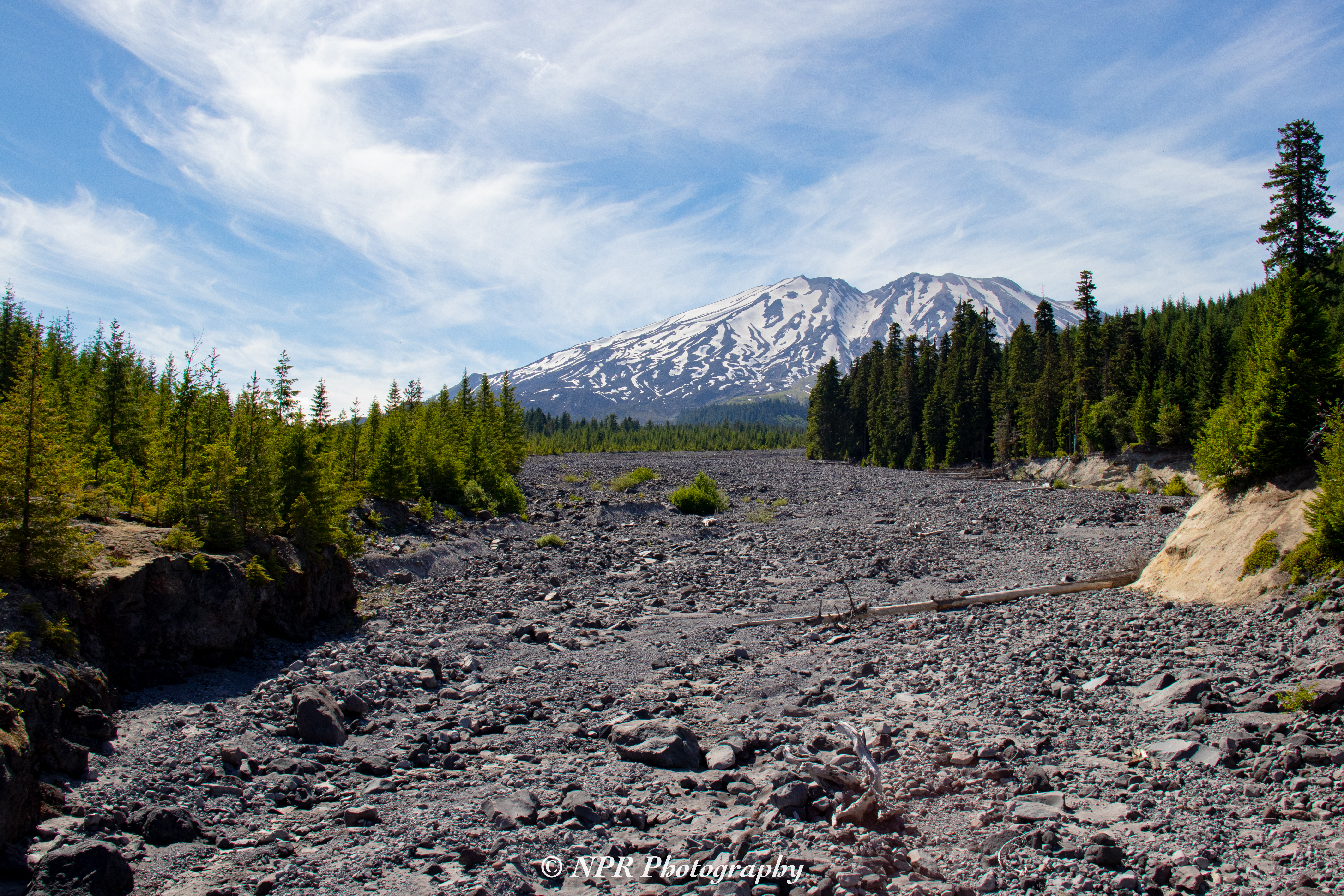
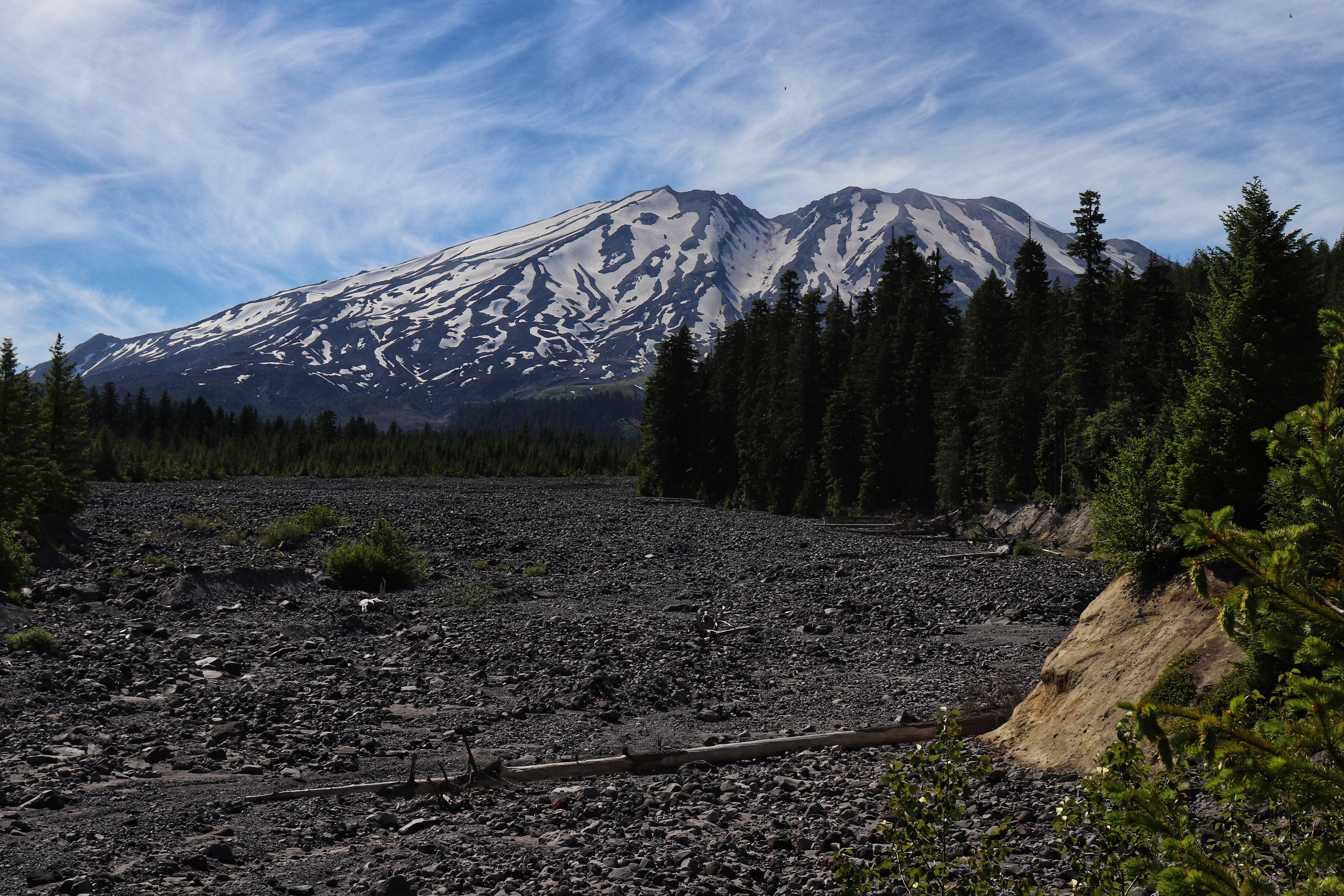
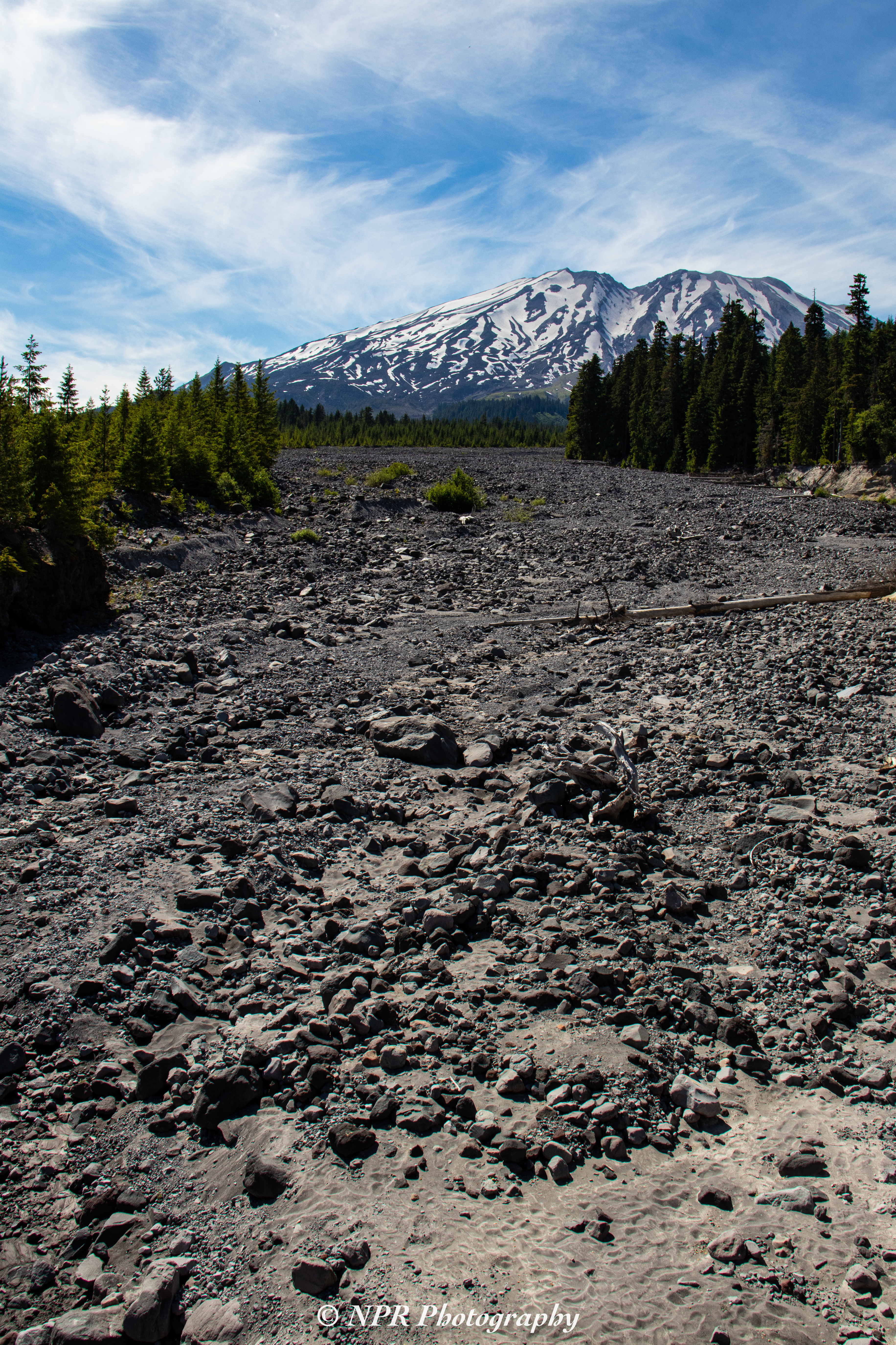
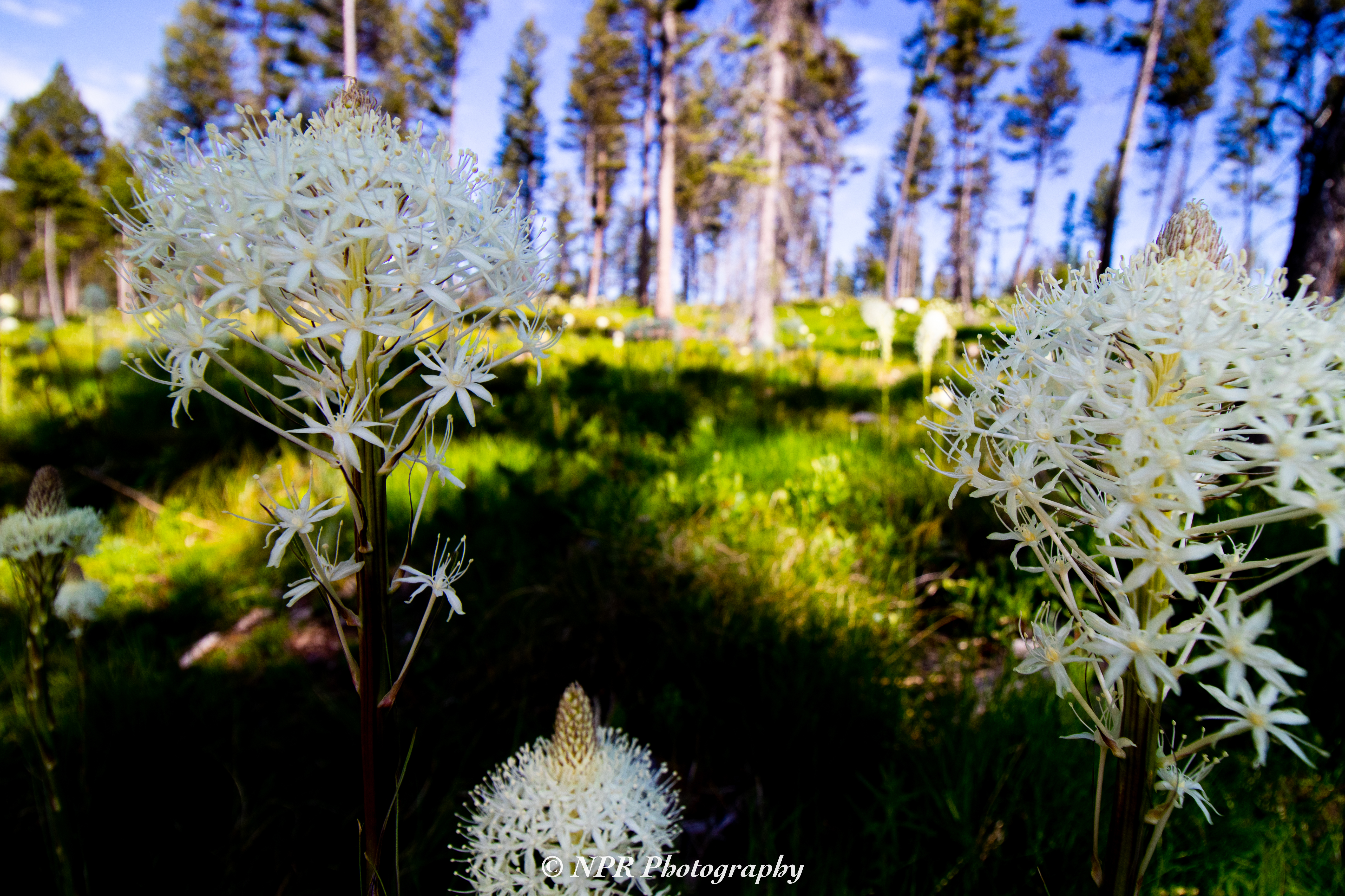
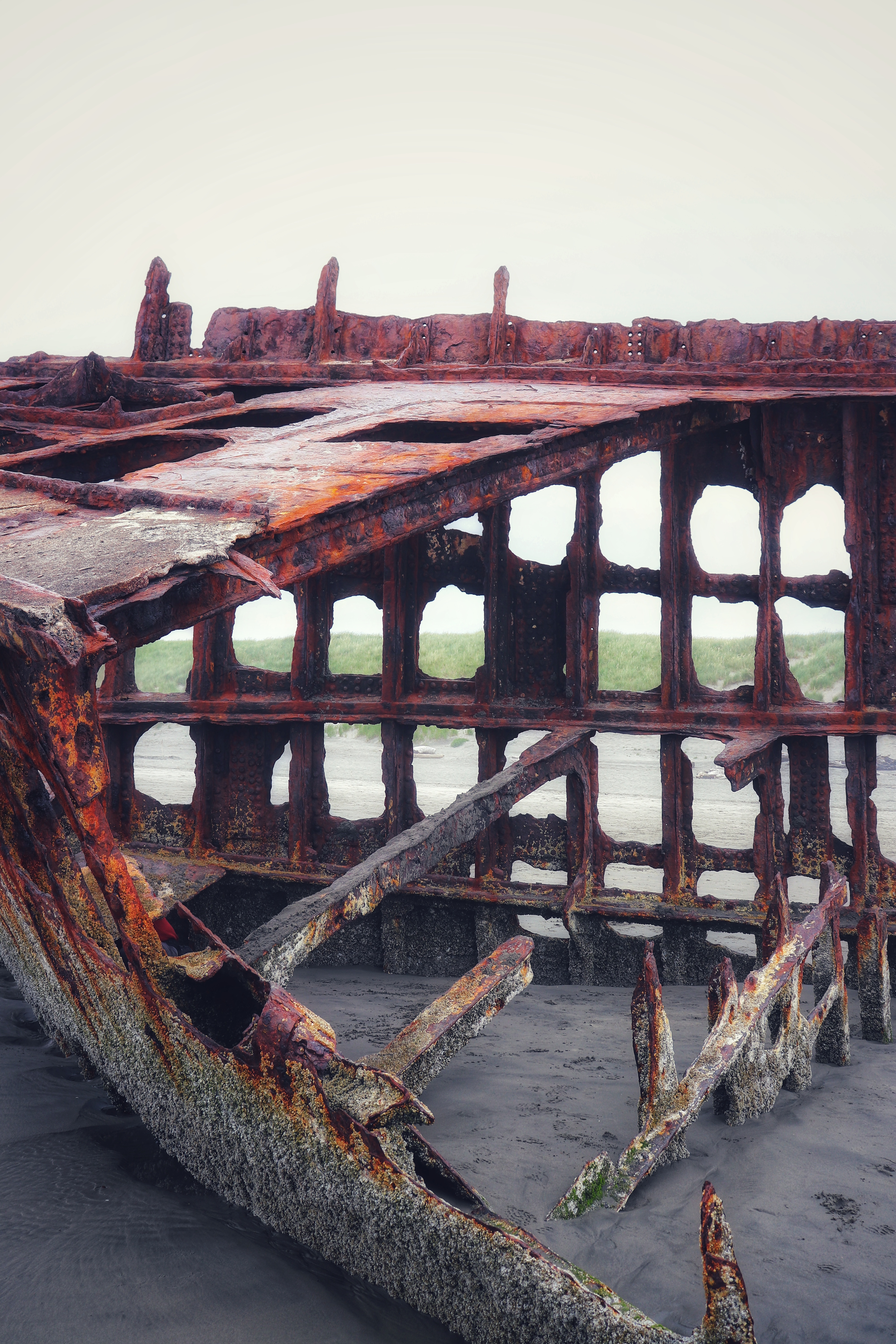
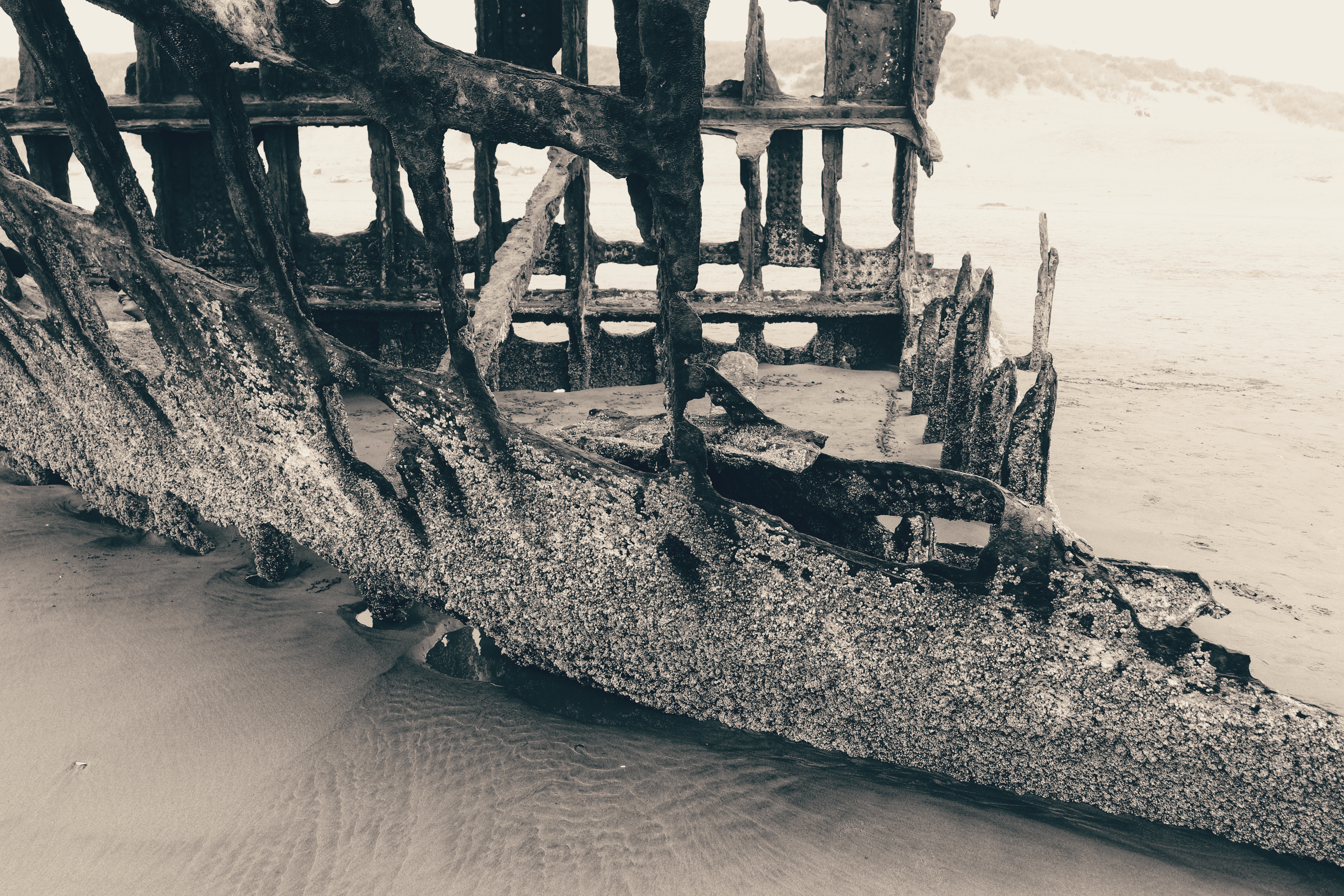
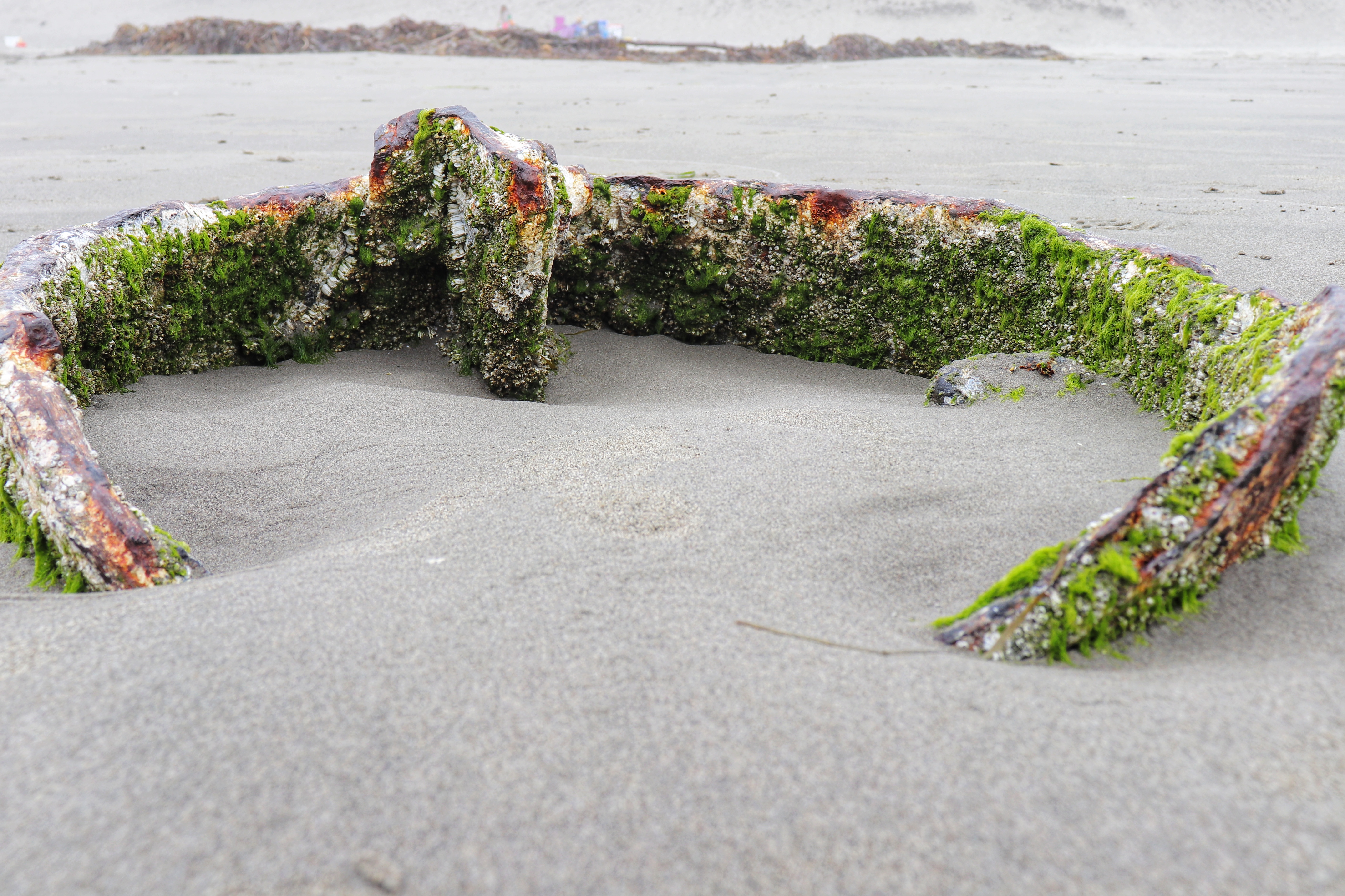
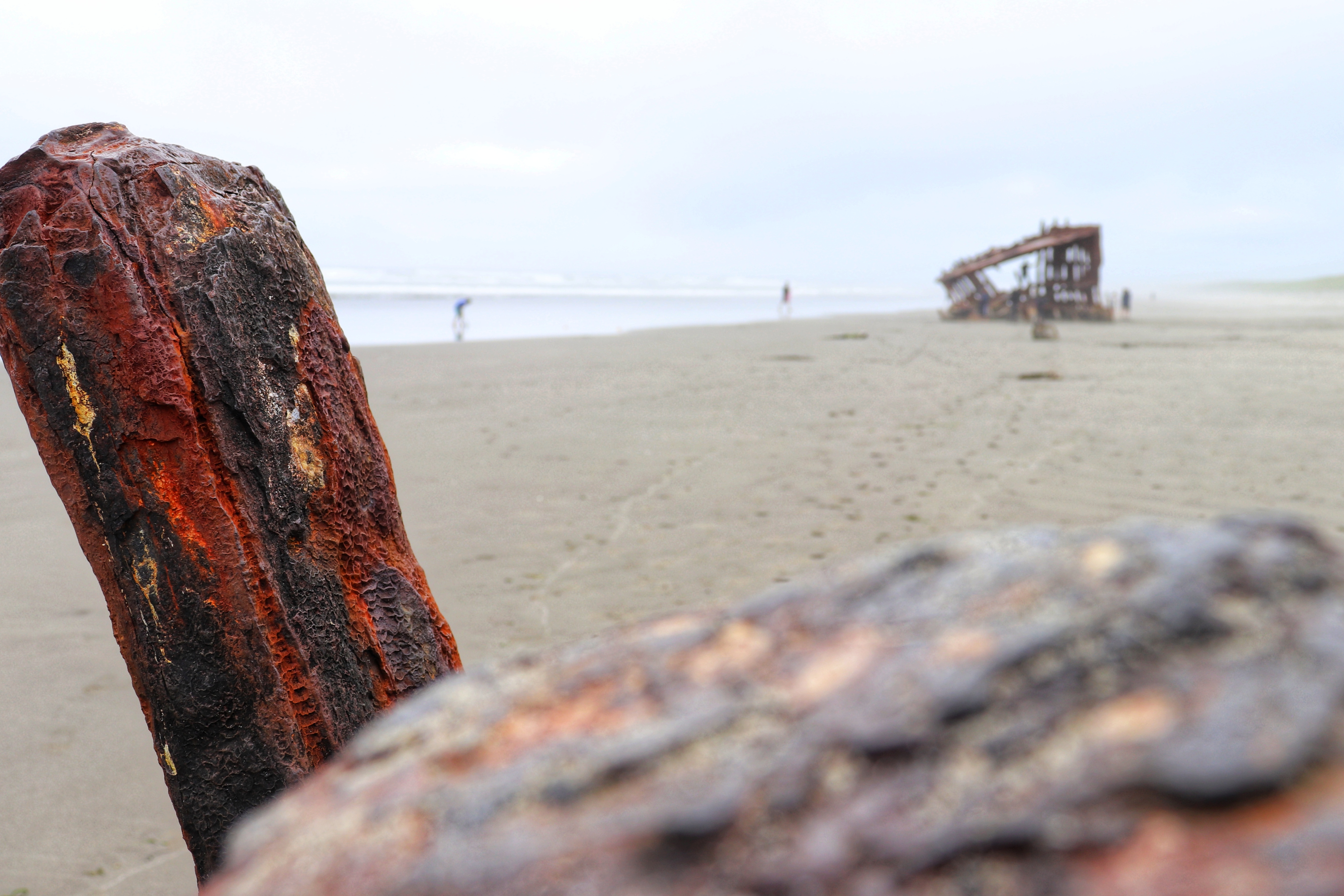
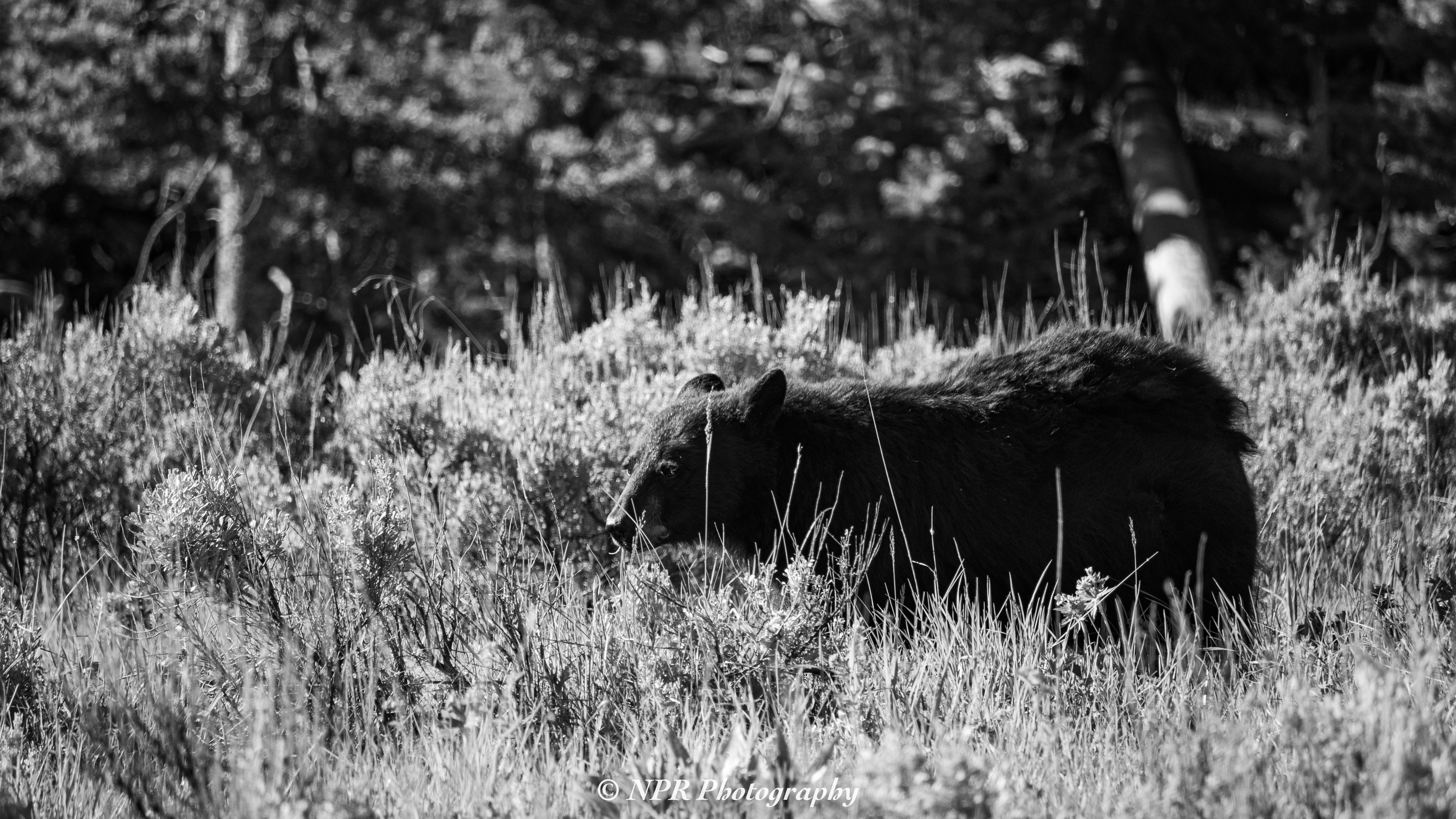
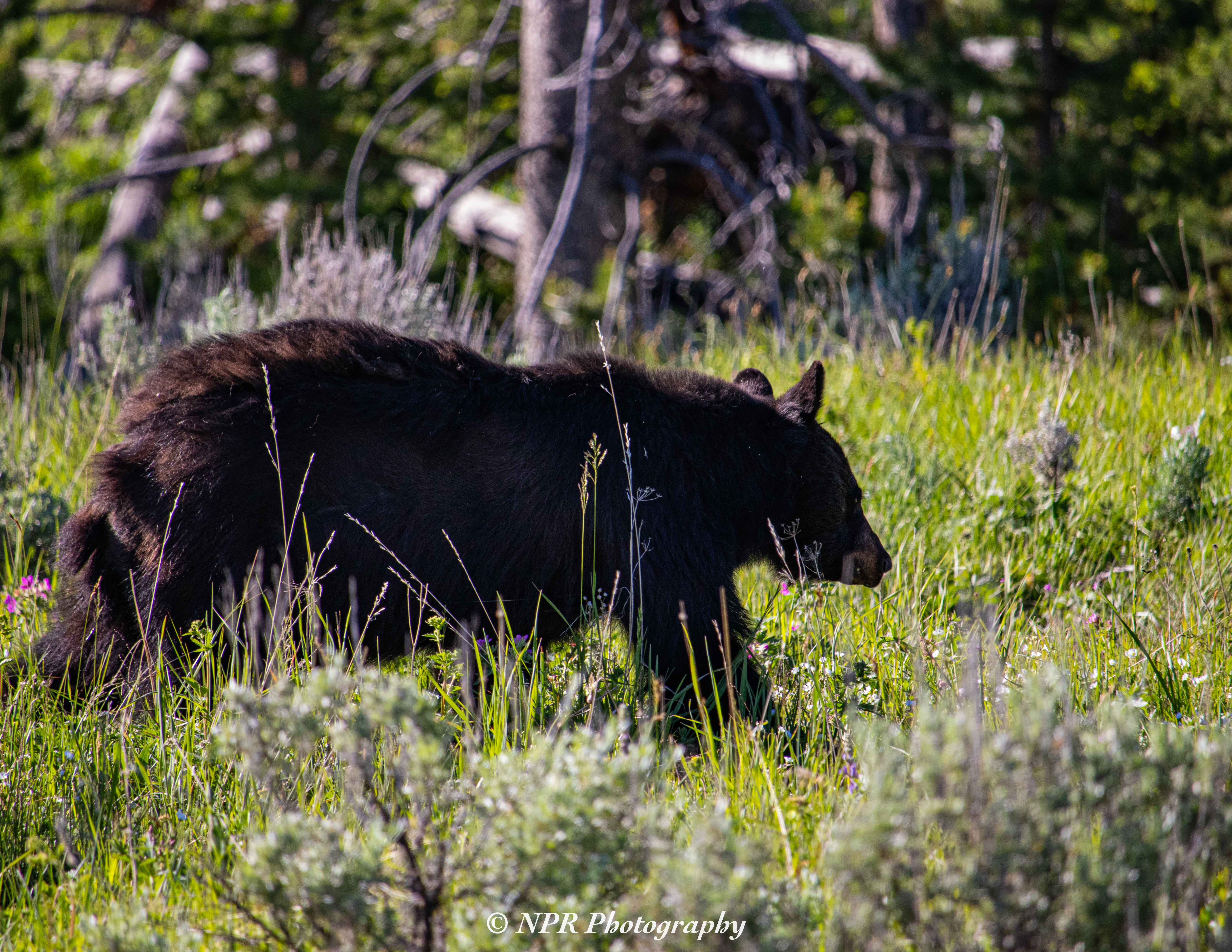
Photos are both above and below.

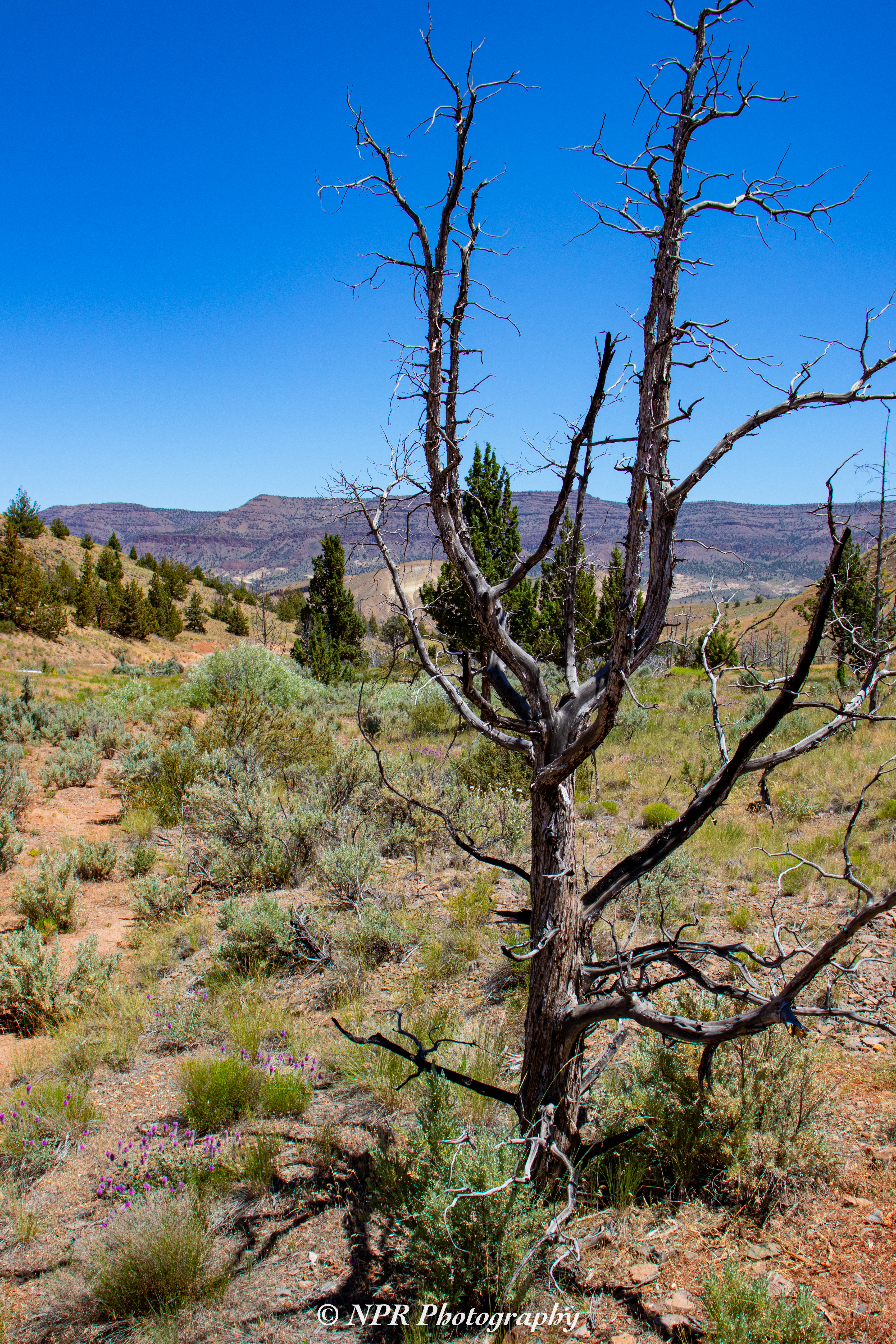
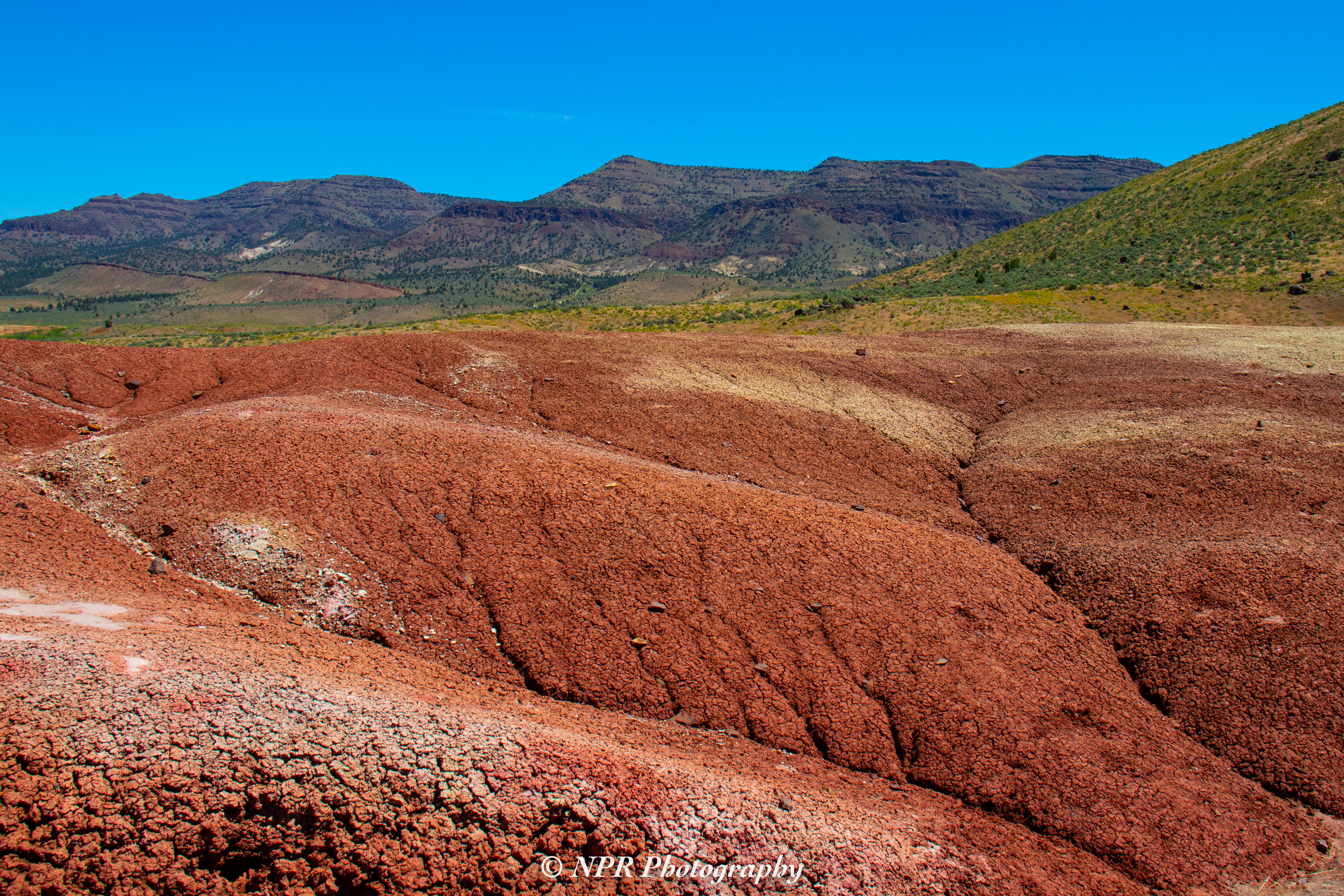
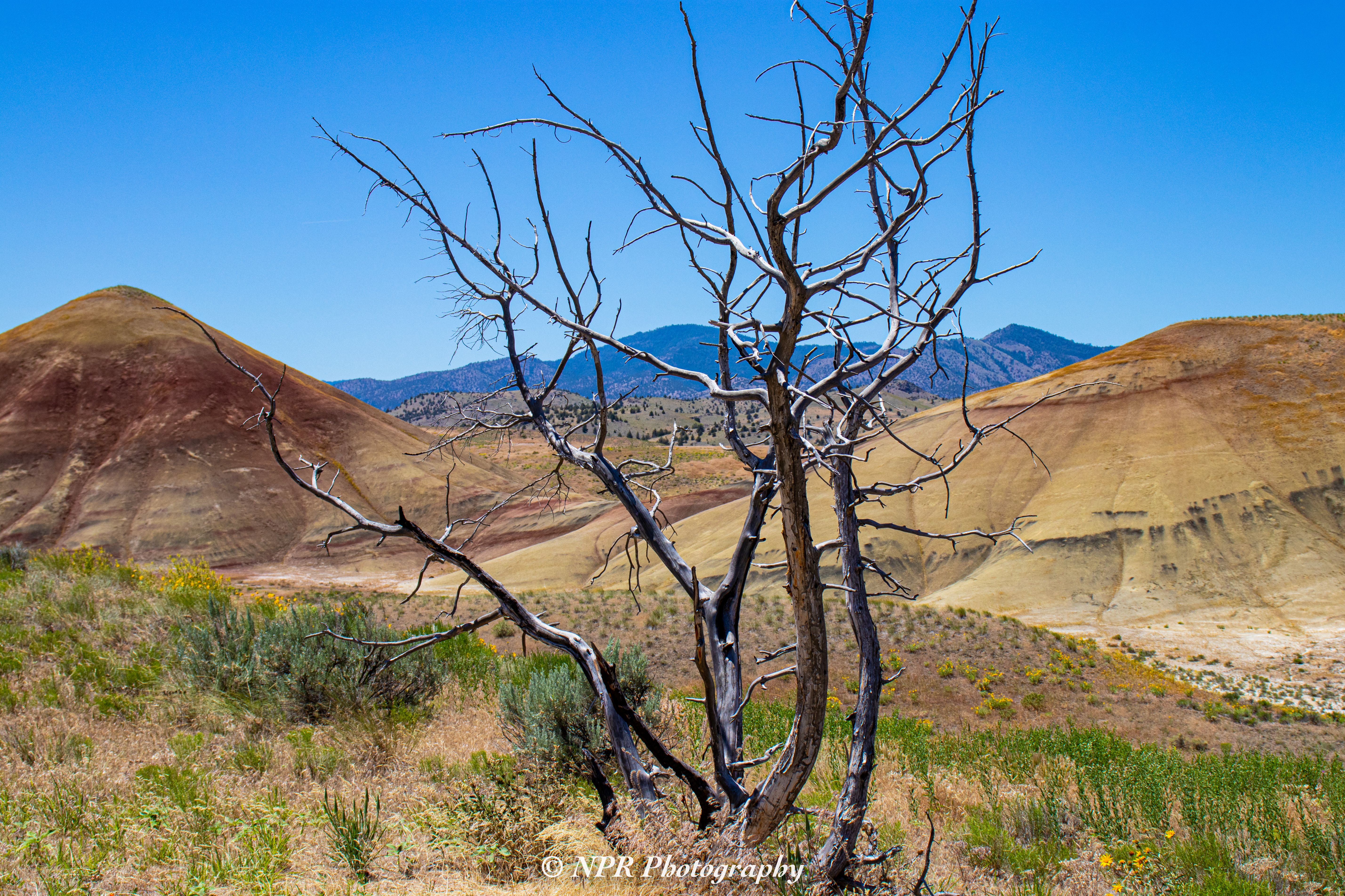
Before leaving the Painted Hills, we stopped at the Painted Hills Overlook we’d enjoyed a great deal during our previous visit. The day was sunny and it gets hot in the high elevation desert environment, so our visit was cut short just after 12:30 PM. Photos of that stop are below.

Returning to Highway 26, we continued East, finally cutting North in Mitchell, OR to take the Service Creek-Mitchell Highway North. Reaching Fossil, OR, we took Highway 218 West to the ghost town of Shaniko, OR. The drive, taking approximately two and a half hours, is a fantastic one. The roadways curve up and down hillsides and mountains, providing lovely views of high-elevation valleys and farmland. If we’d not had other places to go, I’d have loved to spend more time there, stopping for photos on an annoyingly consistent basis.

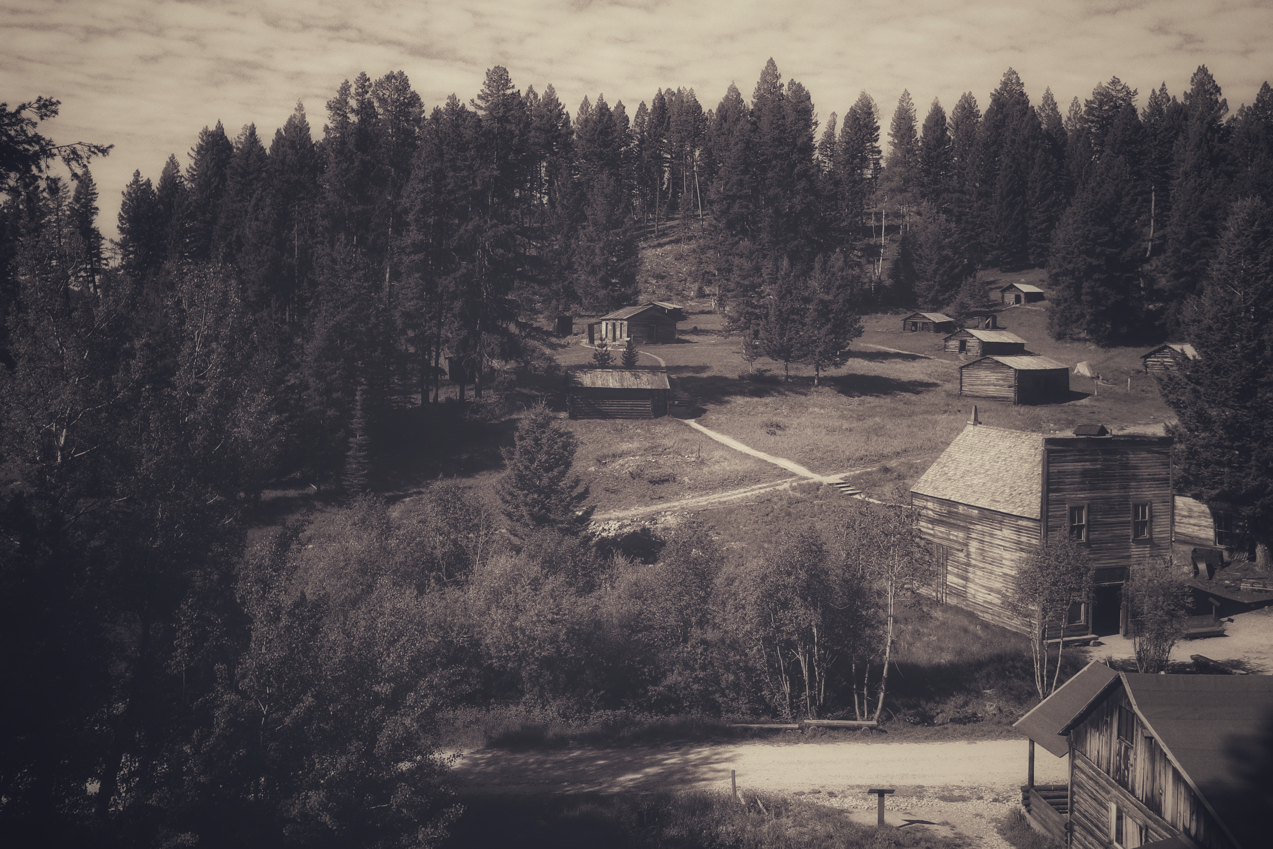
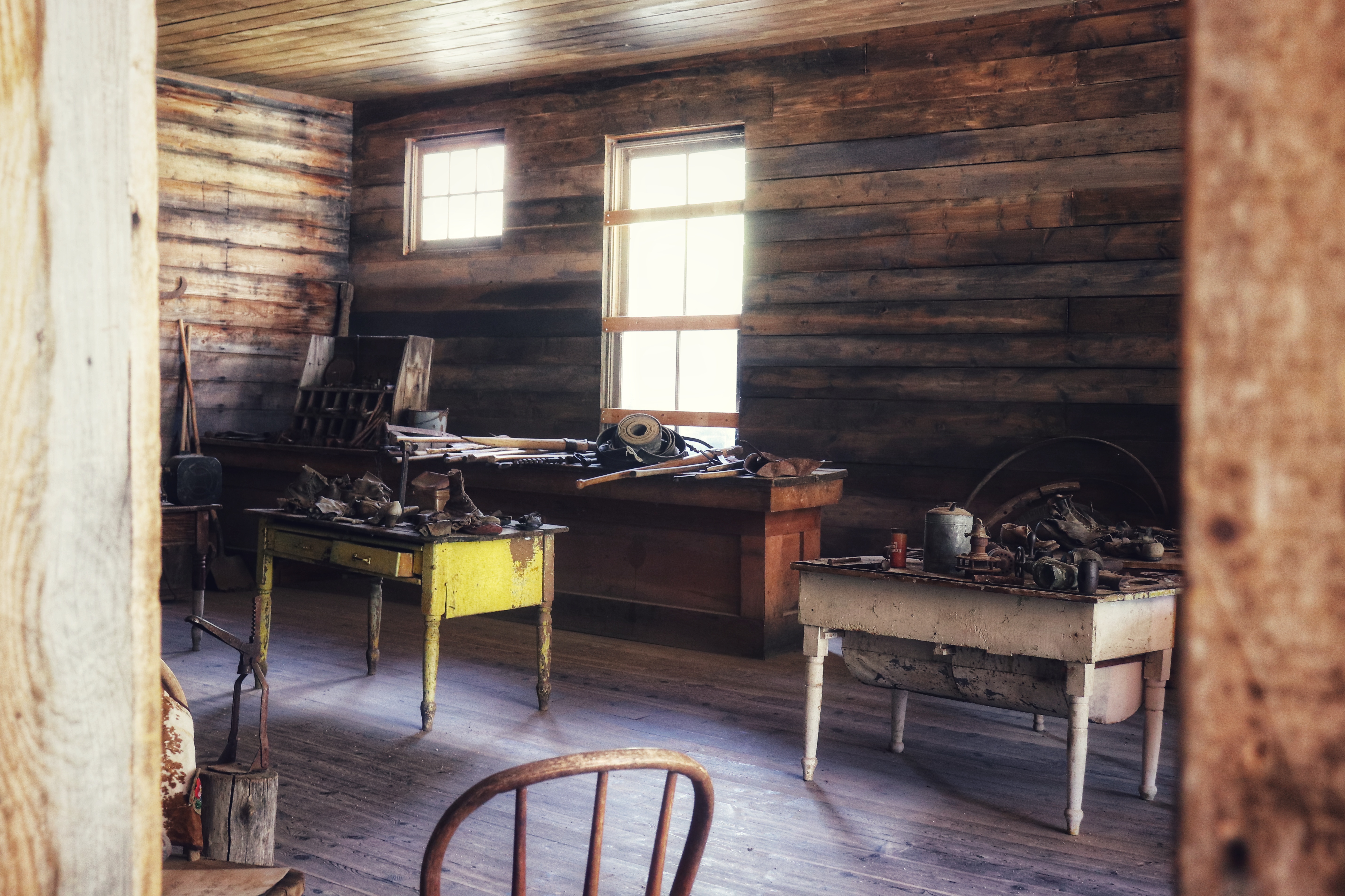
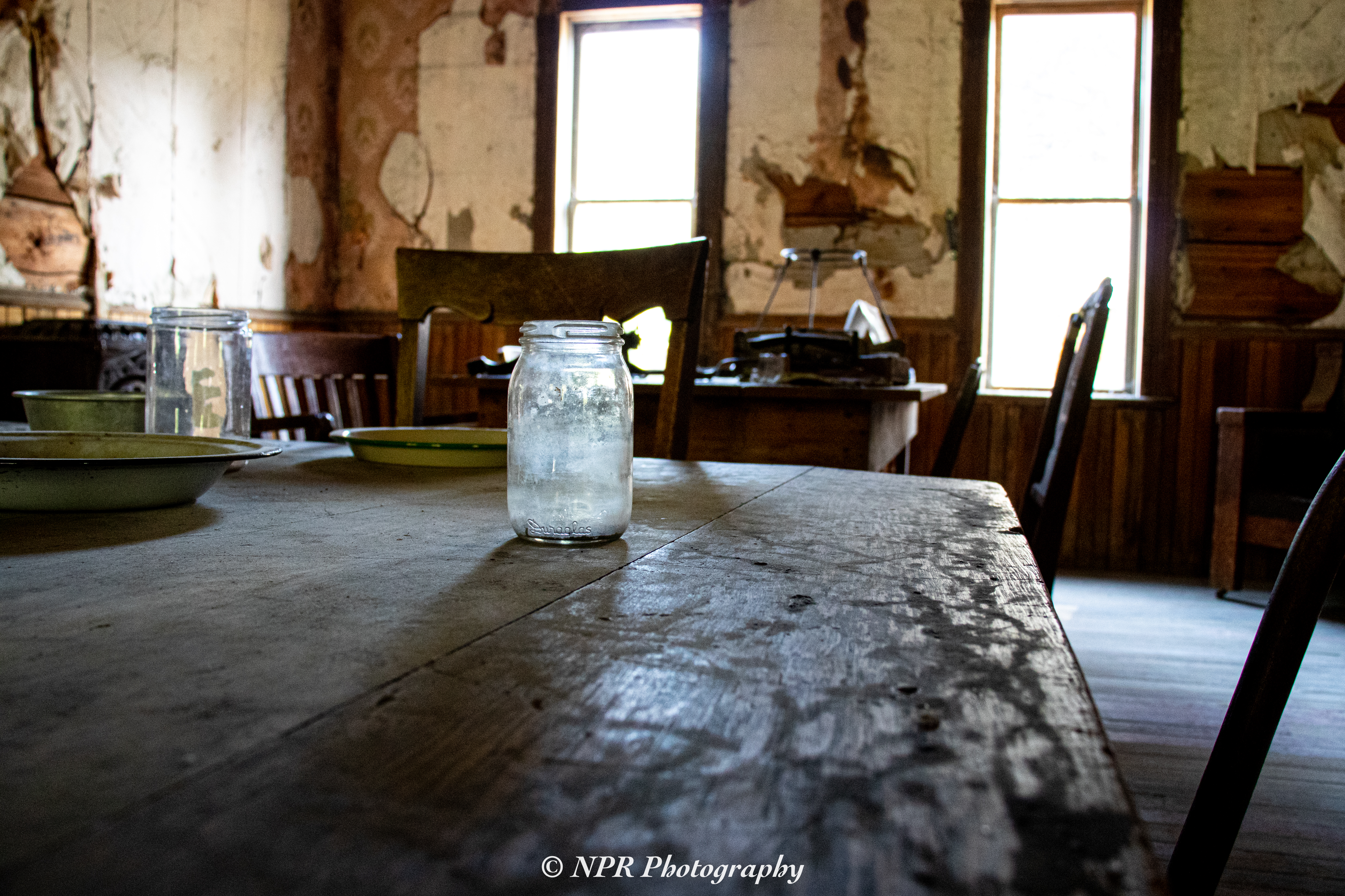
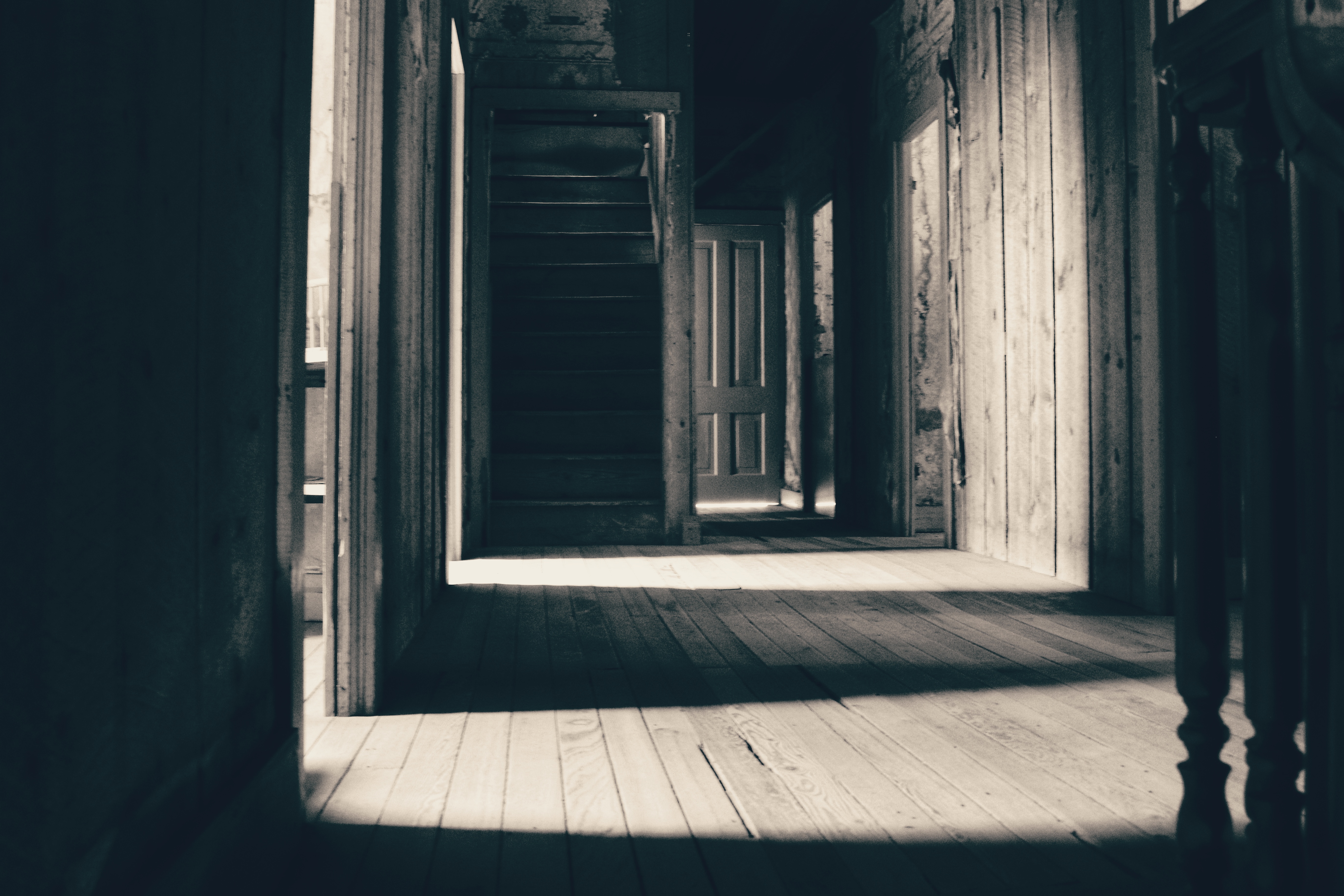
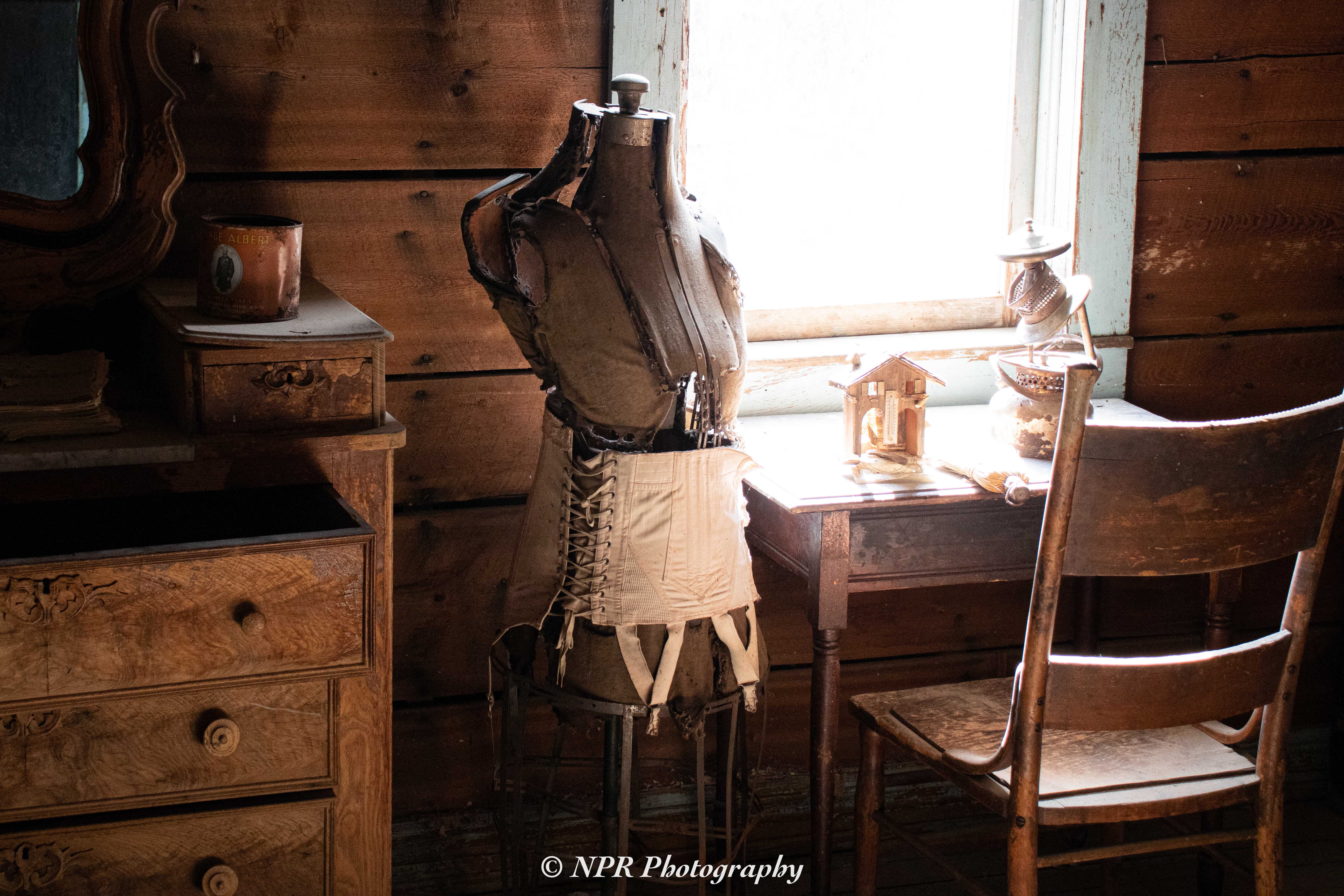
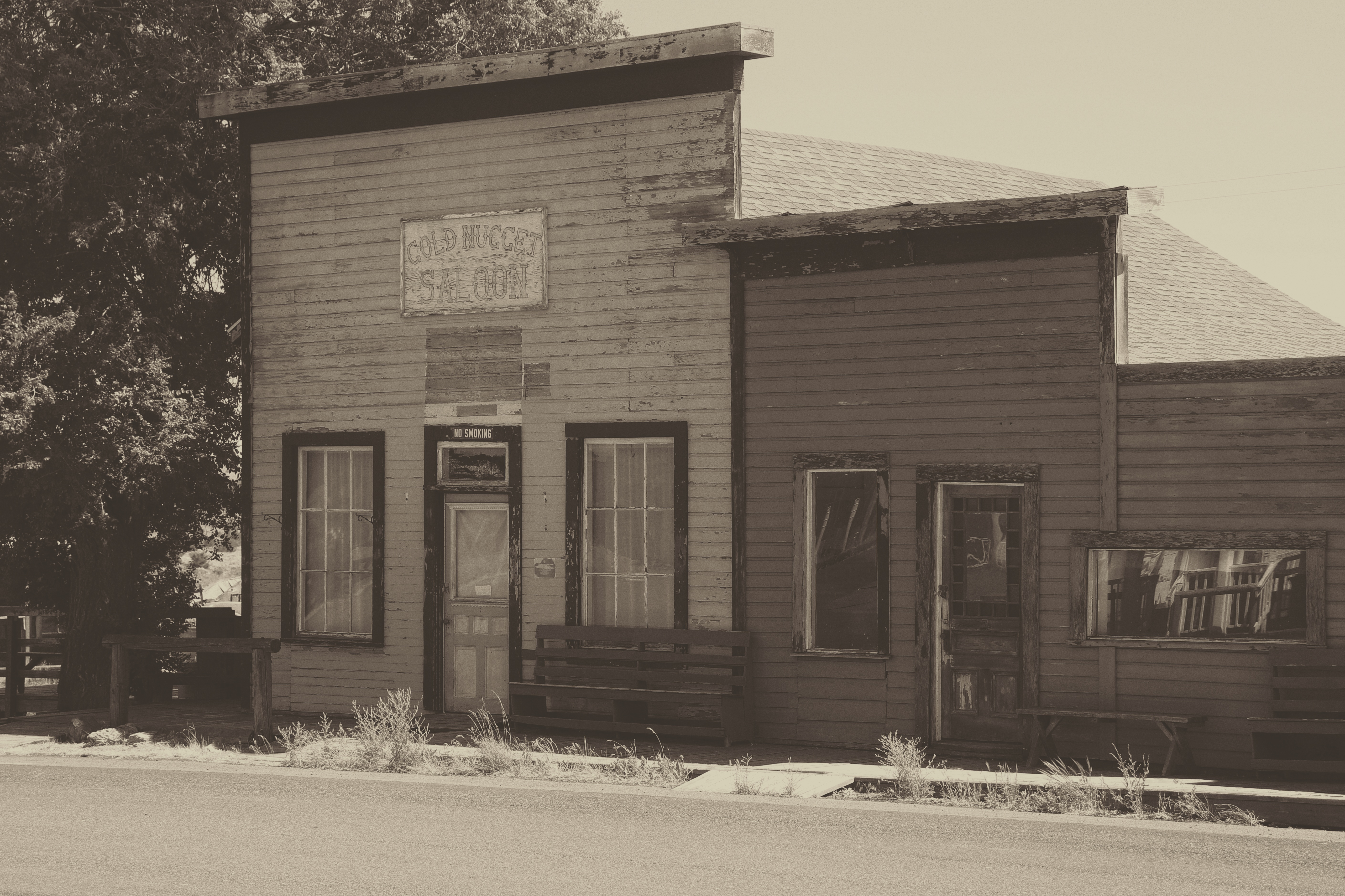
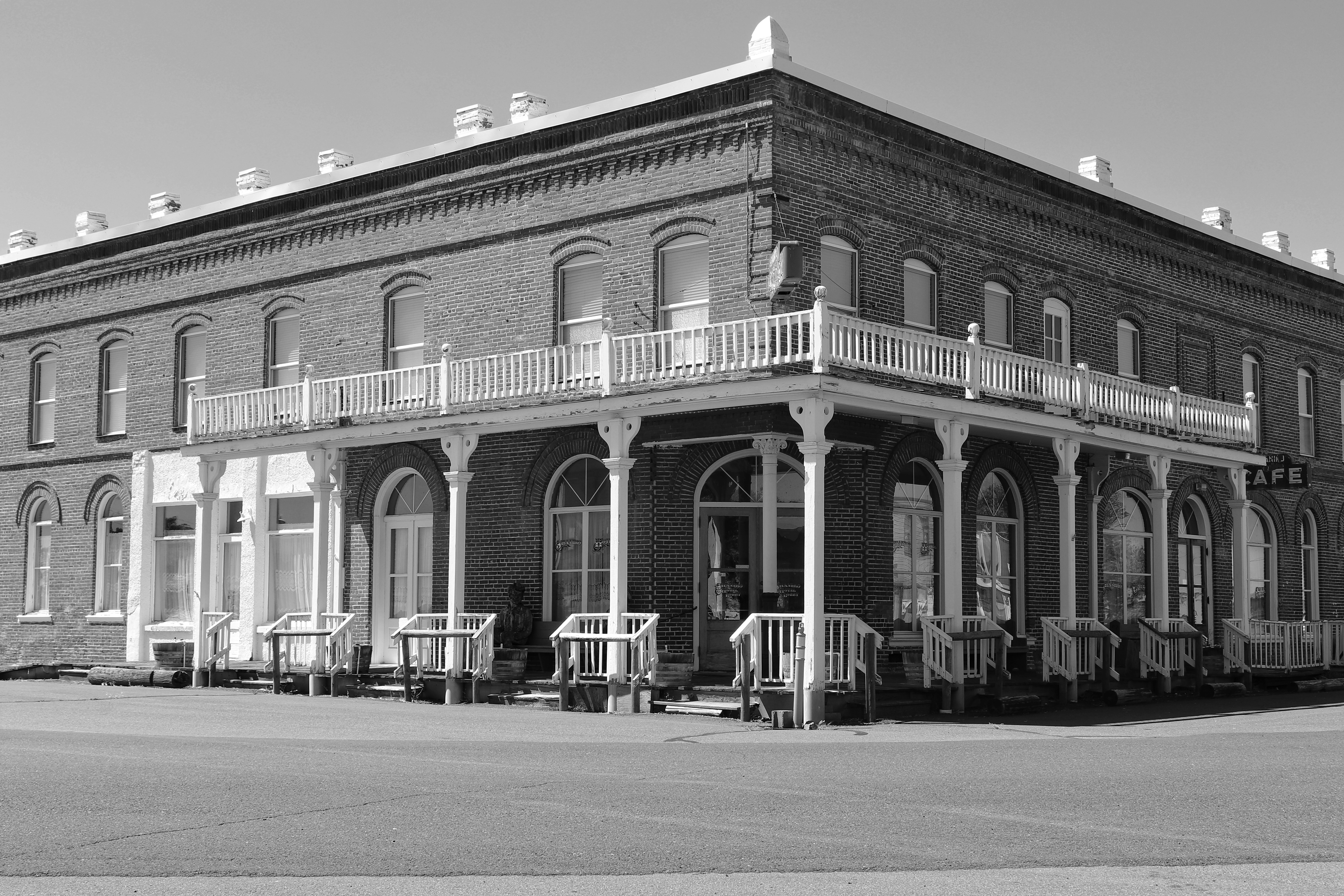
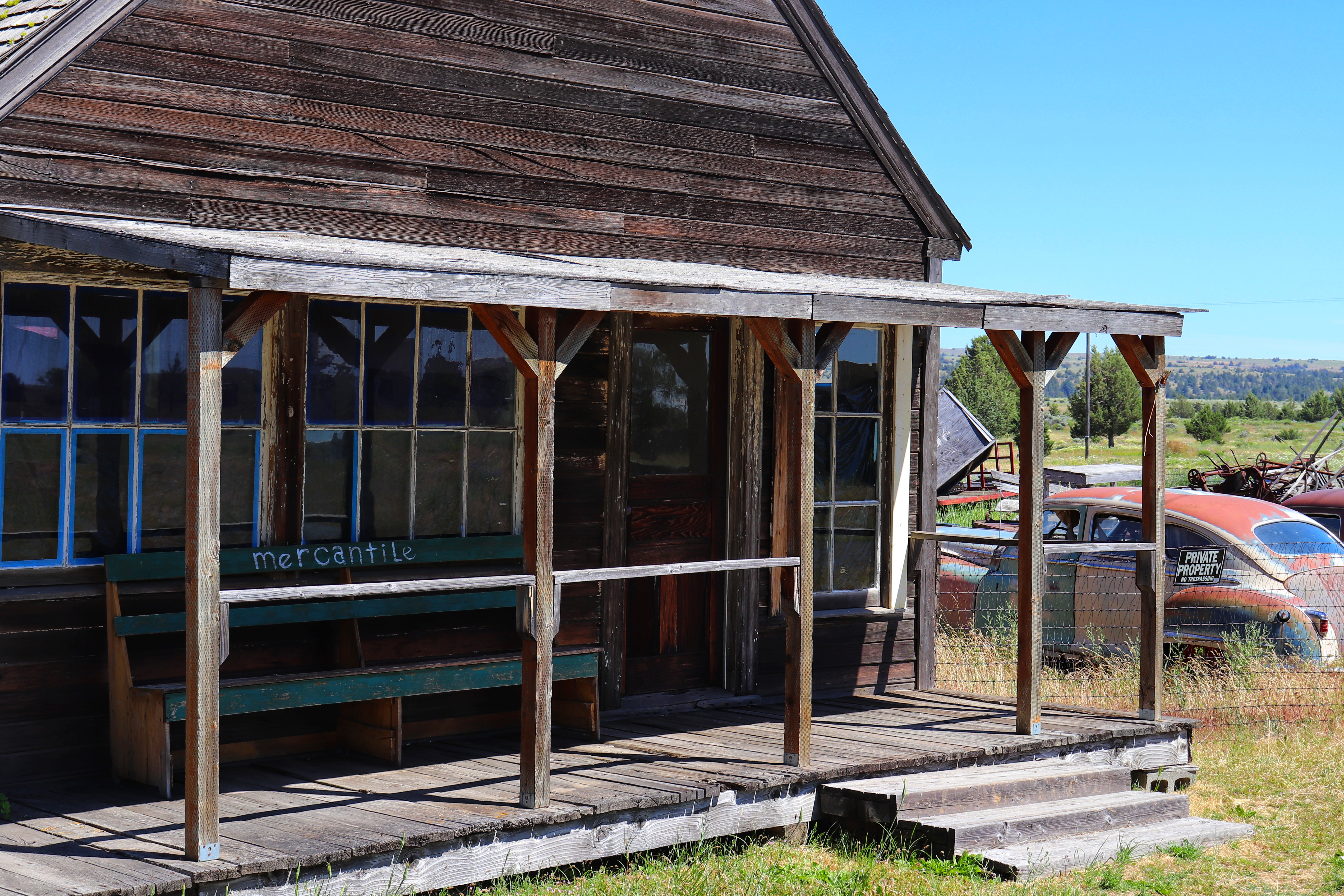
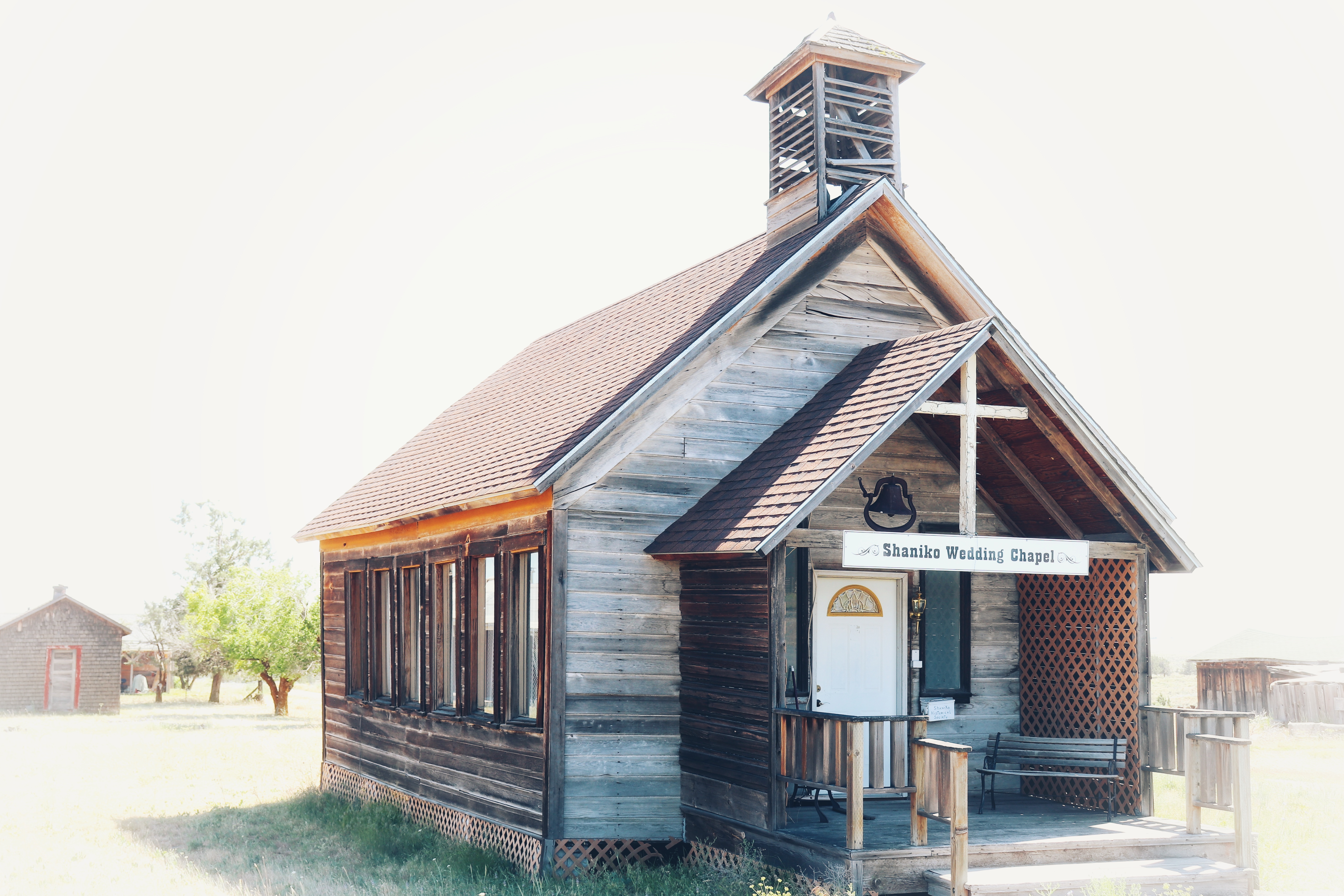
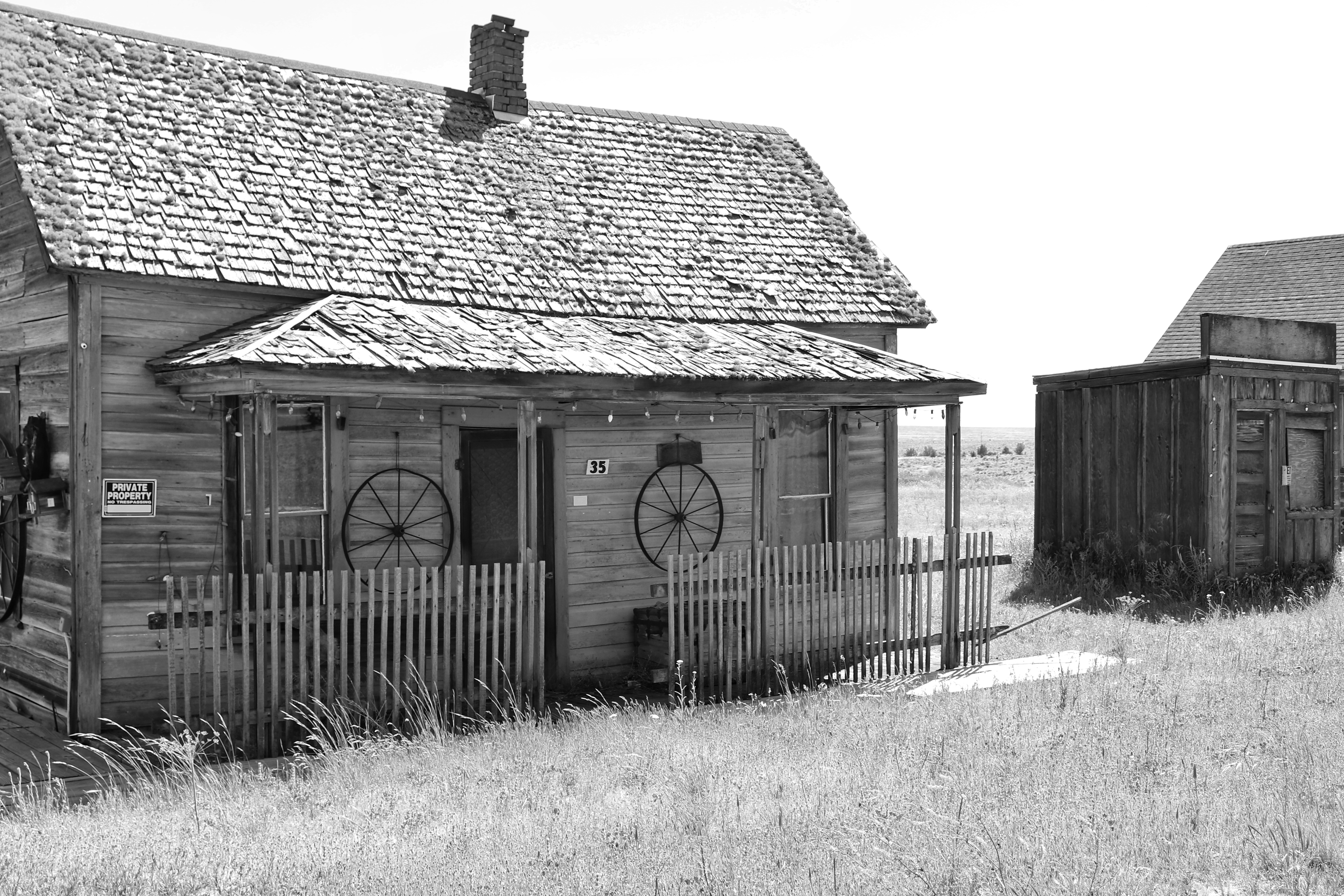
Arriving in Shaniko, we took advantage of an ice cream parlor serving the people who come to see the ghost town. Goldie’s Ice Cream Parlor had a decent variety of flavors and the folks operating the establishment were pleasant and friendly.

Walking the streets of Shaniko isn’t a time consuming endeavor, and it was only twenty minutes or so before we were back on the road.

Photos of Shaniko are below.

We took Highway 97 North to Biggs Junction, OR where we joined Interstate 84 and headed West along the Columbia River.

Arriving in Hood River, OR around 5 PM, we stopped for dinner at Solstice Wood Fire Pizza. I can’t say enough about the quality of the food and the overall environment of that restaurant. The patio area provides a nice view of the Columbia River as well. I wanted to try something different and ordered the siragusa pear pizza, a pizza with pears (as the name would imply), bleu cheese, and caramelized onions…it was amazing.

Leaving Hood River, our next stop was the Bonneville Fish Hatchery. There’s an artificial pond on site for white sturgeon, complete with an underwater viewing window. I’ve submerged one of my GoPro cameras in that pond each time we’ve visited, and captured some excellent video of the two sturgeon swimming. There are also smaller ponds where one can feed trout.

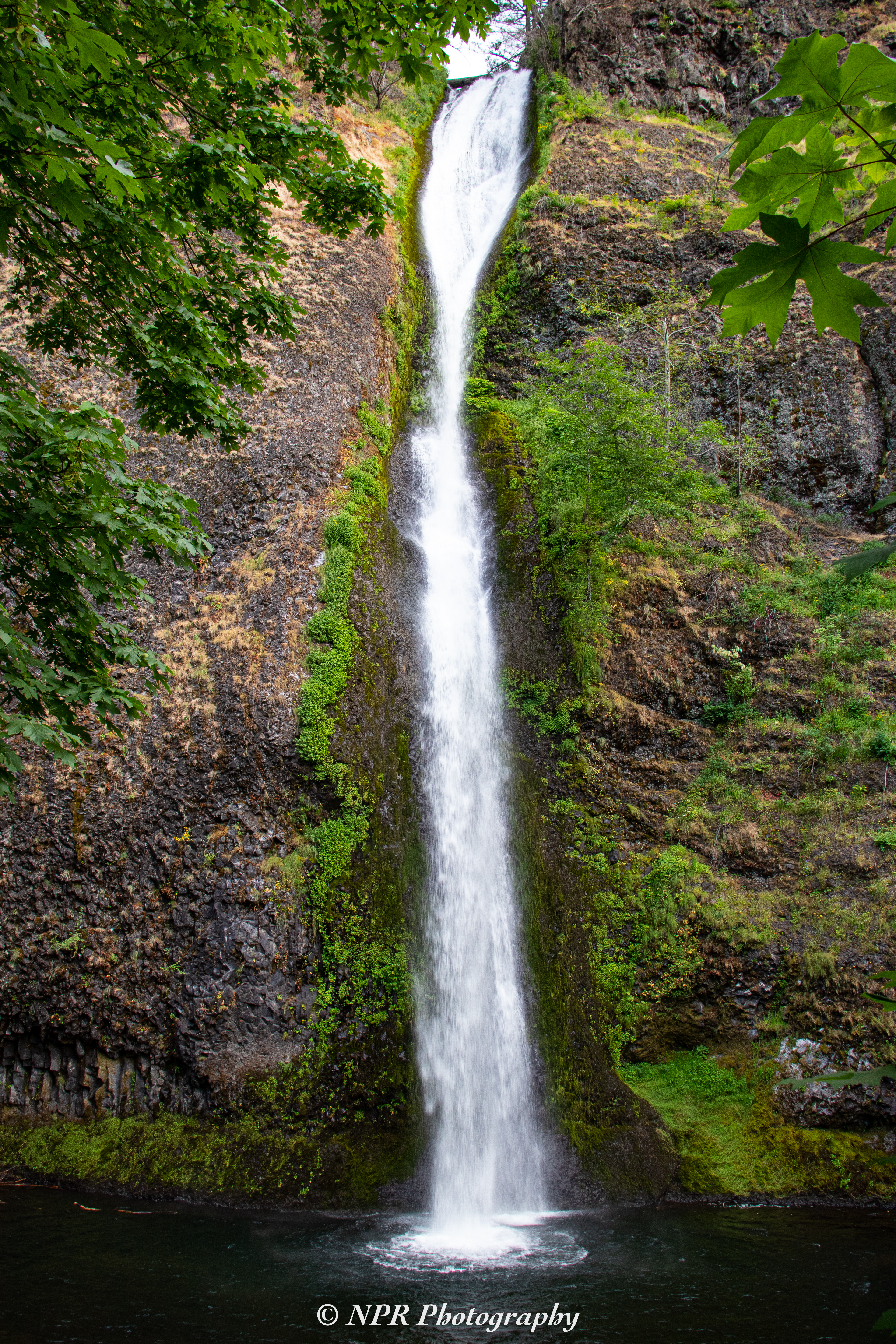
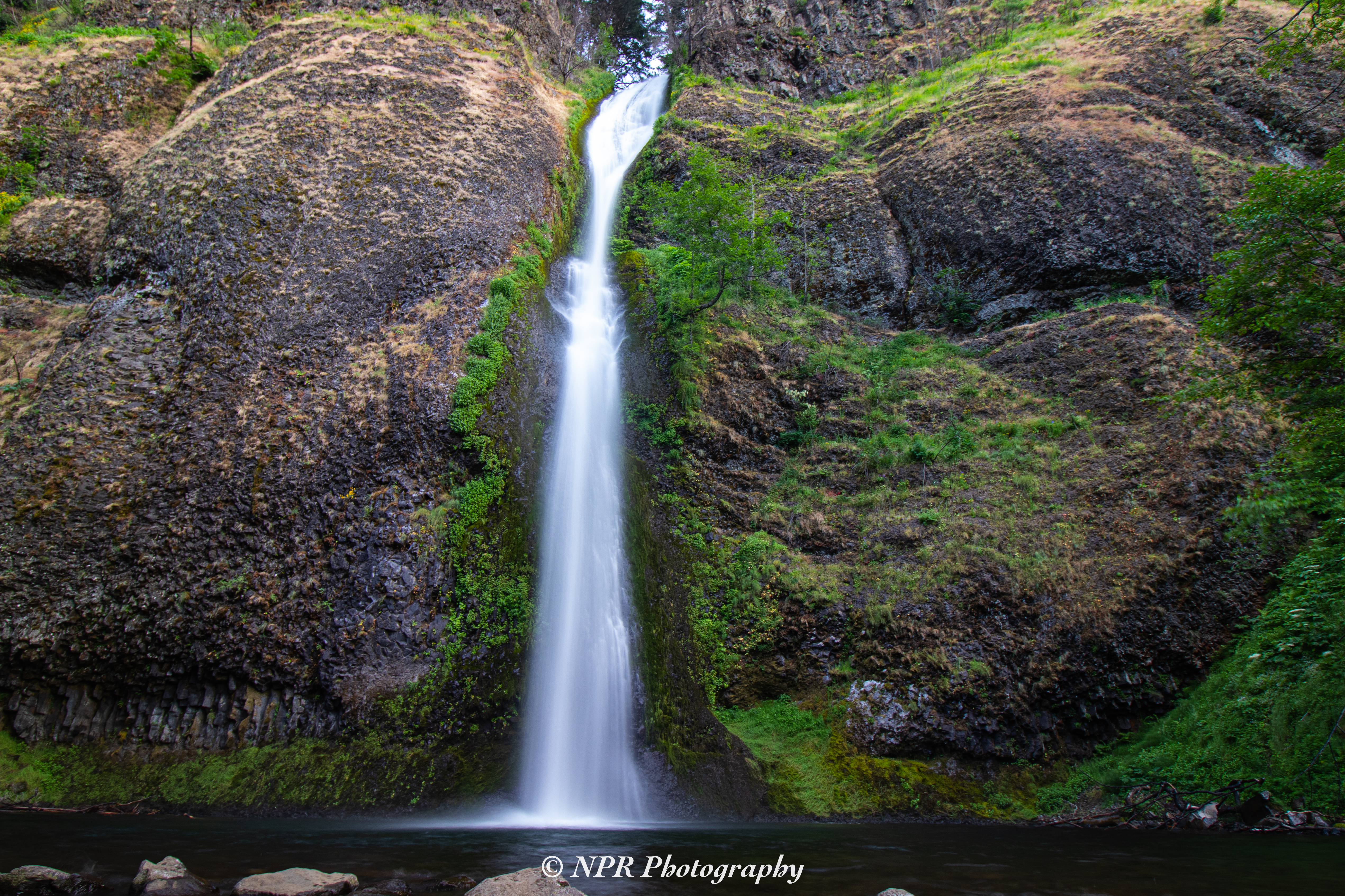
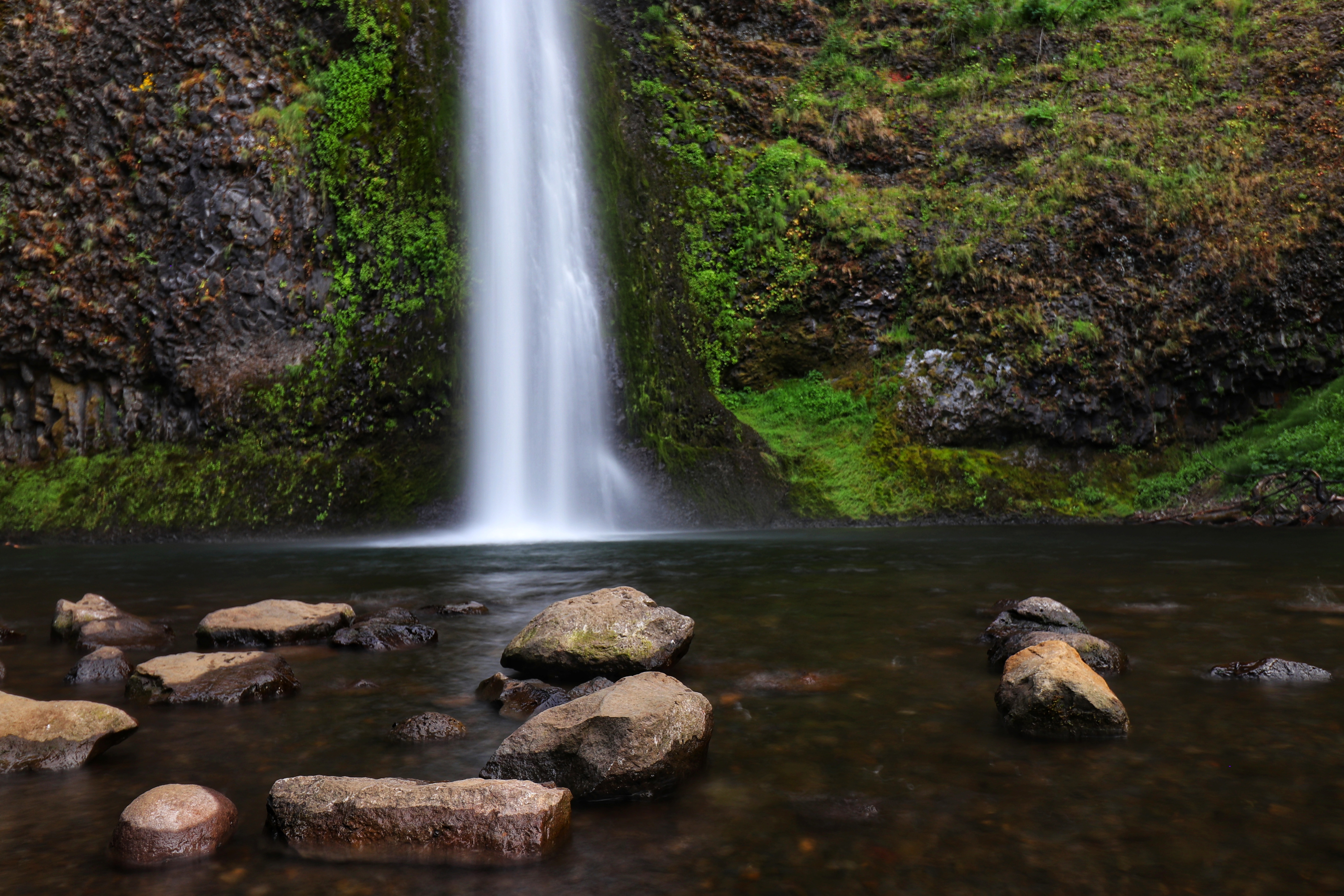
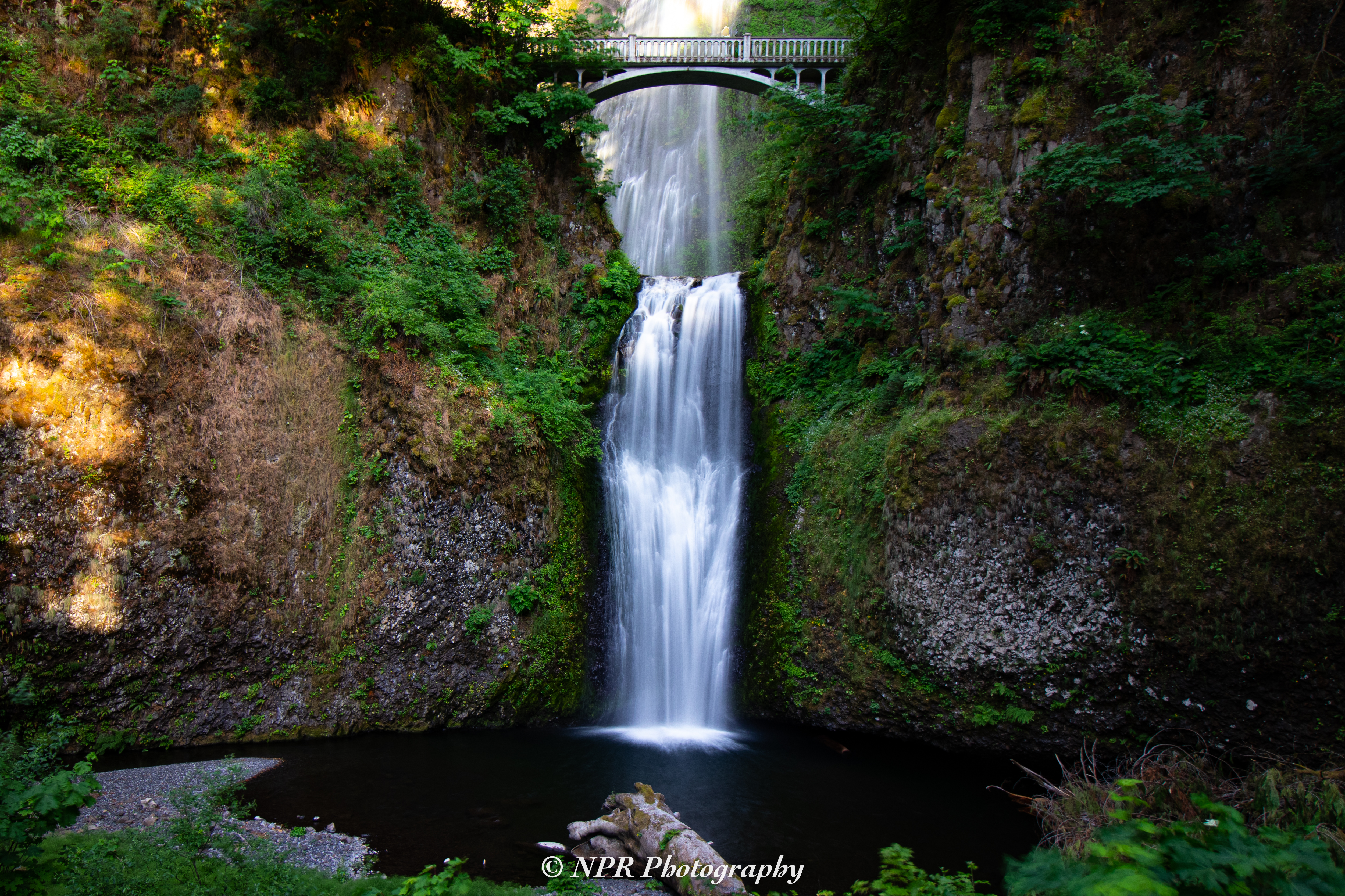
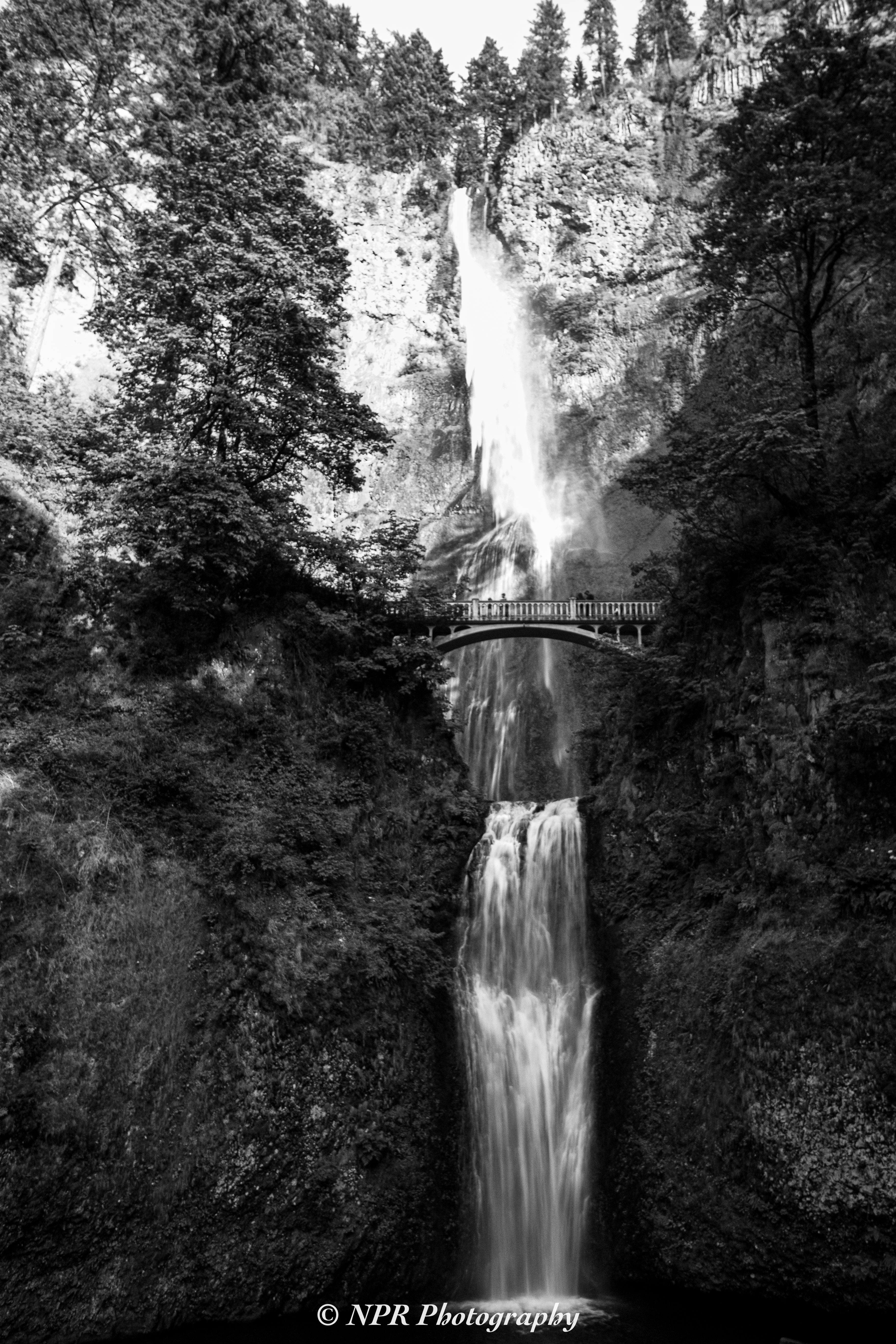
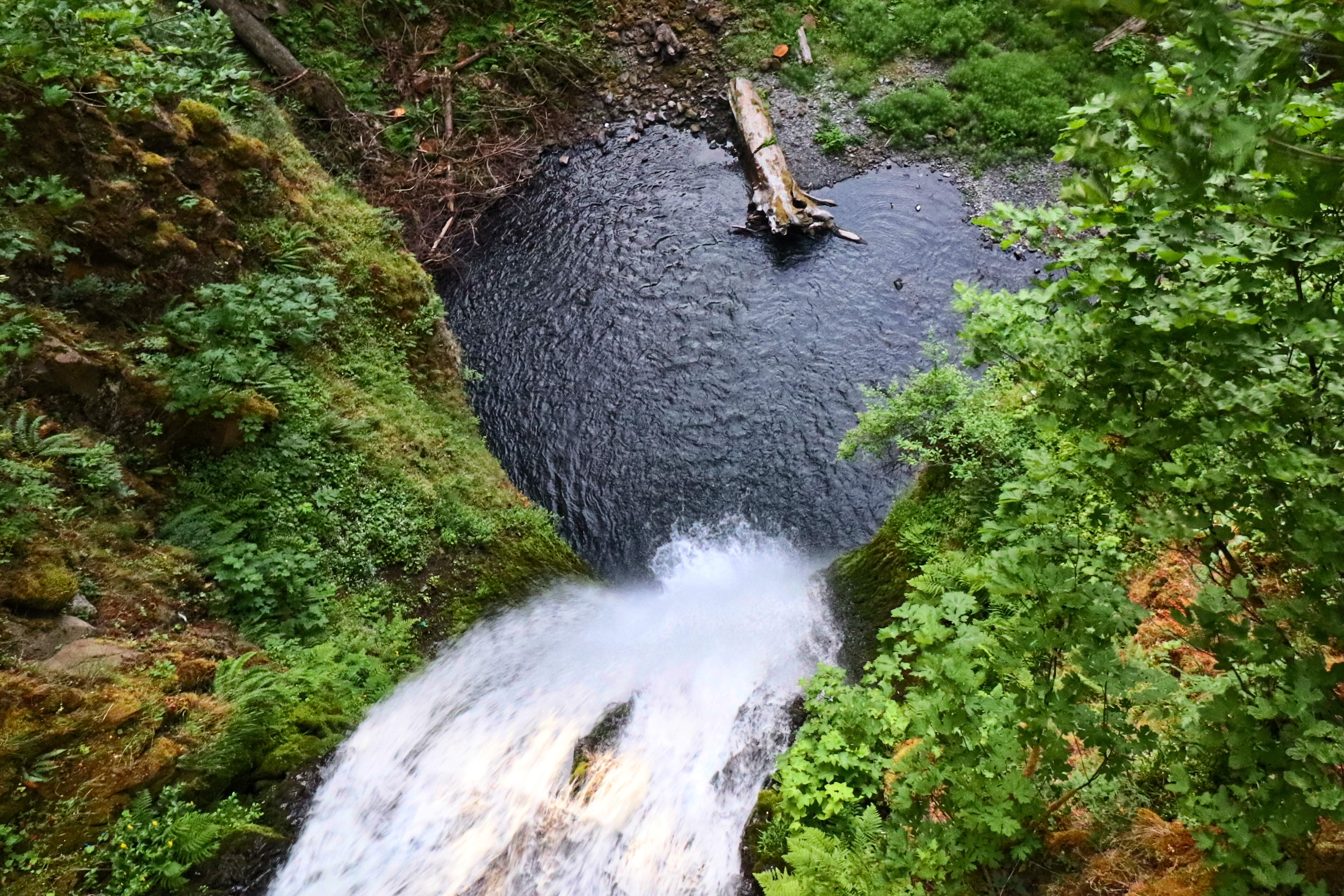
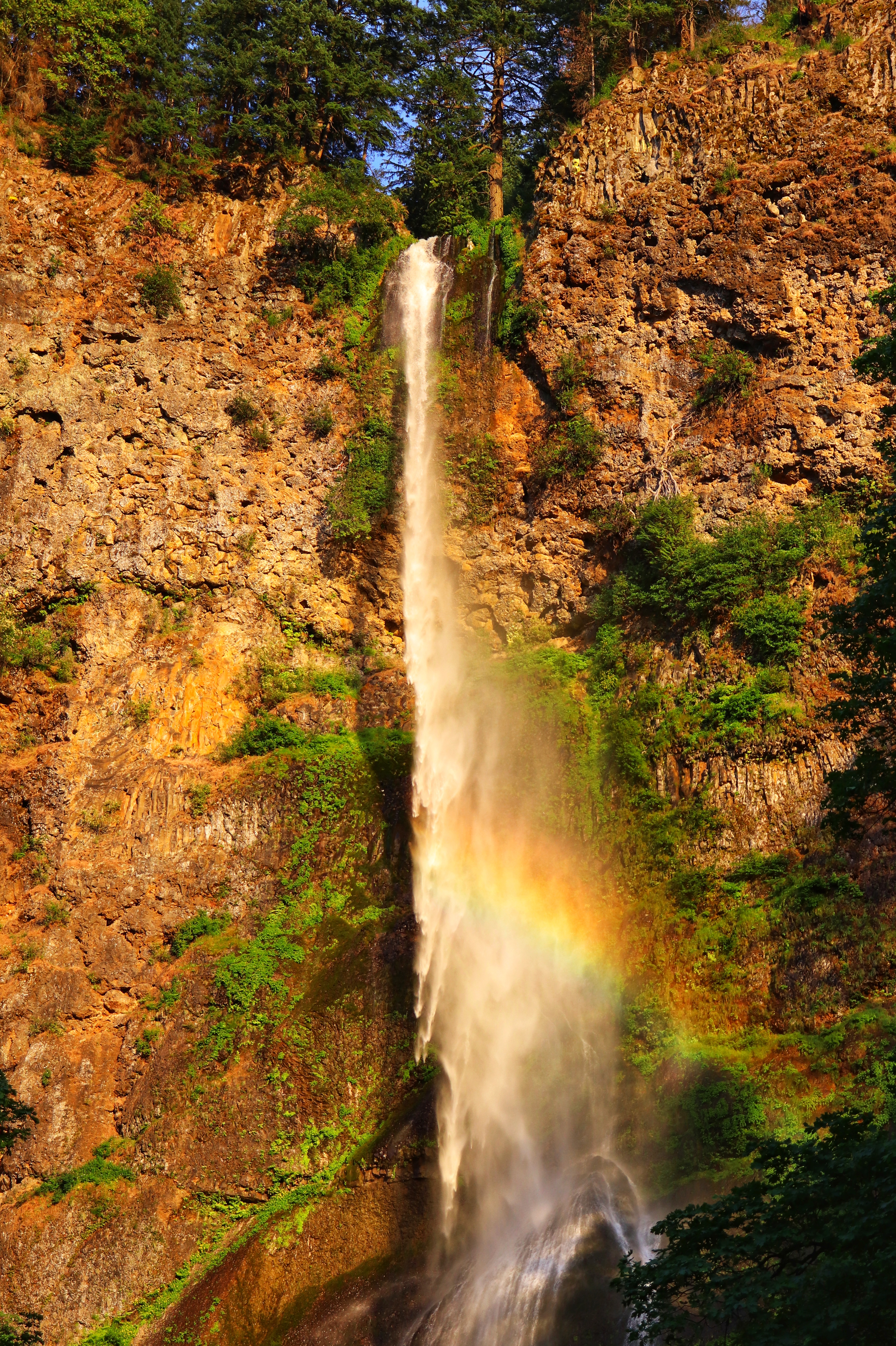
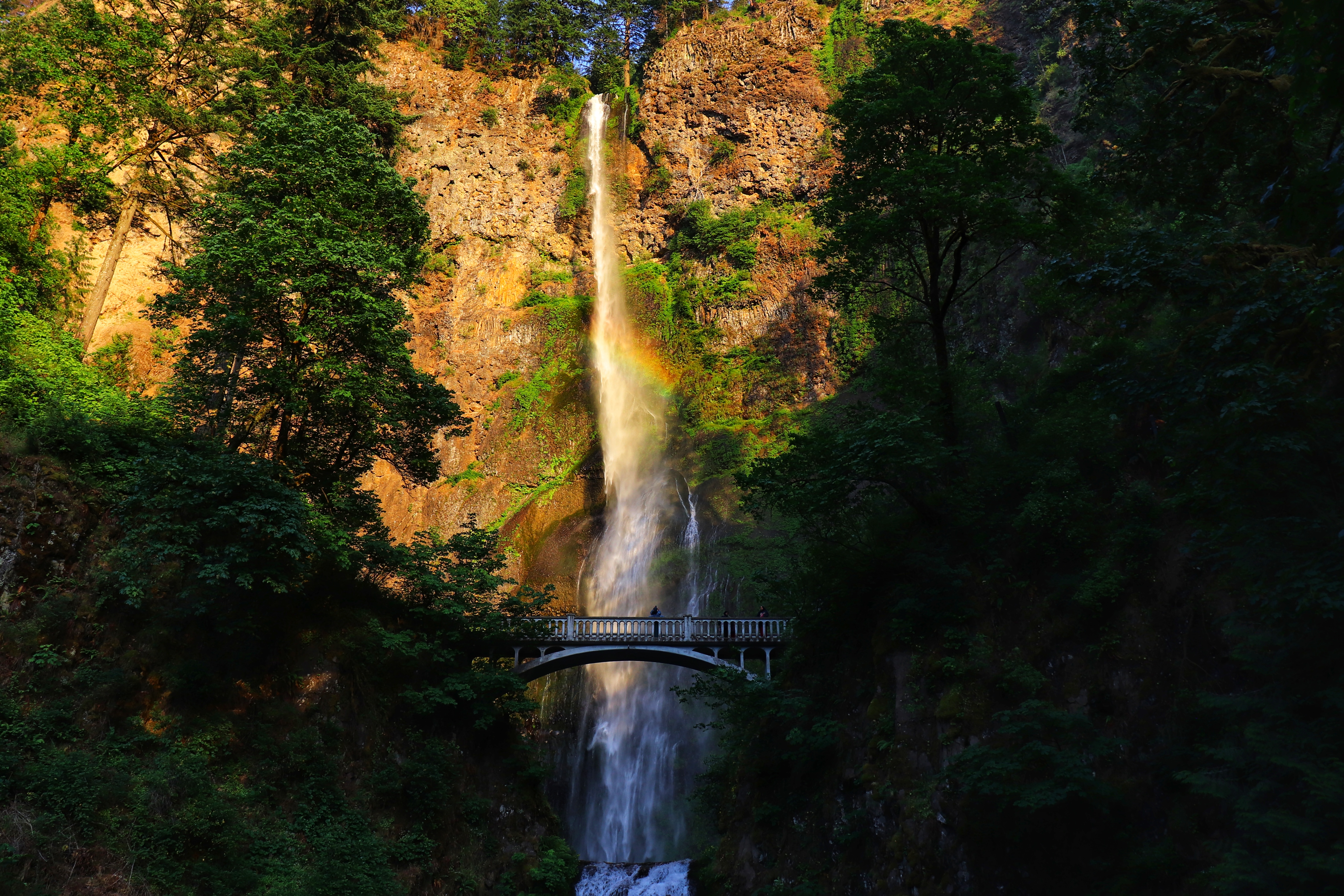
Continuing toward Portland, we stopped at both Horsetail Falls and Multnomah Falls between 7:45 and 8:30 PM.

Naturally, we had to make the climb up to the upper terrace of Multnomah Falls, as the view is always so spectacular. This late in the evening, the crowds weren’t as dense as they often had been before.

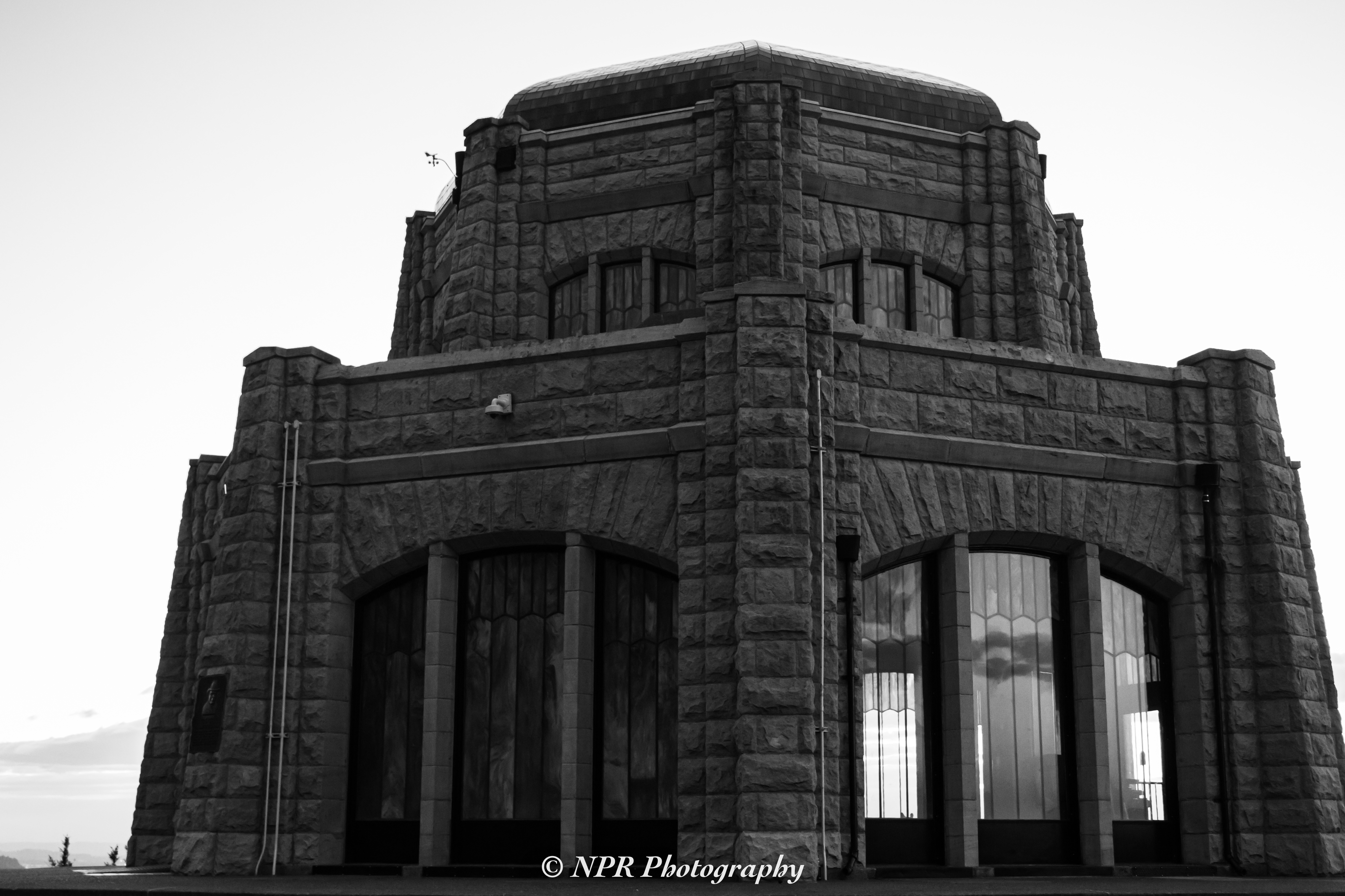
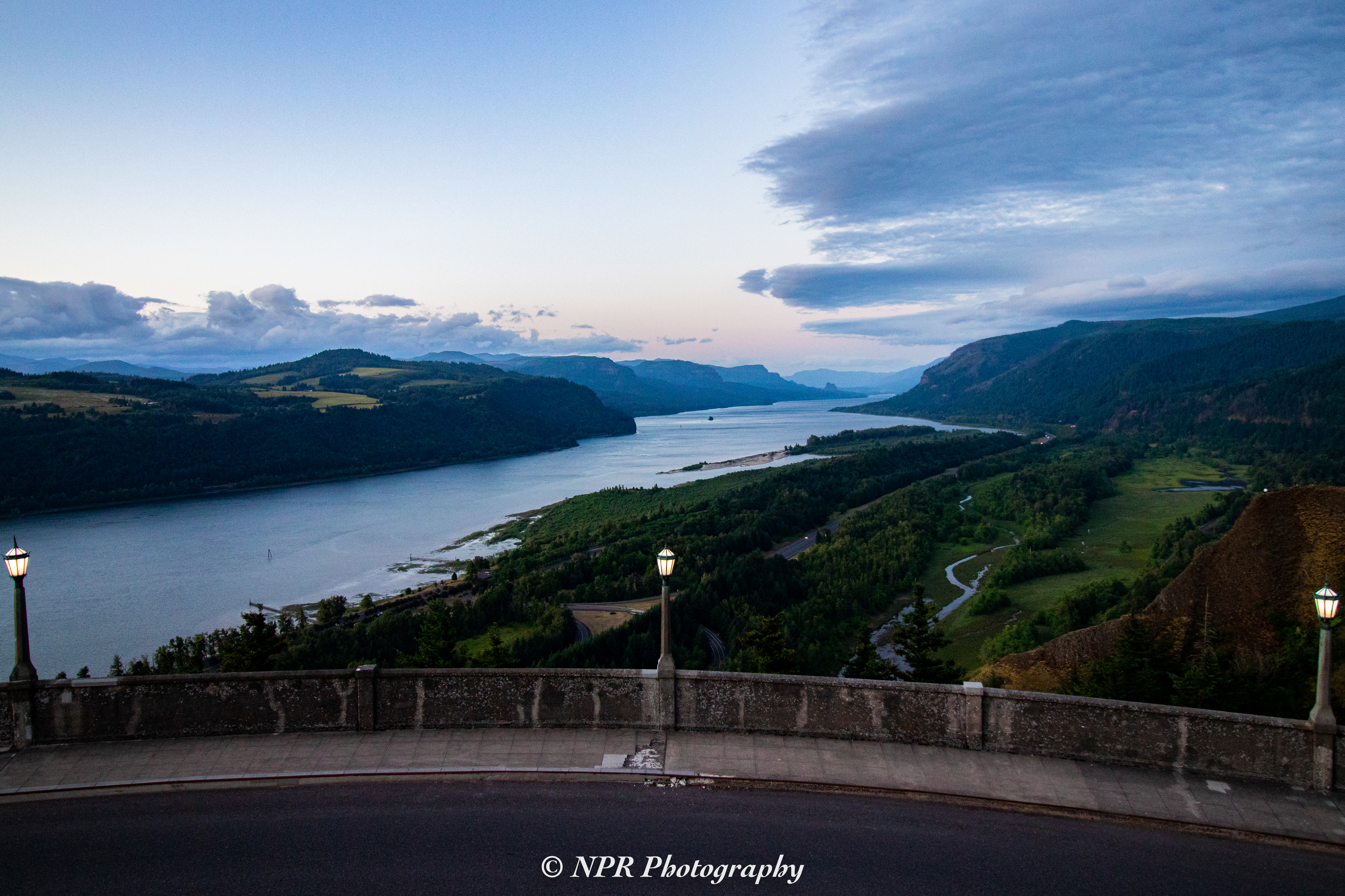
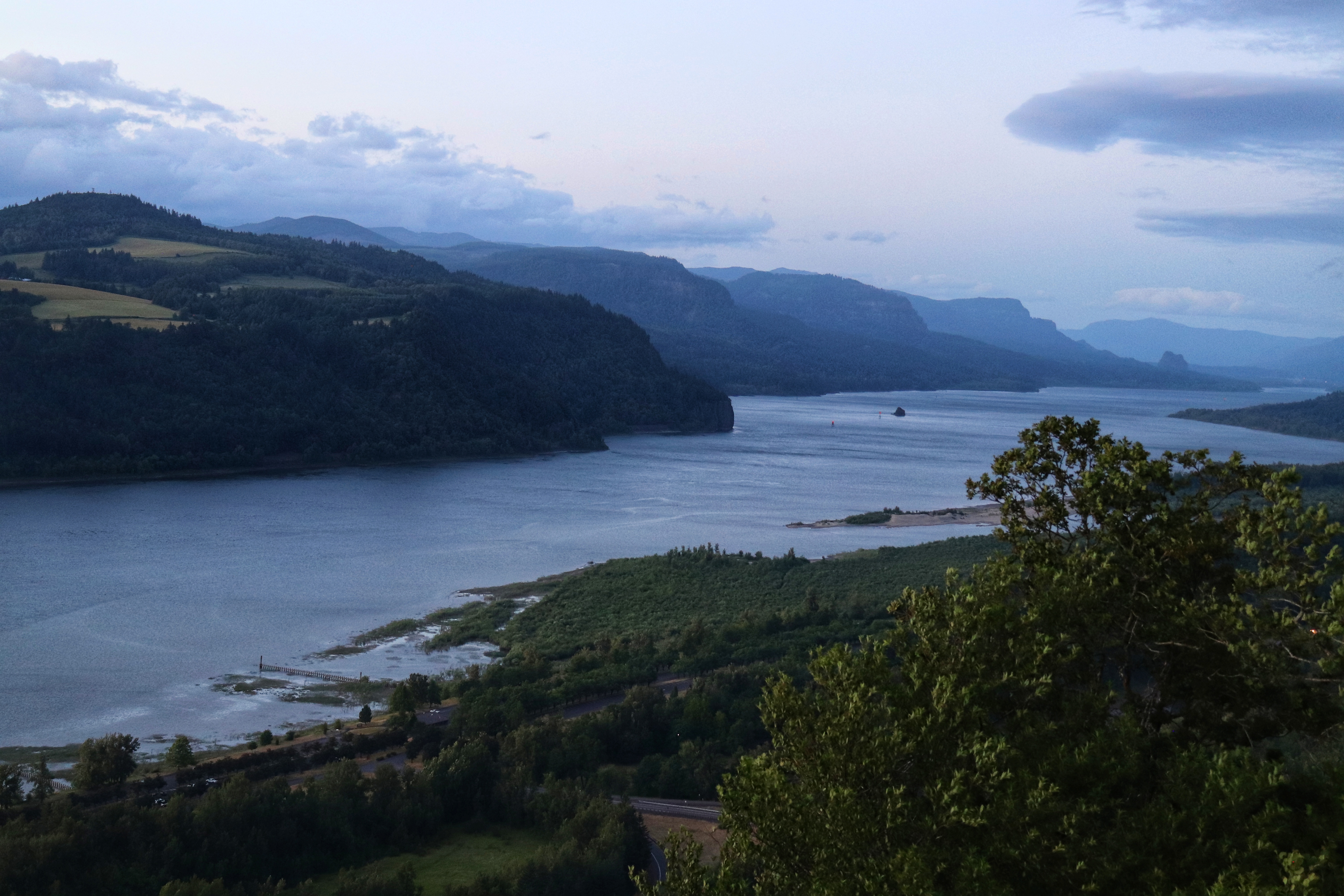
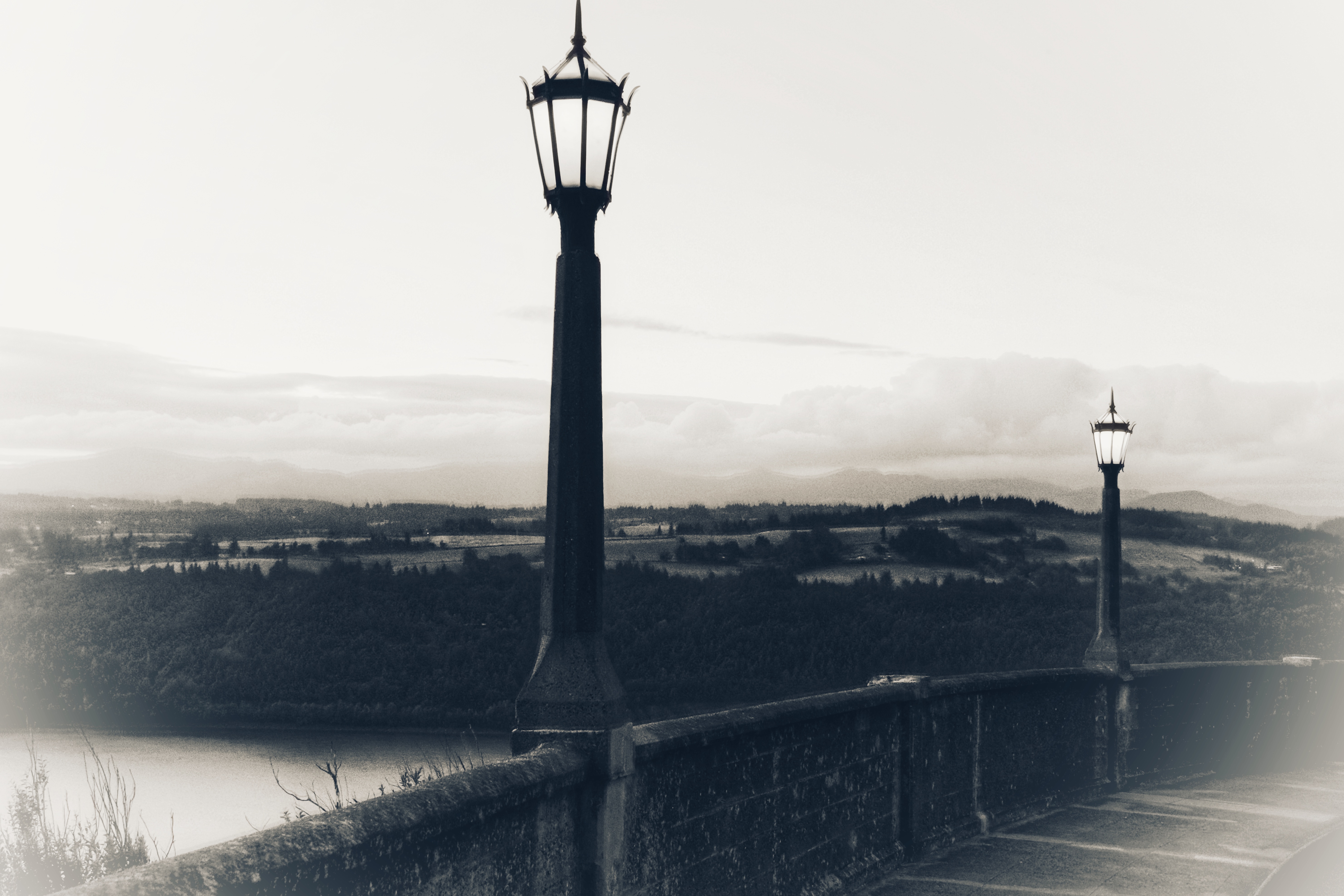
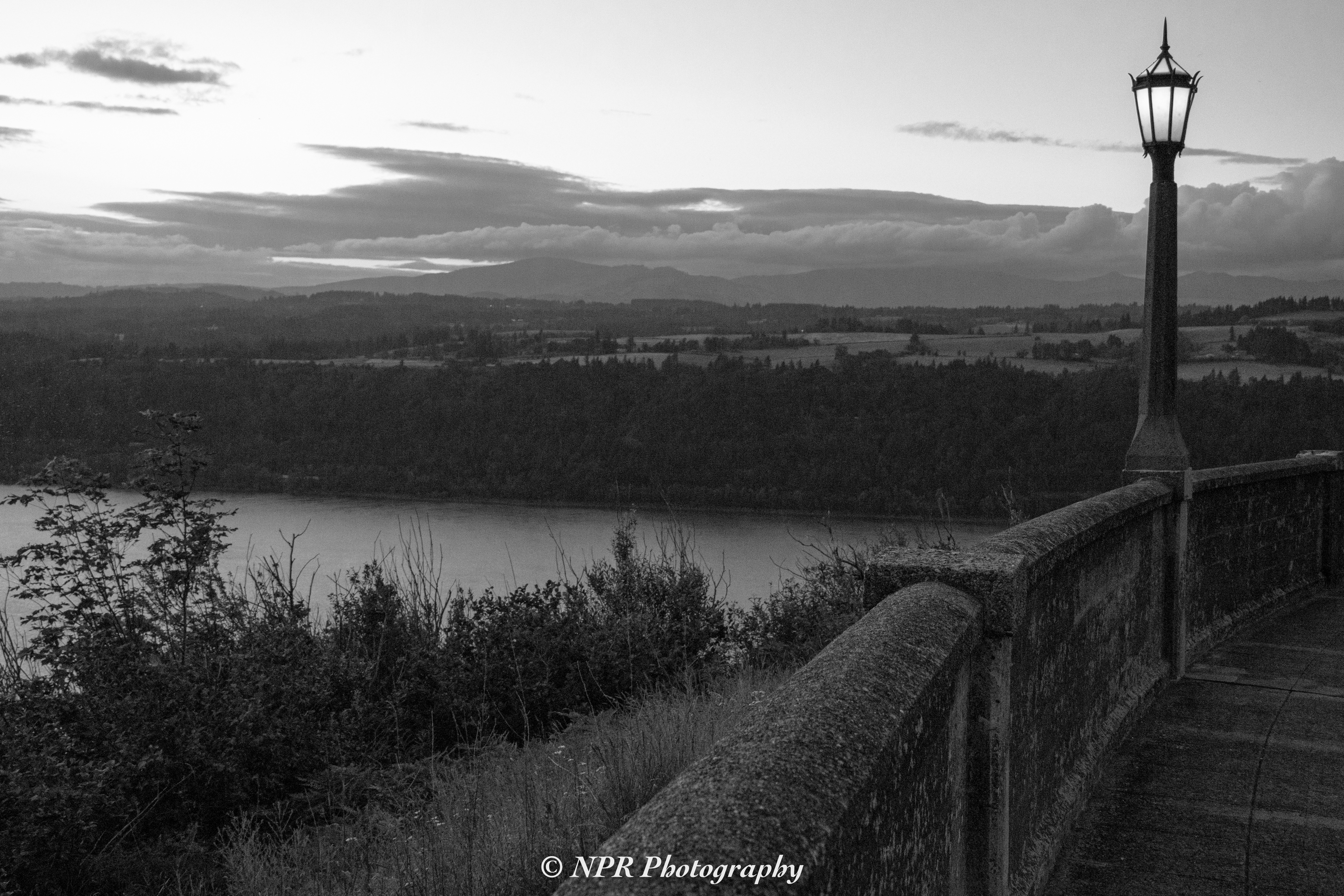
Our final stop on the way back to Portland was Vista House, which seemed like a magnificent place to witness the sunset. We were not disappointed. The views overlooking the Columbia River from that location are spectacular. I may have had to drop down from a fenced area to get to a certain location or two, but it was worth the minor bit of trespassing to see some of what I was able to see.

We continued along the Historic Columbia River Highway after dark, unable to truly enjoy the scenery, returning to our hotel shortly before 10:30 PM.

Mount Saint Helens

Leaving the hotel behind before 7 AM on Tuesday, June 18th of 2019, we made a first stop at Voodoo Doughnut downtown. The wait wasn’t long and we had a delicious, albeit unhealthy, breakfast to start our day.

From downtown Portland we headed North on Interstate 5, traveling to the exit just beyond Castle Rock, WA. Our first destination of the day was the Johnston Ridge Observatory at the opposite end of the Spirit Lake Highway. Stopping at various points along the route, we enjoyed the scenery, the highest elevations obscured by low cloud cover.

As one gets closer to the destination, the trees take on an almost digital appearance, something that’s difficult to adequately describe. The dense forests of mountain pine look sort of like trees in Minecraft, but more faithfully rendered. It’s an interesting thing, to say the least.

Photos from the trip East along Spirit Lake Highway are above.

It was 10 AM when we finally reached our destination. Upon arrival, I ventured off on my own, along the trail leading in the direction of Spirit Lake. The blasted volcano cone was still far too well-hidden behind cloud cover for me to get any worthwhile shots of Saint Helens itself, so I wandered for a couple of miles, hoping to capture some other stunning scenery.

I only started back, to meet up at the observatory when the morning clouds began burning away as the sun warmed the air.

Photos from that interval of hiking are below.

I was able to enjoy her apex being disrobed as the clouds dissipated, revealing her snow covered higher elevations near the cone. The return hike to the observatory was positively beautiful. We took a moment to stop at the Loowit Viewpoint on our way West, back along Spirit Lake Highway.

Photos as Saint Helens emerged from the clouds are below.

Returning to Interstate 5, we returned South, taking the exit at Woodland to follow the Lewis River Road Eastward. Our next stop was a good distance away and we didn’t arrive at Ape Cave until just before 3 PM. Lacking adequate light sources, our travel down the lava tube was trimmed down and my ability to take photos was limited to near the entrance. I’ve included a couple of those below.

Leaving Ape Cave, we decided to continue Northeast, hoping to find some captivating vistas approaching Muddy River and the Lava Canyon Trailhead. We were not disappointed. Approximately an hour after departing from Ape Cave, we experienced some positively stunning scenery.

The photos from that interval are below.

We returned to our hotel room in Portland roughly 11 hours after we’d started out that morning. It had been a long day, but an absolutely worthwhile one. It’s never a disappointment to experience the beauty emerging from devastation like that.

We’d previously visited Mt. Saint Helens in June of 2017, and I had been there in June of 2014 as well. When I was growing up, my mother had a glass jar filled with ash from the eruption that took place only a year and a half after I’d been born. That ash that had found its way as far as South Dakota and Minnesota fascinated me when I was young…and the volcano itself grew to fascinate me as I became an adult.

Second Leg of the Journey

We left Helena, MT shortly after 7 AM on Sunday, June 16th of 2019. Our route took us West to meet Interstate 90 at the Garrison exit. The last time we’d taken this path out of Helena, in June of 2017, we’d narrowly avoided colliding with a doe as she’d ventured onto the highway from thick shrub growth on the right side of the road. This time, thankfully, there were no near misses.

We remained on I-90 for only a short while, taking the exit at Drummond as that was the recommendation of my GPS. I should have learned not to trust the GPS after a particularly awful set of directions in August of 2016, but shame on me because I was fooled twice. We started out on a simple frontage road running parallel with the interstate before connecting with a meandering gravel road. It wasn’t in perfect condition, but I’d taken my 2001 Chevy Impala down worse roads, for sure.

What initially appeared to be a rough patch of road, perhaps still rutted after late winter in the higher elevations, soon became only a taste of what was to come. If I’d been driving a Jeep, I’d have avoided this road if given the opportunity to do so. It kept getting worse rather than better, large stones protruding from the road’s surface (if one could really call it a road) at random points while giant ruts carved miniature ravines through the hard-packed dirt that made up the islands of discernible road.

Unfortunately, there was no choice but to continue forward. Attempting to reverse down the trail would have certainly led to disaster, while powering through the god awful, stressful ordeal was at least potentially going to lead us to a happy outcome.

The road cleared up just as we approached our destination. Garnet, a ghost town maintained by the Department of the Interior, was just ahead. We’d made it…and without tearing anything from the undercarriage of my car.

To add insult to injury, there was a much nicer, well-maintained gravel road up there as well. There had been a far less treacherous path to this destination. We could have avoided the hazards associated with taking my car up something barely suitable for four-wheel drive. Damn the GPS.

We remained there in Garnet for about an hour and a half, not departing until around 11 AM. Photos from our time in Garnet are featured above.

The route we followed leaving Garnet and making our way to Missoula, where we rejoined Interstate 90 was far less stressful than the one we’d experienced only a couple of hours earlier. Along the way, there was a fantastic view and a great place to stop and take it all in. I’ve included photos of that vista below.

Crossing the rest of the distance through Montana and the upper panhandle of Idaho, we entered Washington. At the recommendation from my cousin, Jeremy, we stopped at Viking Drive-Inn. This is a modest diner located Southwest of Spokane, in a small town known as Sprague. The burgers, while simple, were deliciously seasoned and precisely what we were hungry for at just after 2 PM.

We continued following I-90 until we reached Ritzville, WA, where we headed South, making our way to Palouse Falls State Park. We’d seen photos of the magnificent falls, but we’d never seen it in person. It did not disappoint.

Photos of Palouse Falls follow.

We left Palouse Falls at approximately 4:30 PM before continuing Southwest through Kennewick before crossing the border into Oregon. We connected with Interstate 84 and continued on to Portland, OR. We arrived at our hotel shortly before 9 PM.

Having built up an appetite again, we went to the nearest MOD Pizza. We’d fallen in love with that design-your-own pizza chain when we’d been in Seattle in June of 2017. On the way back to our hotel, we stopped at a particularly seedy 7-Eleven, in what appeared to be a fairly run down area of Portland. Regardless of that, we continued returning to this same 7-Eleven during our week-long stay in Portland because they happened to have green apple Jones Soda in their fountain soda machine. It tastes even better as a fountain soda than in the bottles.

We settled back in at the hotel just before 10 PM.

Oregon Coast: Day One

We left our hotel in Portland at 7:20 AM on Monday, June 17th of 2019, and headed West through Beaverton on Highway 26, turning South on the Necanicum Highway so that we could connect with Highway 101 (the Oregon Coast Highway) in Nehalem, OR.

We arrived at our initial destination shortly before 10 AM and began climbing the snaking incline of the Neah-Kah-Nie Mountain trail in order to gain an elevated view of the Pacific coast. Our climb was more abbreviated than any of us would have liked, due to the other stops we wanted to make during that day’s adventure. Someday I hope to return and complete the climb.

Our next stop on the route North was the Cape Falcon trailhead. Just before Noon, we made our way to a sheltered beach where numerous surfers were enjoying the morning’s waves.

Photos from this first part of the day are featured above.

Our next stop was Cannon Beach. We arrived there and made our way to the beautiful, sandy beach around 12:30 PM. We’d been here previously in June of 2017 as well, and I’d been there on another vacation in June of 2014. It’s a lovely little town, but the feature I–and presumably most visitors–came to see was Haystack Rock, protruding only a short distance from the shore.

Photos of Haystack Rock are included above.

We stopped for lunch before venturing further North.

Our next stop was Fort Stevens State Park. Clouds had started rolling in and the day was turning gray. It was shortly after 3 PM when we visited the Jetty Observation Tower at the edge of the park, enjoying the view and witnessing some harbor seals poking up here and there amidst the waves.

We spent a period of time exploring the remains of the wreckage of the Peter Iredale. I hope to return there someday around sunset, as I can’t help but suspect the wreckage would make for a fantastic bit of foreground with the proper sunset over the Pacific behind it.

Photos from that part of our journey are located above.

The final stop of the day was in Astoria, OR where we climbed the stairs within the Astoria Column. The spiral staircase ascending the center of the circular column is an interesting experience, in and of itself. You can feel the vibrations of every footfall from those ascending and descending while you’re on those metal stairs. It’s a long way up–or down.

The views from the platform at the apex are astounding, allowing clear sights of the Columbia River’s mouth where its water mingles with the Pacific Ocean. The hilly neighborhoods of Astoria are laid out before you and you can follow the path of Astoria-Megler Bridge as it traverses the Columbia River and leads Highway 101 into Washington where it continues its own path North almost to the tip of the Olympic Peninsula.

I’ve included some of the photos from that magnificent landmark above.

It was almost 6 PM when we left Astoria and began our return trip to Portland, following the contours of the Columbia River as it meanders along the border between Oregon and Washington. It was close to 8 PM when we returned to our hotel room and settled in for the night.

Sunset At Cape Flattery

I’d first learned of picturesque Cape Flattery–the Northwestern most point of the lower 48 states–from my friend Charles, while he was visiting the Black Hills during the summer of 2016. I wasn’t able to visit the location for myself until the following summer, and I immediately fell in love.

We returned to the Pacific Northwest in June of 2019.

On Tuesday, June 25th we left Port Angeles and headed West shortly before 6 PM. The drive along the Northern edge of Washington’s Olympic Peninsula is a lovely drive, but a long one. It wasn’t until shortly after 8 PM that we arrived at the trailhead to begin the short trek to Cape Flattery.

We arrived in time to enjoy the scenery before we lost the light. The photos above were taken as we initially settled in to await the coming sunset.

Other groups of people came and went, most returning to where they’d parked at the trailhead before darkness descended upon the forest. We stuck it out until we’d been embraced by full dark. We’d carried high-power flashlights with us in anticipation of making our way back to our parked vehicle after nightfall.

The sky ignited with an absolutely beautiful sunset just beyond the not-so-distant island and the lighthouse located there. Photos I’d taken as the sunset lit up the sky are below. It was almost as beautiful when we were no longer able to see anything without a light source. The sound of waves crashing against the cliff face and stone far below us was peaceful and relaxing.

We began the return trip to Port Angeles shortly before 10 PM, and we returned to our hotel room around Midnight.

Sunrise In Yellowstone

The darkness of newly fallen night greeted us as we entered Yellowstone National Park on Saturday, June 29th of 2019. It had been a long drive from Seattle, WA to West Yellowstone, MT and we’d only just entered the park around 10 PM. We’d traveled approximately 800 miles over twelve hours to arrive at the Roaring Mountain parking area before I attempted to join my passengers in slumber.

My 6’3″ height does not acclimate itself well to sleeping behind the wheel of a 2001 Chevy Impala, a fact I’d discovered during our previous trip to the Pacific Northwest when I attempted to sleep in the same position at a rest area just outside of Boise, ID in July of 2017. During the previous trip, the goal was to visit Craters of the Moon National Monument around sunrise, before completing the journey home to the Black Hills of South Dakota. This time, it was to visit Mammoth Hot Springs to witness the sunrise from that already magnificently beautiful location.

Needless to say, I did not sleep well…or long. I was on the road again at approximately 3:30 AM and we arrived at the lower terrace parking area around 4 AM.

We spent the next couple of hours there, and as the first faint hints of dawn emerged behind the mountains to the East, I knew my lack of sleep had been entirely worthwhile. The photos above should serve as testament to the sacrifice being justified.

Returning to the car, we continued through Yellowstone, driving into the Lamar Valley and then reversing course to travel South through the Hayden Valley region so as to exit Yellowstone via the East entrance, returning home via Cody, WY and Highway 14 through the Bighorn Mountains.

Along the way, there were bears. We tend to get lucky during our time in Yellowstone where wildlife is concerned. This trip was no exception. Walking the fine line between maintaining a safe distance and getting close enough for worthwhile shots of the beautiful creatures was as much a challenge for me as it ever is, but I’m not one of those people who can remain safely in my vehicle when taking small risks can produce better results. The photos below are the result of my lack of caution, so you can decide whether it was worthwhile or not.

Another seven and a half hours later, after driving the remaining 430 or so miles, we returned home shortly after 5 PM, after being away for 16 days.

We had intended to spend a few days in Yellowstone National Park followed by another few days in Glacier National Park during June of 2020, but the COVID-19 pandemic made that objective disappear. There will be no vacation for us this summer either, as I’ve changed jobs and, in the process, sacrificed the weeks of annual vacation time I’d earned with my tenure at the previous place of employment.